
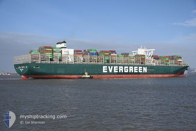
EVER GOVERN
Cargo
Current Trip
| Time Travelled | 18 days |
|---|---|
| Remaining Time | --- |
| Distance Travelled | 8571.85 nm |
| Remaining Distance | --- |
| AVG Speed | 19.1 Knopen |
| MAX Speed | 22.6 Knopen |
| AVG Wind | 14.9 knots |
| MAX Wind | 36 knots |
| MIN Temp | 9.4°C / 48.92°F |
| MAX Temp | 29.6°C / 85.28°F |
| Diepgang | 13 M |
| Positie ontvangen | 8 h, 14 m geleden |
Current Position
| Lengtegraad | 55.54035° |
|---|---|
| Breedtegraat | -20.38488° |
| Status | Under way using engine |
| Snelheid | 20.6 Knopen |
| Koers | 58.4° |
| Gebied | Indian Ocean |
| Station | T-AIS |
| Positie ontvangen | 8 h, 14 m geleden |
Info
Information
The current position of EVER GOVERN is in Indian Ocean with coordinates -20.38488° / 55.54035° as reported on 2024-04-19 09:12 by AIS to our vessel tracker app. The vessel's current speed is 20.6 Knopen and is heading at the port of TANJUNG PELEPAS. The estimated time of arrival as calculated by MyShipTracking vessel tracking app is 2024-04-26 16:00 LT
The vessel EVER GOVERN (IMO: 9832717, MMSI: 356582000) is a Cargo It's sailing under the flag of [PA] Panama.
In this page you can find informations about the vessels current position, last detected port calls, and current voyage information. If the vessels is not in coverage by AIS you will find the latest position.
The current position of EVER GOVERN is detected by our AIS receivers and we are not responsible for the reliability of the data. The last position was recorded while the vessel was in Coverage by the Ais receivers of our vessel tracking app.
The current draught of EVER GOVERN as reported by AIS is 13 meters
Weather
| Temperature | 26.5°C / 79.7°F |
|---|---|
| Wind Speed | 20 knots |
| Direction | 108° ESE |
| Pressure | 1015.2 hPa |
| Humidity | 75.3 % |
| Cloud Coverage | 69 % |
Featured Company
Last Port Calls
| Port | Arrival | Departure | Time In Port |
|---|---|---|---|
| 2024-03-29 04:28 | 2024-04-01 14:27 | 3 d | |
| 2024-03-23 01:42 | 2024-03-27 15:43 | 4 d | |
| 2024-03-19 20:44 | 2024-03-21 20:48 | 2 d | |
| 2024-02-21 01:23 | 2024-02-21 17:51 | 16 h | |
| 2024-02-15 10:50 | 2024-02-16 19:12 | 1 d | |
| 2024-02-09 07:26 | 2024-02-10 16:22 | 1 d | |
| 2024-02-05 13:10 | 2024-02-06 18:02 | 1 d |
Most Visited Ports (Last year)
| Port | Arrivals | |
|---|---|---|
| 5 | ||
| 5 | ||
| 5 | ||
| 5 | ||
| 4 | ||
| 4 |
Last Trips
| Origin | Departure | Destination | Arrival | Distance | |
|---|---|---|---|---|---|
| 2024-03-27 16:43 | 2024-03-29 05:28 | 356.73 nm | |||
| 2024-03-21 21:48 | 2024-03-23 02:42 | 420.20 nm | |||
| 2024-02-21 23:21 | 2024-03-19 21:44 | 10812.36 nm | |||
| 2024-02-17 03:12 | 2024-02-21 06:53 | 1603.68 nm | |||
| 2024-02-11 00:22 | 2024-02-15 18:50 | 1491.91 nm | |||
| 2024-02-07 02:02 | 2024-02-09 15:26 | 836.79 nm | |||
| 2024-01-27 20:49 | 2024-02-05 21:10 | 1272.11 nm |
Events
| Tijd | Evenement | Details | Positie / Bestemming | Info |
|---|---|---|---|---|
| 2024-04-19 09:34 | Status Changed | Default Under way using engine |
-20.31996 / 55.65837
MYTPP
|
Snelheid: 20.6 kn Koers: 58.4° |
| 2024-04-19 09:12 | Buitenbereik |
-20.38488 / 55.54035
Indian Ocean
MYTPP
|
Snelheid: 20.6 kn Koers: 58.4° |
|
| 2024-04-19 05:01 | Wijzig zee gebeid | R�union part of the Indian Ocean South African part of the South Atlantic Ocean |
-21.17087 / 54.25776
Indian Ocean
MYTPP
|
Snelheid: 20 kn Koers: 53.1° |
| 2024-04-19 04:59 | Status Changed | Under way using engine Default |
-21.17813 / 54.24736
MYTPP
|
Snelheid: 20 kn Koers: 54° |
| 2024-04-19 04:55 | Binnenbereik |
-21.17087 / 54.25776
Indian Ocean
MYTPP
|
Snelheid: 20 kn Koers: 53.1° |
|
| 2024-04-14 20:01 | Status Changed | Default Under way using engine |
-34.99985 / 19.58910
MYTPP
|
Snelheid: 20 kn Koers: 114.1° |
| 2024-04-14 19:54 | Status Changed | Under way using engine Default |
-34.98636 / 19.55136
MYTPP
|
Snelheid: 20.3 kn Koers: 113° |
| 2024-04-14 19:54 | Buitenbereik |
-34.98636 / 19.55136
South Atlantic Ocean
MYTPP
|
Snelheid: 20 kn Koers: 114.1° |
|
| 2024-04-14 19:33 | Status Changed | Default Under way using engine |
-34.93969 / 19.41305
MYTPP
|
Snelheid: 20.2 kn Koers: 106.9° |
| 2024-04-14 19:25 | Status Changed | Under way using engine Default |
-34.92558 / 19.36460
MYTPP
|
Snelheid: 20.2 kn Koers: 106° |