
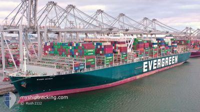
EVER GIVEN
Cargo A
Current Trip
| Time Travelled | 5 days |
|---|---|
| Remaining Time | --- |
| Distance Travelled | 1600.81 nm |
| Remaining Distance | --- |
| AVG Speed | 13.9 Knopen |
| MAX Speed | 18 Knopen |
| AVG Wind | 5.3 knots |
| MAX Wind | 13.8 knots |
| MIN Temp | 27°C / 80.6°F |
| MAX Temp | 30.6°C / 87.08°F |
| Diepgang | 14.6 M |
| Positie ontvangen | 2 m geleden |
Current Position
| Lengtegraad | 103.26839° |
|---|---|
| Breedtegraat | 1.31374° |
| Status | Under way using engine |
| Snelheid | 6.8 Knopen |
| Koers | 134.3° |
| Gebied | North Atlantic Ocean |
| Station | T-AIS |
| Positie ontvangen | 2 m geleden |
Info
Information
The current position of EVER GIVEN is in North Atlantic Ocean with coordinates 1.31374° / 103.26839° as reported on 2024-05-14 12:25 by AIS to our vessel tracker app. The vessel's current speed is 6.8 Knopen
The vessel EVER GIVEN (IMO: 9811000, MMSI: 353136000) is a Cargo A It's sailing under the flag of [PA] Panama.
In this page you can find informations about the vessels current position, last detected port calls, and current voyage information. If the vessels is not in coverage by AIS you will find the latest position.
The current position of EVER GIVEN is detected by our AIS receivers and we are not responsible for the reliability of the data. The last position was recorded while the vessel was in Coverage by the Ais receivers of our vessel tracking app.
The current draught of EVER GIVEN as reported by AIS is 14.6 meters
Weather
| Temperature | 30.4°C / 86.72°F |
|---|---|
| Wind Speed | 2 knots |
| Direction | 127° SE |
| Pressure | 1008.6 hPa |
| Humidity | 68.8 % |
| Cloud Coverage | 55 % |
Featured Company
Last Port Calls
| Port | Arrival | Departure | Time In Port |
|---|---|---|---|
| 2024-05-08 14:48 | 2024-05-09 09:56 | 19 h | |
| 2024-04-12 22:20 | 2024-04-15 09:16 | 2 d | |
| 2024-04-06 00:34 | 2024-04-09 06:24 | 3 d | |
| 2024-03-28 15:45 | 2024-03-31 08:24 | 2 d |
Most Visited Ports (Last year)
| Port | Arrivals | |
|---|---|---|
| 6 | ||
| 4 | ||
| 4 | ||
| 4 | ||
| 3 | ||
| 3 |
Last Trips
| Origin | Departure | Destination | Arrival | Distance | |
|---|---|---|---|---|---|
| 2024-04-15 11:16 | 2024-05-08 20:18 | 10577.52 nm | |||
| 2024-04-09 08:24 | 2024-04-13 00:20 | 355.01 nm | |||
| 2024-03-31 10:24 | 2024-04-06 02:34 | 533.17 nm | |||
| 2024-02-28 00:23 | 2024-03-28 16:45 | 11892.58 nm |
Events
| Tijd | Evenement | Details | Positie / Bestemming | Info |
|---|---|---|---|---|
| 2024-05-14 12:25 | Status Changed | Under way using engine Default |
1.31374 / 103.26839
NLRTM>>LKCMB
|
Snelheid: 6.8 kn Koers: 134° |
| 2024-05-14 12:21 | Status Changed | Default Under way using engine |
1.31970 / 103.26203
NLRTM>>LKCMB
|
Snelheid: 6.8 kn Koers: 133.7° |
| 2024-05-14 12:13 | Gevonden in zee | Malaysian part of the Malacca Strait |
1.32952 / 103.25187
Malacca Strait
|
Snelheid: 6.8 kn Koers: 133.7° |
| 2024-05-14 12:13 | Status Changed | Under way using engine Default |
1.32952 / 103.25187
NLRTM>>LKCMB
|
Snelheid: 6.8 kn Koers: 134° |
| 2024-05-14 11:57 | Binnenbereik |
1.32952 / 103.25187
Malacca Strait
|
Snelheid: 6.8 kn Koers: 133.7° |
|
| 2024-05-13 17:53 | Start beweging |
3.25339 / 100.39259
NLRTM>>LKCMB
|
Snelheid: 5 kn Koers: 102° |
|
| 2024-05-13 10:22 | Stop beweging |
3.23598 / 100.41692
NLRTM>>LKCMB
|
Snelheid: 0.3 kn Koers: 285° |
|
| 2024-05-09 09:56 | Vertrekhaven |
|
6.96879 / 79.83489
NLRTM>>LKCMB
|
Snelheid: 6.1 kn Koers: 9° |
| 2024-05-09 09:49 | Start beweging |
6.95571 / 79.83358
[LK] COLOMBO
|
Snelheid: 3.8 kn Koers: 9° |
|
| 2024-05-08 15:32 | Stop beweging |
6.94618 / 79.82906
[LK] COLOMBO
|
Snelheid: 0.1 kn Koers: 270° |