
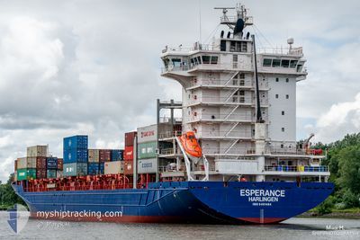
ESPERANCE
Container Ship
Current Trip
| Time Travelled | 2 days |
|---|---|
| Remaining Time | 1 day |
| Distance Travelled | 934.80 nm |
| Remaining Distance | 415.60 nm |
| AVG Speed | 16 Knopen |
| MAX Speed | 18 Knopen |
| AVG Wind | 11.7 knots |
| MAX Wind | 34 knots |
| MIN Temp | 11.3°C / 52.34°F |
| MAX Temp | 17.8°C / 64.04°F |
| Diepgang | 8.9 M |
| Positie ontvangen | 32 m geleden |
Current Position
| Lengtegraad | -5.92184° |
|---|---|
| Breedtegraat | 48.39768° |
| Status | Under way using engine |
| Snelheid | 10.1 Knopen |
| Koers | 26° |
| Gebied | Celtic Sea |
| Station | T-AIS |
| Positie ontvangen | 32 m geleden |
Info
Information
The current position of ESPERANCE is in Celtic Sea with coordinates 48.39768° / -5.92184° as reported on 2024-04-23 18:21 by AIS to our vessel tracker app. The vessel's current speed is 10.1 Knopen and is heading at the port of TILBURY. The estimated time of arrival as calculated by MyShipTracking vessel tracking app is 2024-04-25 05:58 LT
The vessel ESPERANCE (IMO: 9491484, MMSI: 244265000) is a Container Ship that was built in 2011 ( 13 Jaar oud ). It's sailing under the flag of [NL] Netherlands.
In this page you can find informations about the vessels current position, last detected port calls, and current voyage information. If the vessels is not in coverage by AIS you will find the latest position.
The current position of ESPERANCE is detected by our AIS receivers and we are not responsible for the reliability of the data. The last position was recorded while the vessel was in Coverage by the Ais receivers of our vessel tracking app.
The current draught of ESPERANCE as reported by AIS is 8.9 meters
Weather
| Temperature | 11.5°C / 52.7°F |
|---|---|
| Wind Speed | 11 knots |
| Direction | 329° NNW |
| Pressure | 1024.9 hPa |
| Humidity | 81.4 % |
| Cloud Coverage | 45 % |
Featured Company
Last Port Calls
| Port | Arrival | Departure | Time In Port |
|---|---|---|---|
| 2024-04-20 03:16 | 2024-04-21 02:35 | 23 h | |
| 2024-04-15 05:07 | 2024-04-16 19:37 | 1 d | |
| 2024-04-13 03:36 | 2024-04-14 03:51 | 1 d | |
| 2024-04-07 04:41 | 2024-04-07 16:17 | 11 h | |
| 2024-04-03 00:54 | 2024-04-03 19:25 | 18 h | |
| 2024-03-30 14:01 | 2024-04-01 16:04 | 2 d | |
| 2024-03-29 05:54 | 2024-03-29 10:25 | 4 h | |
| 2024-03-28 19:06 | 2024-03-29 04:08 | 9 h | |
| 2024-03-28 06:47 | 2024-03-28 18:41 | 11 h | |
| 2024-03-28 06:36 |
Most Visited Ports (Last year)
| Port | Arrivals | |
|---|---|---|
| 21 | ||
| 15 | ||
| 12 | ||
| 12 | ||
| 12 | ||
| 11 |
Last Trips
| Origin | Departure | Destination | Arrival | Distance | |
|---|---|---|---|---|---|
| 2024-04-16 20:37 | 2024-04-20 04:16 | 501.35 nm | |||
| 2024-04-14 04:51 | 2024-04-15 06:07 | 270.20 nm | |||
| 2024-04-07 18:17 | 2024-04-13 03:36 | 576.22 nm | |||
| 2024-04-03 21:25 | 2024-04-07 06:41 | 974.88 nm | |||
| 2024-04-01 18:04 | 2024-04-03 02:54 | 402.37 nm | |||
| 2024-03-29 11:25 | 2024-03-30 15:01 | 306.13 nm | |||
| 2024-03-29 05:08 | 2024-03-29 06:54 | 17.34 nm | |||
| 2024-03-28 19:41 | 2024-03-28 20:06 | 1.97 nm | |||
| 2024-03-27 18:21 | 2024-03-28 07:47 | 171.10 nm | |||
| 2024-03-27 18:21 | 2024-03-28 07:36 | 170.77 nm |
Events
| Tijd | Evenement | Details | Positie / Bestemming | Info |
|---|---|---|---|---|
| 2024-04-23 18:21 | Status Changed | Under way using engine Default |
48.39768 / -5.92184
TILBURY
|
Snelheid: 10.3 kn Koers: 26° |
| 2024-04-23 18:04 | Status Changed | Default Under way using engine |
48.35414 / -5.95389
TILBURY
|
Snelheid: 10.4 kn Koers: 25.8° |
| 2024-04-23 17:51 | Gevonden in zee | French part of the Celtic Sea |
48.31999 / -5.97920
Celtic Sea
TILBURY
|
Snelheid: 10.4 kn Koers: 25.8° |
| 2024-04-23 17:51 | Status Changed | Under way using engine Default |
48.31999 / -5.97920
TILBURY
|
Snelheid: 10.6 kn Koers: 27° |
| 2024-04-23 17:34 | Binnenbereik |
48.31999 / -5.97920
Celtic Sea
TILBURY
|
Snelheid: 10.4 kn Koers: 25.8° |
|
| 2024-04-22 15:44 | Status Changed | Default Under way using engine |
43.75120 / -9.41415
TILBURY
|
Snelheid: 12.1 kn Koers: 24.1° |
| 2024-04-22 15:42 | Buitenbereik |
43.74732 / -9.41676
North Atlantic Ocean
TILBURY
|
Snelheid: 12.1 kn Koers: 24.1° |
|
| 2024-04-22 14:47 | Status Changed | Under way using engine Default |
43.58416 / -9.53441
TILBURY
|
Snelheid: 11.6 kn Koers: 27° |
| 2024-04-22 14:42 | Status Changed | Default Under way using engine |
43.56882 / -9.54532
TILBURY
|
Snelheid: 10.9 kn Koers: 26.6° |
| 2024-04-22 14:31 | Status Changed | Under way using engine Default |
43.53856 / -9.56677
TILBURY
|
Snelheid: 11.6 kn Koers: 26° |