
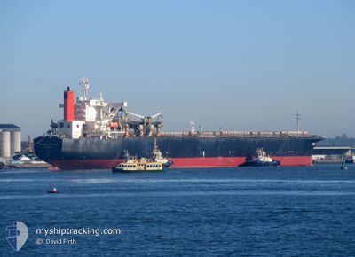
ENERGIA CENTAURUS
Bulk Carrier
Current Trip
| Time Travelled | 7 days |
|---|---|
| Remaining Time | --- |
| Distance Travelled | 2140.05 nm |
| Remaining Distance | --- |
| AVG Speed | 11.6 Knopen |
| MAX Speed | 14.2 Knopen |
| AVG Wind | 9.3 knots |
| MAX Wind | 23.8 knots |
| MIN Temp | 17.6°C / 63.68°F |
| MAX Temp | 30°C / 86°F |
| Diepgang | 15.1 M |
| Positie ontvangen | 6 d geleden |
Current Position
| Lengtegraad | 153.81815° |
|---|---|
| Breedtegraat | -27.19879° |
| Status | Under way using engine |
| Snelheid | 11.6 Knopen |
| Koers | 6.2° |
| Gebied | Coral Sea |
| Station | T-AIS |
| Positie ontvangen | 6 d geleden |
Info
Information
The current position of ENERGIA CENTAURUS is in Coral Sea with coordinates -27.19879° / 153.81815° as reported on 2024-04-19 06:20 by AIS to our vessel tracker app. The vessel's current speed is 11.6 Knopen and is heading at the port of KUDAMATSU. The estimated time of arrival as calculated by MyShipTracking vessel tracking app is 2024-05-02 23:00 LT
The vessel ENERGIA CENTAURUS (IMO: 9233557, MMSI: 432838000) is a Bulk Carrier that was built in 2001 ( 23 Jaar oud ). It's sailing under the flag of [JP] Japan.
In this page you can find informations about the vessels current position, last detected port calls, and current voyage information. If the vessels is not in coverage by AIS you will find the latest position.
The current position of ENERGIA CENTAURUS is detected by our AIS receivers and we are not responsible for the reliability of the data. The last position was recorded while the vessel was in Coverage by the Ais receivers of our vessel tracking app.
The current draught of ENERGIA CENTAURUS as reported by AIS is 15.1 meters
Weather
| Temperature | 28.5°C / 83.3°F |
|---|---|
| Wind Speed | 4 knots |
| Direction | 92° E |
| Pressure | 1006.7 hPa |
| Humidity | 75.6 % |
| Cloud Coverage | 88 % |
Featured Company
Most Visited Ports (Last year)
| Port | Arrivals | |
|---|---|---|
| 6 | ||
| 2 | ||
| 1 |
Last Trips
| Origin | Departure | Destination | Arrival | Distance | |
|---|---|---|---|---|---|
| 2024-02-09 08:00 | 2024-04-16 13:24 | 9165.42 nm | |||
| 2023-12-25 19:33 | 2024-02-07 19:50 | 5313.88 nm |
Events
| Tijd | Evenement | Details | Positie / Bestemming | Info |
|---|---|---|---|---|
| 2024-04-19 06:20 | Buitenbereik |
-27.19879 / 153.81815
Coral Sea
JPKUD
|
Snelheid: 11.6 kn Koers: 6.2° |
|
| 2024-04-19 01:32 | Gevonden in zee | Australian part of the Coral Sea |
-28.13167 / 153.81779
Coral Sea
JPKUD
|
Snelheid: 11 kn Koers: 359° |
| 2024-04-19 01:29 | Status Changed | Under way using engine Default |
-28.13982 / 153.81805
JPKUD
|
Snelheid: 10.6 kn Koers: 358° |
| 2024-04-19 01:19 | Binnenbereik |
-28.13167 / 153.81779
Coral Sea
JPKUD
|
Snelheid: 11 kn Koers: 359° |
|
| 2024-04-18 01:20 | Status Changed | Default Under way using engine |
-32.51557 / 152.71455
JPKUD
|
Snelheid: 9 kn Koers: 31.2° |
| 2024-04-18 01:12 | Buitenbereik |
-32.53426 / 152.70420
Tasman Sea
JPKUD
|
Snelheid: 9 kn Koers: 31.2° |
|
| 2024-04-17 19:42 | Status Changed | Under way using engine Moored |
-32.92773 / 151.85017
JPKUD
|
Snelheid: 9.7 kn Koers: 118.8° |
| 2024-04-17 19:24 | Vertrekhaven |
|
-32.91182 / 151.80565
JPKUD
|
Snelheid: 7.5 kn Koers: 73° |
| 2024-04-17 18:35 | Start beweging |
-32.88580 / 151.75816
[AU] NEWCASTLE
|
Snelheid: 3.1 kn Koers: 123° |
|
| 2024-04-17 17:28 | Draught Changed | 15.1 15 |
-32.88009 / 151.75019
[AU] NEWCASTLE
|
Snelheid: Koers: 124° |