
EMS HIGHWAY
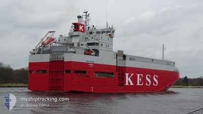
Vehicles Carrier
Current Trip
| Trip Time | 11 h, 0 mins |
|---|---|
| Trip Distance | 162.47 nm |
| AVG Speed | 14.7 Knopen |
| MAX Speed | 16.2 Knopen |
| Diepgang | 4.8 M |
| AVG Wind | 10.9 knots |
| MAX Wind | 19 knots |
| MIN Temp | 5.7°C / 42.26°F |
| MAX Temp | 7.5°C / 45.5°F |
| Positie ontvangen | 2 m geleden |
Current Position
| Lengtegraad | 12.10473° |
|---|---|
| Breedtegraat | 54.14543° |
| Status | Moored |
| Snelheid | |
| Koers | 353° |
| Gebied | Baltic Sea |
| Station | T-AIS |
| Positie ontvangen | 2 m geleden |
Info
Information
The current position of EMS HIGHWAY is in Baltic Sea with coordinates 54.14543° / 12.10473° as reported on 2024-04-19 04:04 by AIS to our vessel tracker app. The vessel's current speed is 0 Knopen and is currently inside the port of ROSTOCK.
The vessel EMS HIGHWAY (IMO: 9195133, MMSI: 212882000) is a Vehicles Carrier that was built in 1999 ( 25 Jaar oud ). It's sailing under the flag of [CY] Cyprus.
In this page you can find informations about the vessels current position, last detected port calls, and current voyage information. If the vessels is not in coverage by AIS you will find the latest position.
The current position of EMS HIGHWAY is detected by our AIS receivers and we are not responsible for the reliability of the data. The last position was recorded while the vessel was in Coverage by the Ais receivers of our vessel tracking app.
The current draught of EMS HIGHWAY as reported by AIS is 4.8 meters
Weather
| Temperature | 5.2°C / 41.36°F |
|---|---|
| Wind Speed | 14 knots |
| Direction | 215° SW |
| Pressure | 1006.4 hPa |
| Humidity | 86.9 % |
| Cloud Coverage | 100 % |
Featured Company
Last Port Calls
| Port | Arrival | Departure | Time In Port |
|---|---|---|---|
| 2024-04-19 00:27 | |||
| 2024-04-18 00:05 | 2024-04-18 13:27 | 13 h | |
| 2024-04-17 00:36 | 2024-04-17 12:30 | 11 h | |
| 2024-04-15 15:40 | 2024-04-16 07:55 | 16 h | |
| 2024-04-14 04:11 | 2024-04-14 19:13 | 15 h | |
| 2024-04-13 06:15 | 2024-04-13 06:48 | 32 m | |
| 2024-04-12 19:08 | 2024-04-12 19:25 | 16 m | |
| 2024-04-10 22:06 | 2024-04-11 15:48 | 17 h | |
| 2024-04-09 01:53 | 2024-04-09 13:19 | 11 h | |
| 2024-04-08 00:27 | 2024-04-08 13:53 | 13 h |
Last Trips
| Origin | Departure | Destination | Arrival | Distance | |
|---|---|---|---|---|---|
| 2024-04-18 15:27 | 2024-04-19 02:27 | 162.47 nm | |||
| 2024-04-17 14:30 | 2024-04-18 02:05 | 166.12 nm | |||
| 2024-04-16 09:55 | 2024-04-17 02:36 | 149.91 nm | |||
| 2024-04-14 21:13 | 2024-04-15 17:40 | 315.86 nm | |||
| 2024-04-13 07:48 | 2024-04-14 06:11 | 206.82 nm | |||
| 2024-04-12 20:25 | 2024-04-13 07:15 | 1.74 nm | |||
| 2024-04-11 17:48 | 2024-04-12 20:08 | 306.88 nm | |||
| 2024-04-09 15:19 | 2024-04-11 00:06 | 387.35 nm | |||
| 2024-04-08 15:53 | 2024-04-09 03:53 | 166.34 nm | |||
| 2024-04-06 18:00 | 2024-04-08 02:27 | 397.03 nm |
Events
| Tijd | Evenement | Details | Positie / Bestemming | Info |
|---|---|---|---|---|
| 2024-04-19 01:13 | Status Changed | Moored Under way using engine |
54.14543 / 12.10473
[DE] ROSTOCK
|
Snelheid: Koers: 351° |
| 2024-04-19 01:01 | Stop beweging |
54.14557 / 12.10463
[DE] ROSTOCK
|
Snelheid: 0.3 kn Koers: 352° |
|
| 2024-04-19 00:52 | Start beweging |
54.15408 / 12.10203
[DE] ROSTOCK
|
Snelheid: 4.4 kn Koers: 355° |
|
| 2024-04-19 00:49 | Stop beweging |
54.15588 / 12.10160
[DE] ROSTOCK
|
Snelheid: 0.2 kn Koers: 338° |
|
| 2024-04-19 00:27 | Aankomsthaven |
|
54.18825 / 12.08893
[DE] ROSTOCK
|
Snelheid: 8.3 kn Koers: 160.8° |
| 2024-04-18 23:08 | Wijzig zee gebeid | German part of the Baltic Sea Danish part of the Baltic Sea |
54.45943 / 12.17275
Baltic Sea
ROSTOCK
|
Snelheid: 16 kn Koers: 199.3° |
| 2024-04-18 19:32 | Wijzig zee gebeid | Danish part of the Baltic Sea Danish part of the Kattegat |
55.32040 / 12.62572
Baltic Sea
ROSTOCK
|
Snelheid: 15 kn Koers: 181.2° |
| 2024-04-18 19:26 | Wijzig zee gebeid | Danish part of the Kattegat Swedish part of the Kattegat |
55.34577 / 12.63300
Kattegat
ROSTOCK
|
Snelheid: 15.1 kn Koers: 189.6° |
| 2024-04-18 18:59 | Wijzig zee gebeid | Swedish part of the Kattegat Danish part of the Kattegat |
55.45557 / 12.66893
Kattegat
ROSTOCK
|
Snelheid: 14.8 kn Koers: 193.6° |
| 2024-04-18 15:38 | Wijzig zee gebeid | Danish part of the Kattegat Swedish part of the Kattegat |
56.19007 / 12.40358
Kattegat
ROSTOCK
|
Snelheid: 14.8 kn Koers: 166.7° |