
ESL WASL
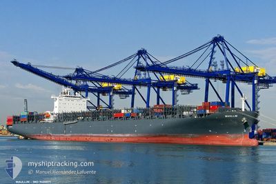
Container Ship
Current Trip
| Time Travelled | 3 days |
|---|---|
| Remaining Time | --- |
| Distance Travelled | 1208.89 nm |
| Remaining Distance | 1537.36 nm |
| AVG Speed | 15.1 Knopen |
| MAX Speed | 21.4 Knopen |
| AVG Wind | 6.7 knots |
| MAX Wind | 11.2 knots |
| MIN Temp | 26.4°C / 79.52°F |
| MAX Temp | 29.7°C / 85.46°F |
| Diepgang | 10.2 M |
| Positie ontvangen | 2 d geleden |
Current Position
| Lengtegraad | 104.36420° |
|---|---|
| Breedtegraat | 1.31824° |
| Status | Under way using engine |
| Snelheid | 14.4 Knopen |
| Koers | 57.4° |
| Gebied | South China Sea |
| Station | T-AIS |
| Positie ontvangen | 2 d geleden |
Info
Information
The current position of ESL WASL is in South China Sea with coordinates 1.31824° / 104.36420° as reported on 2024-04-20 15:33 by AIS to our vessel tracker app. The vessel's current speed is 14.4 Knopen and is heading at the port of BUSAN. The estimated time of arrival as calculated by MyShipTracking vessel tracking app is 2024-04-27 09:30 LT
The vessel ESL WASL (IMO: 9400071, MMSI: 636091744) is a Container Ship that was built in 2010 ( 14 Jaar oud ). It's sailing under the flag of [LR] Liberia.
In this page you can find informations about the vessels current position, last detected port calls, and current voyage information. If the vessels is not in coverage by AIS you will find the latest position.
The current position of ESL WASL is detected by our AIS receivers and we are not responsible for the reliability of the data. The last position was recorded while the vessel was in Coverage by the Ais receivers of our vessel tracking app.
The current draught of ESL WASL as reported by AIS is 10.2 meters
Weather
| Temperature | 29.3°C / 84.74°F |
|---|---|
| Wind Speed | 7 knots |
| Direction | 119° ESE |
| Pressure | 1009.1 hPa |
| Humidity | 74.2 % |
| Cloud Coverage | 15 % |
Featured Company
Last Port Calls
| Port | Arrival | Departure | Time In Port |
|---|---|---|---|
| 2024-04-19 23:04 | |||
| 2024-04-08 03:49 | 2024-04-09 01:05 | 21 h | |
| 2024-04-03 20:35 | 2024-04-05 03:33 | 1 d | |
| 2024-03-27 21:31 | 2024-03-29 21:41 | 2 d | |
| 2024-03-22 20:34 | 2024-03-23 13:08 | 16 h | |
| 2024-03-09 17:21 | 2024-03-10 05:35 | 12 h | |
| 2024-03-03 05:00 | 2024-03-04 00:16 | 19 h | |
| 2024-02-29 12:41 | 2024-03-01 10:28 | 21 h | |
| 2024-02-18 11:19 | 2024-02-18 23:12 | 11 h | |
| 2024-02-08 05:10 | 2024-02-09 13:23 | 1 d |
Most Visited Ports (Last year)
| Port | Arrivals | |
|---|---|---|
| 8 | ||
| 8 | ||
| 7 | ||
| 7 | ||
| 7 | ||
| 6 |
Last Trips
| Origin | Departure | Destination | Arrival | Distance | |
|---|---|---|---|---|---|
| 2024-04-05 06:33 | 2024-04-08 07:49 | 570.36 nm | |||
| 2024-03-30 01:41 | 2024-04-03 23:35 | 352.80 nm | |||
| 2024-03-23 17:08 | 2024-03-28 01:31 | 268.29 nm | |||
| 2024-03-10 13:35 | 2024-03-23 00:34 | 4808.67 nm | |||
| 2024-03-04 08:16 | 2024-03-10 01:21 | 1157.40 nm | |||
| 2024-03-01 19:28 | 2024-03-03 13:00 | 503.86 nm | |||
| 2024-02-19 07:12 | 2024-02-29 21:41 | 2824.62 nm | |||
| 2024-02-09 17:23 | 2024-02-18 19:19 | 3206.48 nm | |||
| 2024-02-06 20:06 | 2024-02-08 09:10 | 99.77 nm | |||
| 2024-02-03 01:47 | 2024-02-06 00:26 | 351.87 nm |
Events
| Tijd | Evenement | Details | Positie / Bestemming | Info |
|---|---|---|---|---|
| 2024-04-20 15:40 | Status Changed | Default Under way using engine |
1.33349 / 104.38801
KRPUS
|
Snelheid: 14.4 kn Koers: 57.4° |
| 2024-04-20 15:33 | Wijzig zee gebeid | Malaysian part of the South China Sea Malaysian part of the Singapore Strait |
1.31824 / 104.36420
South China Sea
KRPUS
|
Snelheid: 14.4 kn Koers: 57.4° |
| 2024-04-20 15:33 | Status Changed | Under way using engine Default |
1.31824 / 104.36420
KRPUS
|
Snelheid: 14.4 kn Koers: 57° |
| 2024-04-20 15:33 | Buitenbereik |
1.31824 / 104.36420
South China Sea
KRPUS
|
Snelheid: 14.4 kn Koers: 57.4° |
|
| 2024-04-20 15:28 | Status Changed | Default Under way using engine |
1.30749 / 104.34822
KRPUS
|
Snelheid: 13.9 kn Koers: 61.6° |
| 2024-04-20 14:44 | Wijzig zee gebeid | Malaysian part of the Singapore Strait Indonesian part of the Singapore Strait |
1.25805 / 104.17813
Singapore Strait
KRPUS
|
Snelheid: 15.2 kn Koers: 80.8° |
| 2024-04-20 11:23 | Draught Changed | 10.2 10.9 |
1.15304 / 103.46769
KRPUS
|
Snelheid: 12.4 kn Koers: 122.1° |
| 2024-04-20 11:23 | Destination Changed | KRPUS PORT KLANG |
1.15304 / 103.46769
KRPUS
|
Snelheid: 12.4 kn Koers: 122.1° |
| 2024-04-20 11:23 | ETA Changed | 2024/04/27 09:30 2024/04/19 09:00 |
1.15304 / 103.46769
KRPUS
|
Snelheid: 12.4 kn Koers: 122.1° |
| 2024-04-20 11:11 | Wijzig zee gebeid | Indonesian part of the Singapore Strait Indonesian part of the Malacca Strait |
1.17582 / 103.43198
Singapore Strait
|
Snelheid: 12.2 kn Koers: 122.8° |