
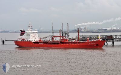
ELI KNUTSEN
Oil/Chemical Tanker
Current Trip
| Time Travelled | 22 h, 42 mins |
|---|---|
| Remaining Time | 1 day |
| Distance Travelled | 280.49 nm |
| Remaining Distance | 335.04 nm |
| AVG Speed | 11.9 Knopen |
| MAX Speed | 14.4 Knopen |
| AVG Wind | 9.6 knots |
| MAX Wind | 18.8 knots |
| MIN Temp | 3.2°C / 37.76°F |
| MAX Temp | 10.3°C / 50.54°F |
| Diepgang | 8.7 M |
| Positie ontvangen | 4 h, 3 m geleden |
Current Position
| Lengtegraad | -0.90064° |
|---|---|
| Breedtegraat | 50.33553° |
| Status | Under way using engine |
| Snelheid | 11.5 Knopen |
| Koers | 254.6° |
| Gebied | English Channel |
| Station | T-AIS |
| Positie ontvangen | 4 h, 3 m geleden |
Info
Information
The current position of ELI KNUTSEN is in English Channel with coordinates 50.33553° / -0.90064° as reported on 2024-04-18 18:49 by AIS to our vessel tracker app. The vessel's current speed is 11.5 Knopen and is heading at the port of DONGES. The estimated time of arrival as calculated by MyShipTracking vessel tracking app is 2024-04-20 00:22 LT
The vessel ELI KNUTSEN (IMO: 9409261, MMSI: 215288000) is a Oil/Chemical Tanker that was built in 2009 ( 15 Jaar oud ). It's sailing under the flag of [MT] Malta.
In this page you can find informations about the vessels current position, last detected port calls, and current voyage information. If the vessels is not in coverage by AIS you will find the latest position.
The current position of ELI KNUTSEN is detected by our AIS receivers and we are not responsible for the reliability of the data. The last position was recorded while the vessel was in Coverage by the Ais receivers of our vessel tracking app.
The current draught of ELI KNUTSEN as reported by AIS is 8.7 meters
Weather
| Temperature | 10.3°C / 50.54°F |
|---|---|
| Wind Speed | 17 knots |
| Direction | 271° W |
| Pressure | 1023.6 hPa |
| Humidity | 73.4 % |
| Cloud Coverage | 99 % |
Featured Company
Last Port Calls
| Port | Arrival | Departure | Time In Port |
|---|---|---|---|
| 2024-04-13 09:49 | 2024-04-18 00:11 | 4 d | |
| 2024-04-02 22:06 | 2024-04-06 14:01 | 3 d | |
| 2024-03-29 18:06 | 2024-03-30 14:04 | 19 h | |
| 2024-03-28 03:28 | 2024-03-29 05:44 | 1 d | |
| 2024-03-26 15:40 | 2024-03-27 03:02 | 11 h | |
| 2024-03-19 04:09 | 2024-03-22 04:20 | 3 d | |
| 2024-03-14 06:00 | 2024-03-16 07:15 | 2 d | |
| 2024-03-07 20:46 | 2024-03-11 02:15 | 3 d | |
| 2024-03-07 19:37 | 2024-03-07 20:04 | 27 m | |
| 2024-02-27 21:20 | 2024-02-28 16:27 | 19 h |
Last Trips
| Origin | Departure | Destination | Arrival | Distance | |
|---|---|---|---|---|---|
| 2024-04-06 16:01 | 2024-04-13 11:49 | 665.50 nm | |||
| 2024-03-30 15:04 | 2024-04-03 00:06 | 112.60 nm | |||
| 2024-03-29 06:44 | 2024-03-29 19:06 | 39.43 nm | |||
| 2024-03-27 04:02 | 2024-03-28 04:28 | 132.03 nm | |||
| 2024-03-22 05:20 | 2024-03-26 16:40 | 898.63 nm | |||
| 2024-03-16 08:15 | 2024-03-19 05:09 | 642.38 nm | |||
| 2024-03-11 03:15 | 2024-03-14 07:00 | 696.56 nm | |||
| 2024-03-07 21:04 | 2024-03-07 21:46 | 5.48 nm | |||
| 2024-02-28 17:27 | 2024-03-07 20:37 | 1403.66 nm | |||
| 2024-02-26 19:29 | 2024-02-27 22:20 | 260.90 nm |
Events
| Tijd | Evenement | Details | Positie / Bestemming | Info |
|---|---|---|---|---|
| 2024-04-18 18:56 | Status Changed | Default Under way using engine |
50.32968 / -.93268
DONGES
|
Snelheid: 11.5 kn Koers: 254.6° |
| 2024-04-18 18:49 | Buitenbereik |
50.33553 / -.90064
English Channel
DONGES
|
Snelheid: 11.5 kn Koers: 254.6° |
|
| 2024-04-18 11:38 | Wijzig zee gebeid | United Kingdom part of the English Channel French part of the English Channel |
50.88169 / 1.27419
English Channel
DONGES
|
Snelheid: 13.2 kn Koers: 236.7° |
| 2024-04-18 11:17 | Wijzig zee gebeid | French part of the English Channel United Kingdom part of the English Channel |
50.94449 / 1.35000
English Channel
DONGES
|
Snelheid: 13.4 kn Koers: 215.4° |
| 2024-04-18 10:38 | Wijzig zee gebeid | United Kingdom part of the English Channel United Kingdom part of the North Sea |
51.05120 / 1.49984
English Channel
DONGES
|
Snelheid: 12.8 kn Koers: 225° |
| 2024-04-18 07:56 | Wijzig zee gebeid | United Kingdom part of the North Sea French part of the North Sea |
51.40517 / 2.05872
North Sea
DONGES
|
Snelheid: 11.1 kn Koers: 301.5° |
| 2024-04-18 06:57 | Gevonden in zee | French part of the North Sea |
51.34429 / 2.33761
North Sea
DONGES
|
Snelheid: 12.5 kn Koers: 249.9° |
| 2024-04-18 04:59 | ETA Changed | 2024/04/20 03:00 2025/03/20 03:00 |
51.37780 / 2.90893
DONGES
|
Snelheid: 12.9 kn Koers: 257.3° |
| 2024-04-18 03:41 | Wijzig zee gebeid | Belgian part of the North Sea Dutch part of the North Sea |
51.40687 / 3.32903
North Sea
|
Snelheid: 12.4 kn Koers: 268.2° |
| 2024-04-18 02:09 | ETA Changed | 2025/03/20 03:00 2025/03/20 02:00 |
51.37736 / 3.73062
DONGES
|
Snelheid: 12.9 kn Koers: 319.4° |