
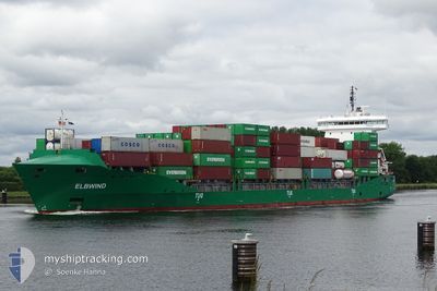
ELBWIND
Container Ship
Current Trip
| Time Travelled | 1 day |
|---|---|
| Remaining Time | 11 h, 35 mins |
| Distance Travelled | 580.18 nm |
| Remaining Distance | 175.12 nm |
| AVG Speed | 15.1 Knopen |
| MAX Speed | 17.1 Knopen |
| AVG Wind | 12.7 knots |
| MAX Wind | 27 knots |
| MIN Temp | 1°C / 33.8°F |
| MAX Temp | 4.5°C / 40.1°F |
| Diepgang | 8.2 M |
| Positie ontvangen | Nu |
Current Position
| Lengtegraad | 11.13342° |
|---|---|
| Breedtegraat | 54.60665° |
| Status | Under way using engine |
| Snelheid | 14.8 Knopen |
| Koers | 265.5° |
| Gebied | Baltic Sea |
| Station | T-AIS |
| Positie ontvangen | Nu |
Info
Information
The current position of ELBWIND is in Baltic Sea with coordinates 54.60665° / 11.13342° as reported on 2024-04-23 07:45 by AIS to our vessel tracker app. The vessel's current speed is 14.8 Knopen and is heading at the port of BREMERHAVEN. The estimated time of arrival as calculated by MyShipTracking vessel tracking app is 2024-04-23 19:21 LT
The vessel ELBWIND (IMO: 9483334, MMSI: 210017000) is a Container Ship that was built in 2012 ( 12 Jaar oud ). It's sailing under the flag of [CY] Cyprus.
In this page you can find informations about the vessels current position, last detected port calls, and current voyage information. If the vessels is not in coverage by AIS you will find the latest position.
The current position of ELBWIND is detected by our AIS receivers and we are not responsible for the reliability of the data. The last position was recorded while the vessel was in Coverage by the Ais receivers of our vessel tracking app.
The current draught of ELBWIND as reported by AIS is 8.2 meters
Weather
| Temperature | 4.1°C / 39.38°F |
|---|---|
| Wind Speed | 9 knots |
| Direction | 260° W |
| Pressure | 1019.4 hPa |
| Humidity | 70.2 % |
| Cloud Coverage | 10 % |
Featured Company
Last Port Calls
| Port | Arrival | Departure | Time In Port |
|---|---|---|---|
| 2024-04-21 03:47 | 2024-04-21 18:01 | 14 h | |
| 2024-04-16 20:21 | 2024-04-17 11:44 | 15 h | |
| 2024-04-15 03:44 | 2024-04-16 11:41 | 1 d | |
| 2024-04-14 13:40 | 2024-04-14 14:14 | 34 m | |
| 2024-04-12 08:34 | 2024-04-13 09:04 | 1 d | |
| 2024-04-08 22:51 | 2024-04-09 13:18 | 14 h | |
| 2024-04-04 04:53 | 2024-04-06 02:27 | 1 d | |
| 2024-04-03 06:23 | 2024-04-03 20:33 | 14 h | |
| 2024-03-31 15:22 | 2024-04-01 06:45 | 15 h | |
| 2024-03-28 13:27 | 2024-03-29 02:27 | 12 h |
Most Visited Ports (Last year)
| Port | Arrivals | |
|---|---|---|
| 56 | ||
| 23 | ||
| 17 | ||
| 13 | ||
| 13 | ||
| 11 |
Last Trips
| Origin | Departure | Destination | Arrival | Distance | |
|---|---|---|---|---|---|
| 2024-04-17 13:44 | 2024-04-21 06:47 | 912.52 nm | |||
| 2024-04-16 13:41 | 2024-04-16 22:21 | 118.39 nm | |||
| 2024-04-14 16:14 | 2024-04-15 05:44 | 88.60 nm | |||
| 2024-04-13 11:04 | 2024-04-14 15:40 | 352.71 nm | |||
| 2024-04-09 15:18 | 2024-04-12 10:34 | 352.82 nm | |||
| 2024-04-06 04:27 | 2024-04-09 00:51 | 562.44 nm | |||
| 2024-04-03 22:33 | 2024-04-04 06:53 | 113.54 nm | |||
| 2024-04-01 09:45 | 2024-04-03 08:23 | 546.99 nm | |||
| 2024-03-29 03:27 | 2024-03-31 18:22 | 566.78 nm | |||
| 2024-03-26 21:34 | 2024-03-28 14:27 | 486.84 nm |
Events
| Tijd | Evenement | Details | Positie / Bestemming | Info |
|---|---|---|---|---|
| 2024-04-23 07:16 | Wijzig zee gebeid | German part of the Baltic Sea Danish part of the Baltic Sea |
54.56463 / 11.32798
Baltic Sea
DEBRV VIA NOK
|
Snelheid: 15.5 kn Koers: 296.1° |
| 2024-04-23 05:16 | Wijzig zee gebeid | Danish part of the Baltic Sea German part of the Baltic Sea |
54.44293 / 12.13647
Baltic Sea
DEBRV VIA NOK
|
Snelheid: 14 kn Koers: 262.1° |
| 2024-04-23 04:59 | Wijzig zee gebeid | German part of the Baltic Sea Danish part of the Baltic Sea |
54.48611 / 12.20634
Baltic Sea
DEBRV VIA NOK
|
Snelheid: 14.8 kn Koers: 194.1° |
| 2024-04-23 02:38 | Wijzig zee gebeid | Danish part of the Baltic Sea German part of the Baltic Sea |
54.83695 / 12.92132
Baltic Sea
DEBRV VIA NOK
|
Snelheid: 14.8 kn Koers: 255.9° |
| 2024-04-23 00:29 | Gevonden in zee | German part of the Baltic Sea |
55.01130 / 13.79857
Baltic Sea
DEBRV VIA NOK
|
Snelheid: 15.2 kn Koers: 249.8° |
| 2024-04-22 21:35 | Wijzig zee gebeid | Swedish part of the Baltic Sea Danish part of the Kattegat |
55.48446 / 14.71793
Baltic Sea
DEBRV VIA NOK
|
Snelheid: 15 kn Koers: 239.9° |
| 2024-04-22 20:16 | Wijzig zee gebeid | Danish part of the Kattegat Swedish part of the Baltic Sea |
55.64798 / 15.22212
Kattegat
DEBRV VIA NOK
|
Snelheid: 14.9 kn Koers: 240.8° |
| 2024-04-22 16:20 | ETA Changed | 2024/04/24 05:00 2024/04/24 04:00 |
56.14173 / 16.73590
DEBRV VIA NOK
|
Snelheid: 15.3 kn Koers: 232.8° |
| 2024-04-22 15:51 | Status Changed | Under way using engine Default |
56.21066 / 16.91257
DEBRV VIA NOK
|
Snelheid: 15.1 kn Koers: 232° |
| 2024-04-22 15:44 | Gevonden in zee | Swedish part of the Baltic Sea |
56.22650 / 16.95345
Baltic Sea
DEBRV VIA NOK
|
Snelheid: 15.1 kn Koers: 236° |