
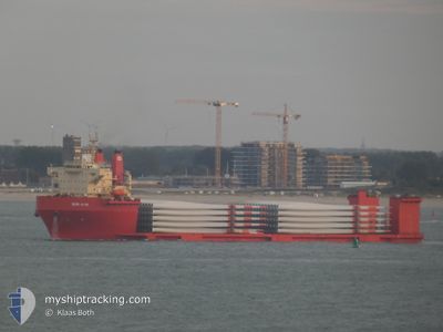
SUN RISE
Heavy Lift Vessel
Current Trip
| Time Travelled | 2 days |
|---|---|
| Remaining Time | --- |
| Distance Travelled | 242.13 nm |
| Remaining Distance | --- |
| AVG Speed | 8.5 Knopen |
| MAX Speed | 10.4 Knopen |
| AVG Wind | 9.7 knots |
| MAX Wind | 21.8 knots |
| MIN Temp | -0.4°C / 31.28°F |
| MAX Temp | 7.5°C / 45.5°F |
| Diepgang | 6.6 M |
| Positie ontvangen | Nu |
Current Position
| Lengtegraad | 10.41693° |
|---|---|
| Breedtegraat | 56.95219° |
| Status | Under way using engine |
| Snelheid | 7.7 Knopen |
| Koers | 113.8° |
| Gebied | Kattegat |
| Station | T-AIS |
| Positie ontvangen | Nu |
Info
Information
The current position of SUN RISE is in Kattegat with coordinates 56.95219° / 10.41693° as reported on 2024-04-24 23:14 by AIS to our vessel tracker app. The vessel's current speed is 7.7 Knopen and is heading at the port of NORFOLK. The estimated time of arrival as calculated by MyShipTracking vessel tracking app is 2024-05-13 12:00 LT
The vessel SUN RISE (IMO: 9623219, MMSI: 440032000) is a Heavy Lift Vessel that was built in 2012 ( 12 Jaar oud ). It's sailing under the flag of [KR] Korea.
In this page you can find informations about the vessels current position, last detected port calls, and current voyage information. If the vessels is not in coverage by AIS you will find the latest position.
The current position of SUN RISE is detected by our AIS receivers and we are not responsible for the reliability of the data. The last position was recorded while the vessel was in Coverage by the Ais receivers of our vessel tracking app.
The current draught of SUN RISE as reported by AIS is 6.6 meters
Weather
| Temperature | 6.5°C / 43.7°F |
|---|---|
| Wind Speed | 9 knots |
| Direction | 164° SSE |
| Pressure | 1005.9 hPa |
| Humidity | 68.6 % |
| Cloud Coverage | 100 % |
Featured Company
Last Trips
| Origin | Departure | Destination | Arrival | Distance | |
|---|---|---|---|---|---|
| 2024-03-31 07:43 | 2024-04-20 10:24 | 4927.84 nm | |||
| 2024-03-08 14:11 | 2024-03-29 22:09 | 4869.61 nm | |||
| 2024-02-19 14:45 | 2024-02-22 11:29 | 748.03 nm | |||
| 2024-02-15 15:20 | 2024-02-17 10:29 | 8.49 nm | |||
| 2024-01-13 11:34 | 2024-02-12 19:28 | 6976.93 nm |
Events
| Tijd | Evenement | Details | Positie / Bestemming | Info |
|---|---|---|---|---|
| 2024-04-24 21:29 | Start beweging | 3.22 nm, East of AALBORG |
57.05427 / 10.05776
USPTM
|
Snelheid: 3.1 kn Koers: 117° |
| 2024-04-24 21:20 | Status Changed | Under way using engine Moored |
57.05652 / 10.04831
USPTM
|
Snelheid: 1.1 kn Koers: 124° |
| 2024-04-24 20:37 | ETA Changed | 2024/05/13 12:00 2024/04/23 05:00 |
57.05692 / 10.04518
USPTM
|
Snelheid: Koers: 125° |
| 2024-04-24 20:27 | Destination Changed | USPTM DKAAL |
57.05694 / 10.04518
USPTM
|
Snelheid: Koers: 125° |
| 2024-04-24 11:54 | Status Changed | Moored Default |
57.05704 / 10.04498
DKAAL
|
Snelheid: Koers: 125° |
| 2024-04-24 11:51 | Status Changed | Default Moored |
57.05704 / 10.04496
DKAAL
|
Snelheid: Koers: 125° |
| 2024-04-24 08:15 | Status Changed | Moored Under way using engine |
57.05787 / 10.04300
DKAAL
|
Snelheid: Koers: 306° |
| 2024-04-24 08:14 | Status Changed | Under way using engine Moored |
57.05789 / 10.04300
DKAAL
|
Snelheid: Koers: 305° |
| 2024-04-23 06:17 | Status Changed | Moored Under way using engine |
57.05776 / 10.04344
DKAAL
|
Snelheid: 0.2 kn Koers: 306° |
| 2024-04-23 06:06 | Stop beweging | 2.77 nm, East of AALBORG |
57.05756 / 10.04453
DKAAL
|
Snelheid: 0.3 kn Koers: 297° |