
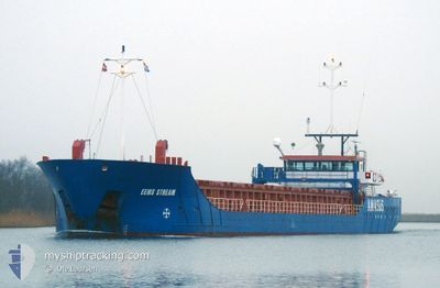
EEMS STREAM
General Cargo
Current Trip
| Trip Time | 7 days |
|---|---|
| Trip Distance | 1463.49 nm |
| AVG Speed | 8.4 Knopen |
| MAX Speed | 11.4 Knopen |
| Diepgang | 4.5 M |
| AVG Wind | 7.4 knots |
| MAX Wind | 27 knots |
| MIN Temp | 12.2°C / 53.96°F |
| MAX Temp | 24°C / 75.2°F |
| Positie ontvangen | 2 m geleden |
Current Position
| Lengtegraad | 29.60025° |
|---|---|
| Breedtegraat | 40.77799° |
| Status | Moored |
| Snelheid | |
| Koers | 79° |
| Gebied | Sea of Marmara |
| Station | T-AIS |
| Positie ontvangen | 2 m geleden |
Info
Information
The current position of EEMS STREAM is in Sea of Marmara with coordinates 40.77799° / 29.60025° as reported on 2024-04-19 23:17 by AIS to our vessel tracker app. The vessel's current speed is 0 Knopen and is currently inside the port of HEREKE.
The vessel EEMS STREAM (IMO: 9559638, MMSI: 245926000) is a General Cargo that was built in 2010 ( 14 Jaar oud ). It's sailing under the flag of [NL] Netherlands.
In this page you can find informations about the vessels current position, last detected port calls, and current voyage information. If the vessels is not in coverage by AIS you will find the latest position.
The current position of EEMS STREAM is detected by our AIS receivers and we are not responsible for the reliability of the data. The last position was recorded while the vessel was in Coverage by the Ais receivers of our vessel tracking app.
The current draught of EEMS STREAM as reported by AIS is 4.5 meters
Weather
| Temperature | 11.9°C / 53.42°F |
|---|---|
| Wind Speed | 11 knots |
| Direction | 79° E |
| Pressure | 1005.8 hPa |
| Humidity | 76.5 % |
| Cloud Coverage | 51 % |
Featured Company
Last Port Calls
| Port | Arrival | Departure | Time In Port |
|---|---|---|---|
| 2024-04-19 14:04 | |||
| 2024-04-11 21:02 | 2024-04-11 21:38 | 36 m | |
| 2024-04-10 10:30 | 2024-04-10 11:15 | 45 m | |
| 2024-04-07 10:13 | 2024-04-08 16:11 | 1 d | |
| 2024-03-20 00:59 | 2024-03-22 13:59 | 2 d | |
| 2024-03-10 09:08 | 2024-03-13 16:44 | 3 d | |
| 2024-02-29 08:12 | 2024-03-01 19:21 | 1 d | |
| 2024-02-14 18:42 | 2024-02-15 19:15 | 1 d | |
| 2024-02-09 15:03 | 2024-02-14 05:15 | 4 d | |
| 2024-02-03 11:52 |
Most Visited Ports (Last year)
| Port | Arrivals | |
|---|---|---|
| 14 | ||
| 11 | ||
| 5 | ||
| 4 | ||
| 2 | ||
| 2 |
Last Trips
| Origin | Departure | Destination | Arrival | Distance | |
|---|---|---|---|---|---|
| 2024-04-11 23:38 | 2024-04-19 17:04 | 1463.49 nm | |||
| 2024-04-10 13:15 | 2024-04-11 23:02 | 49.67 nm | |||
| 2024-04-08 18:11 | 2024-04-10 12:30 | 277.01 nm | |||
| 2024-03-22 14:59 | 2024-04-07 12:13 | 1956.72 nm | |||
| 2024-03-13 17:44 | 2024-03-20 01:59 | 1220.12 nm | |||
| 2024-03-01 20:21 | 2024-03-10 10:08 | 1485.63 nm | |||
| 2024-02-15 20:15 | 2024-02-29 09:12 | 2700.40 nm | |||
| 2024-02-14 06:15 | 2024-02-14 19:42 | 26.56 nm | |||
| 2024-02-03 12:52 | 2024-02-09 16:03 | 1214.36 nm |
Events
| Tijd | Evenement | Details | Positie / Bestemming | Info |
|---|---|---|---|---|
| 2024-04-19 14:24 | Status Changed | Moored Under way using engine |
40.77799 / 29.60024
[TR] HEREKE
|
Snelheid: Koers: 79° |
| 2024-04-19 14:17 | Stop beweging |
40.77785 / 29.60021
[TR] HEREKE
|
Snelheid: 0.1 kn Koers: 78° |
|
| 2024-04-19 14:04 | Aankomsthaven |
|
40.77265 / 29.59423
[TR] HEREKE
|
Snelheid: 2.5 kn Koers: 45° |
| 2024-04-19 11:08 | Start beweging | 8.83 nm, South West of TUZLA |
40.75718 / 29.10025
TRHER
|
Snelheid: 5.5 kn Koers: 126.3° |
| 2024-04-19 08:16 | Stop beweging | 8.84 nm, South West of KARTAL |
40.75852 / 29.09728
TRHER
|
Snelheid: 0.3 kn Koers: 69° |
| 2024-04-19 07:06 | Start beweging | 6.87 nm, South of MALTEPE |
40.80763 / 29.07793
TRHER
|
Snelheid: 3.7 kn Koers: 170° |
| 2024-04-18 17:24 | Stop beweging | 7.84 nm, South West of KARTAL |
40.78048 / 29.09476
TRHER
|
Snelheid: 0.3 kn Koers: 140° |
| 2024-04-18 08:59 | Binnenbereik |
40.73512 / 28.36731
Sea of Marmara
TRHER
|
Snelheid: 8.8 kn Koers: 89.9° |
|
| 2024-04-18 07:39 | Status Changed | Default Under way using engine |
40.73594 / 28.09160
TRHER
|
Snelheid: 9.5 kn Koers: 80.4° |
| 2024-04-18 07:36 | Buitenbereik |
40.73482 / 28.08242
Sea of Marmara
TRHER
|
Snelheid: 9.5 kn Koers: 80.4° |