
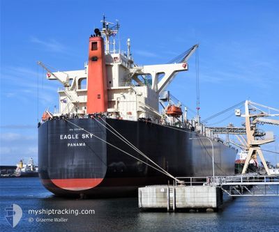
EAGLE SKY
Wood Chips Carrier
Current Trip
| Time Travelled | 4 days |
|---|---|
| Remaining Time | --- |
| Distance Travelled | 1210.82 nm |
| Remaining Distance | --- |
| AVG Speed | 10.6 Knopen |
| MAX Speed | 14.6 Knopen |
| AVG Wind | 17.2 knots |
| MAX Wind | 26 knots |
| MIN Temp | 14.9°C / 58.82°F |
| MAX Temp | 22.1°C / 71.78°F |
| Diepgang | 7.3 M |
| Positie ontvangen | 4 d geleden |
Current Position
| Lengtegraad | 134.98365° |
|---|---|
| Breedtegraat | 33.81555° |
| Status | Under way using engine |
| Snelheid | 9.8 Knopen |
| Koers | 151.3° |
| Gebied | Philippine Sea |
| Station | T-AIS |
| Positie ontvangen | 4 d geleden |
Info
Information
The current position of EAGLE SKY is in Philippine Sea with coordinates 33.81555° / 134.98365° as reported on 2024-04-15 13:00 by AIS to our vessel tracker app. The vessel's current speed is 9.8 Knopen and is heading at the port of CORRAL. The estimated time of arrival as calculated by MyShipTracking vessel tracking app is 2024-05-25 00:00 LT
The vessel EAGLE SKY (IMO: 9539298, MMSI: 351010000) is a Wood Chips Carrier that was built in 2014 ( 10 Jaar oud ). It's sailing under the flag of [PA] Panama.
In this page you can find informations about the vessels current position, last detected port calls, and current voyage information. If the vessels is not in coverage by AIS you will find the latest position.
The current position of EAGLE SKY is detected by our AIS receivers and we are not responsible for the reliability of the data. The last position was recorded while the vessel was in Coverage by the Ais receivers of our vessel tracking app.
The current draught of EAGLE SKY as reported by AIS is 7.3 meters
Weather
| Temperature | 22.4°C / 72.32°F |
|---|---|
| Wind Speed | 13 knots |
| Direction | 352° N |
| Pressure | 1015.7 hPa |
| Humidity | 88.2 % |
| Cloud Coverage | 77 % |
Featured Company
Last Port Calls
| Port | Arrival | Departure | Time In Port |
|---|---|---|---|
| 2024-04-11 01:14 | 2024-04-15 00:30 | 3 d | |
| 2024-03-20 06:40 | 2024-03-24 03:45 | 3 d | |
| 2024-02-25 00:32 | 2024-03-02 03:34 | 6 d | |
| 2024-02-11 01:45 | 2024-02-16 02:11 | 5 d | |
| 2024-02-04 04:34 |
Last Trips
| Origin | Departure | Destination | Arrival | Distance | |
|---|---|---|---|---|---|
| 2024-03-24 11:45 | 2024-04-11 10:14 | 4500.39 nm | |||
| 2024-03-02 12:34 | 2024-03-20 14:40 | 4498.99 nm | |||
| 2024-02-16 09:11 | 2024-02-25 09:32 | 2269.94 nm | |||
| 2024-02-04 12:34 | 2024-02-11 08:45 | 1450.95 nm |
Events
| Tijd | Evenement | Details | Positie / Bestemming | Info |
|---|---|---|---|---|
| 2024-04-15 13:05 | Status Changed | Default Under way using engine |
33.80302 / 134.99171
CORRAL CHILE
|
Snelheid: 9.8 kn Koers: 151.3° |
| 2024-04-15 13:00 | Buitenbereik |
33.81555 / 134.98365
Philippine Sea
|
Snelheid: 9.8 kn Koers: 151.3° |
|
| 2024-04-15 12:48 | Status Changed | Under way using engine Default |
33.84388 / 134.96314
CORRAL CHILE
|
Snelheid: 9.1 kn Koers: 148° |
| 2024-04-15 12:18 | Status Changed | Default Under way using engine |
33.92042 / 134.95660
CORRAL CHILE
|
Snelheid: 10.1 kn Koers: 179.2° |
| 2024-04-15 12:14 | Status Changed | Under way using engine Default |
33.93312 / 134.95639
CORRAL CHILE
|
Snelheid: 10.1 kn Koers: 180° |
| 2024-04-15 12:06 | Status Changed | Default Under way using engine |
33.95410 / 134.95586
CORRAL CHILE
|
Snelheid: 10.1 kn Koers: 175.8° |
| 2024-04-15 10:11 | Wijzig zee gebeid | Japanese part of the Philippine Sea Japanese part of the Inland Sea |
34.26985 / 134.96959
Philippine Sea
|
Snelheid: 13.9 kn Koers: 188.8° |
| 2024-04-15 04:30 | Status Changed | Under way using engine Default |
34.41617 / 134.17574
CORRAL CHILE
|
Snelheid: 13.1 kn Koers: 113° |
| 2024-04-15 04:26 | Status Changed | Default Under way using engine |
34.42107 / 134.16159
CORRAL CHILE
|
Snelheid: 13 kn Koers: 113.6° |
| 2024-04-15 03:56 | Status Changed | Under way using engine Default |
34.43337 / 134.03857
CORRAL CHILE
|
Snelheid: 12 kn Koers: 65° |