
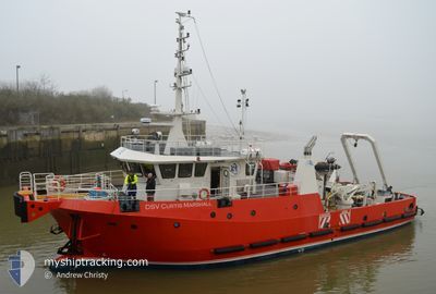
DSV CURTIS MARSHALL
Spare - Local Vessel
Current Trip
| Time Travelled | 2 days |
|---|---|
| Remaining Time | --- |
| Distance Travelled | 62.88 nm |
| Remaining Distance | --- |
| AVG Speed | 8.7 Knopen |
| MAX Speed | 12.9 Knopen |
| AVG Wind | 12 knots |
| MAX Wind | 19.1 knots |
| MIN Temp | 6.1°C / 42.98°F |
| MAX Temp | 7.7°C / 45.86°F |
| Diepgang | 2.8 M |
| Positie ontvangen | 1 d geleden |
Current Position
| Lengtegraad | -2.86281° |
|---|---|
| Breedtegraat | 58.46967° |
| Status | Under way using engine |
| Snelheid | 10.6 Knopen |
| Koers | 235.5° |
| Gebied | North Sea |
| Station | T-AIS |
| Positie ontvangen | 1 d geleden |
Info
Information
The current position of DSV CURTIS MARSHALL is in North Sea with coordinates 58.46967° / -2.86281° as reported on 2024-04-18 07:12 by AIS to our vessel tracker app. The vessel's current speed is 10.6 Knopen and is heading at the port of WICK. The estimated time of arrival as calculated by MyShipTracking vessel tracking app is 2024-04-18 10:00 LT
The vessel DSV CURTIS MARSHALL (IMO: 9775012, MMSI: 235107219) is a Spare - Local Vessel It's sailing under the flag of [GB] United Kingdom.
In this page you can find informations about the vessels current position, last detected port calls, and current voyage information. If the vessels is not in coverage by AIS you will find the latest position.
The current position of DSV CURTIS MARSHALL is detected by our AIS receivers and we are not responsible for the reliability of the data. The last position was recorded while the vessel was in Coverage by the Ais receivers of our vessel tracking app.
The current draught of DSV CURTIS MARSHALL as reported by AIS is 2.8 meters
Weather
| Temperature | 6.3°C / 43.34°F |
|---|---|
| Wind Speed | 19 knots |
| Direction | 222° SW |
| Pressure | 1013.7 hPa |
| Humidity | 85.8 % |
| Cloud Coverage | 100 % |
Featured Company
Last Port Calls
| Port | Arrival | Departure | Time In Port |
|---|---|---|---|
| 2024-04-15 16:41 | 2024-04-17 05:04 | 1 d | |
| 2024-04-14 16:21 | 2024-04-15 05:04 | 12 h | |
| 2024-04-10 12:24 | 2024-04-14 11:54 | 3 d | |
| 2024-04-09 05:52 | 2024-04-10 07:34 | 1 d | |
| 2024-04-01 10:36 | 2024-04-08 16:10 | 7 d | |
| 2024-03-26 12:24 | 2024-03-30 05:55 | 3 d | |
| 2024-03-21 02:36 | 2024-03-25 06:01 | 4 d | |
| 2024-03-15 04:32 | 2024-03-19 21:43 | 4 d | |
| 2024-03-08 06:24 | 2024-03-14 06:03 | 5 d | |
| 2024-03-03 17:09 | 2024-03-07 17:36 | 4 d |
Last Trips
| Origin | Departure | Destination | Arrival | Distance | |
|---|---|---|---|---|---|
| 2024-04-15 06:04 | 2024-04-15 17:41 | 42.71 nm | |||
| 2024-04-14 12:54 | 2024-04-14 17:21 | 19.14 nm | |||
| 2024-04-10 08:34 | 2024-04-10 13:24 | 23.17 nm | |||
| 2024-04-08 17:10 | 2024-04-09 06:52 | 87.38 nm | |||
| 2024-03-30 05:55 | 2024-04-01 11:36 | 91.09 nm | |||
| 2024-03-25 06:01 | 2024-03-26 12:24 | 49.16 nm | |||
| 2024-03-19 21:43 | 2024-03-21 02:36 | 37.99 nm | |||
| 2024-03-14 06:03 | 2024-03-15 04:32 | 21.02 nm | |||
| 2024-03-07 17:36 | 2024-03-08 06:24 | 129.94 nm | |||
| 2024-03-02 05:54 | 2024-03-03 17:09 | 155.49 nm |
Events
| Tijd | Evenement | Details | Positie / Bestemming | Info |
|---|---|---|---|---|
| 2024-04-18 07:12 | Buitenbereik |
58.46967 / -2.86281
North Sea
WICK
|
Snelheid: 10.6 kn Koers: 235.5° |
|
| 2024-04-18 07:09 | Destination Changed | WICK ENGAGED SURVEY OPS |
58.47558 / -2.84624
WICK
|
Snelheid: 10.9 kn Koers: 238° |
| 2024-04-18 07:09 | ETA Changed | 2024/04/18 10:00 2024/04/17 10:00 |
58.47558 / -2.84624
WICK
|
Snelheid: 10.9 kn Koers: 238° |
| 2024-04-18 07:08 | Status Changed | Under way using engine Restricted manoeuverability |
58.47619 / -2.84455
ENGAGED SURVEY OPS
|
Snelheid: 3.9 kn Koers: 239° |
| 2024-04-18 05:39 | Start beweging | 13.59 nm, South East of JOHN O'GROATS |
58.54795 / -2.67860
ENGAGED SURVEY OPS
|
Snelheid: 3.5 kn Koers: 259° |
| 2024-04-18 05:24 | Stop beweging | 13.42 nm, South East of JOHN O'GROATS |
58.54749 / -2.68512
ENGAGED SURVEY OPS
|
Snelheid: 0.2 kn Koers: 327° |
| 2024-04-18 05:18 | Destination Changed | ENGAGED SURVEY OPS TRANSIT TO WORKSITE |
58.54677 / -2.68898
ENGAGED SURVEY OPS
|
Snelheid: 1.3 kn Koers: 331° |
| 2024-04-18 05:04 | Binnenbereik |
58.54604 / -2.69829
North Sea
|
Snelheid: 2.4 kn Koers: 107° |
|
| 2024-04-18 03:38 | Buitenbereik |
58.53444 / -2.76060
North Sea
|
Snelheid: 2.8 kn Koers: 112.3° |
|
| 2024-04-18 03:27 | Binnenbereik |
58.53391 / -2.78874
North Sea
|
Snelheid: 4.6 kn Koers: 87.5° |