
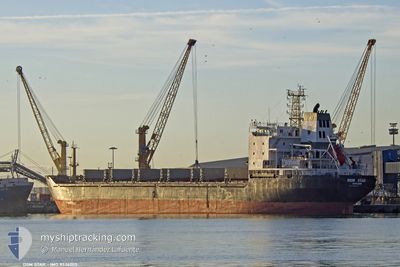
DSM STAR
Bulk Carrier
Current Trip
| Time Travelled | 6 h, 41 mins |
|---|---|
| Remaining Time | 2 h, 2 mins |
| Distance Travelled | 38.09 nm |
| Remaining Distance | 11.09 nm |
| AVG Speed | 5.3 Knopen |
| MAX Speed | 10.3 Knopen |
| AVG Wind | 14.3 knots |
| MAX Wind | 20.3 knots |
| MIN Temp | 11.9°C / 53.42°F |
| MAX Temp | 12.8°C / 55.04°F |
| Diepgang | 9.9 M |
| Positie ontvangen | Nu |
Current Position
| Lengtegraad | 28.80898° |
|---|---|
| Breedtegraat | 40.84669° |
| Status | Under way using engine |
| Snelheid | 4.7 Knopen |
| Koers | 178° |
| Gebied | Sea of Marmara |
| Station | T-AIS |
| Positie ontvangen | Nu |
Info
Information
The current position of DSM STAR is in Sea of Marmara with coordinates 40.84669° / 28.80898° as reported on 2024-04-20 08:25 by AIS to our vessel tracker app. The vessel's current speed is 4.7 Knopen and is heading at the port of ISTANBUL. The estimated time of arrival as calculated by MyShipTracking vessel tracking app is 2024-04-20 10:28 LT
The vessel DSM STAR (IMO: 9524205, MMSI: 511100661) is a Bulk Carrier that was built in 2008 ( 16 Jaar oud ). It's sailing under the flag of [PW] Palau.
In this page you can find informations about the vessels current position, last detected port calls, and current voyage information. If the vessels is not in coverage by AIS you will find the latest position.
The current position of DSM STAR is detected by our AIS receivers and we are not responsible for the reliability of the data. The last position was recorded while the vessel was in Coverage by the Ais receivers of our vessel tracking app.
The current draught of DSM STAR as reported by AIS is 9.9 meters
Weather
| Temperature | 12.4°C / 54.32°F |
|---|---|
| Wind Speed | 8 knots |
| Direction | 179° S |
| Pressure | 1001.4 hPa |
| Humidity | 91.9 % |
| Cloud Coverage | 100 % |
Featured Company
Last Port Calls
| Port | Arrival | Departure | Time In Port |
|---|---|---|---|
| 2024-04-18 11:54 | 2024-04-20 01:45 | 1 d | |
| 2024-03-29 11:59 | 2024-04-02 13:54 | 4 d | |
| 2024-03-09 14:25 | |||
| 2024-02-06 02:32 | 2024-02-10 13:00 | 4 d |
Most Visited Ports (Last year)
| Port | Arrivals | |
|---|---|---|
| 3 | ||
| 3 | ||
| 2 | ||
| 2 | ||
| 2 | ||
| 1 |
Last Trips
| Origin | Departure | Destination | Arrival | Distance | |
|---|---|---|---|---|---|
| 2024-04-02 15:54 | 2024-04-18 14:54 | 1678.86 nm | |||
| 2024-03-09 16:25 | 2024-03-29 12:59 | 1998.71 nm | |||
| 2024-01-25 09:45 | 2024-02-06 03:32 | 2005.18 nm |
Events
| Tijd | Evenement | Details | Positie / Bestemming | Info |
|---|---|---|---|---|
| 2024-04-20 02:38 | Destination Changed | TR IST TR IZT |
40.76075 / 29.23546
TR IST
|
Snelheid: 9.2 kn Koers: 283.5° |
| 2024-04-20 02:38 | ETA Changed | 2024/04/20 08:00 2024/04/18 13:00 |
40.76075 / 29.23546
TR IST
|
Snelheid: 9.2 kn Koers: 283.5° |
| 2024-04-20 01:52 | Start beweging | 0.91 nm, South West of GEBZE |
40.74734 / 29.36128
TR IZT
|
Snelheid: 3.1 kn Koers: 167° |
| 2024-04-20 01:49 | Status Changed | Under way using engine Moored |
40.74984 / 29.36191
TR IZT
|
Snelheid: 2.8 kn Koers: 187° |
| 2024-04-20 01:45 | Vertrekhaven |
|
40.75239 / 29.36362
TR IZT
|
Snelheid: 2 kn Koers: 209° |
| 2024-04-20 01:20 | Draught Changed | 9.9 5.8 |
40.75632 / 29.36470
[TR] GEBZE
|
Snelheid: Koers: 307° |
| 2024-04-18 14:38 | Destination Changed | TR IZT TR IST |
40.75632 / 29.36470
[TR] GEBZE
|
Snelheid: Koers: 307° |
| 2024-04-18 12:09 | Status Changed | Moored Under way using engine |
40.75634 / 29.36462
[TR] GEBZE
|
Snelheid: 0.1 kn Koers: 307° |
| 2024-04-18 12:03 | Stop beweging |
40.75623 / 29.36453
[TR] GEBZE
|
Snelheid: 0.3 kn Koers: 310° |
|
| 2024-04-18 11:54 | Aankomsthaven |
|
40.75417 / 29.36775
[TR] GEBZE
|
Snelheid: 3.1 kn Koers: 304° |