
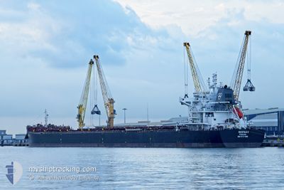
DESPINA V
Cargo
Current Trip
| Trip Time | 13 days |
|---|---|
| Trip Distance | 2360.62 nm |
| AVG Speed | 9.3 Knopen |
| MAX Speed | 12.2 Knopen |
| Diepgang | 13.7 M |
| AVG Wind | 15.7 knots |
| MAX Wind | 34 knots |
| MIN Temp | 12.2°C / 53.96°F |
| MAX Temp | 28.5°C / 83.3°F |
| Positie ontvangen | 1 d geleden |
Current Position
| Lengtegraad | -7.46078° |
|---|---|
| Breedtegraat | 43.77340° |
| Status | Under way using engine |
| Snelheid | 4.1 Knopen |
| Koers | 225° |
| Gebied | Bay of Biscay |
| Station | T-AIS |
| Positie ontvangen | 1 d geleden |
Info
Information
The current position of DESPINA V is in Bay of Biscay with coordinates 43.77340° / -7.46078° as reported on 2024-04-18 10:50 by AIS to our vessel tracker app. The vessel's current speed is 4.1 Knopen and is currently inside the port of SAN CIPRIAN.
The vessel DESPINA V (IMO: 9727986, MMSI: 371313000) is a Cargo It's sailing under the flag of [PA] Panama.
In this page you can find informations about the vessels current position, last detected port calls, and current voyage information. If the vessels is not in coverage by AIS you will find the latest position.
The current position of DESPINA V is detected by our AIS receivers and we are not responsible for the reliability of the data. The last position was recorded while the vessel was in Coverage by the Ais receivers of our vessel tracking app.
The current draught of DESPINA V as reported by AIS is 13.7 meters
Weather
| Temperature | 13°C / 55.4°F |
|---|---|
| Wind Speed | 23 knots |
| Direction | 91° E |
| Pressure | 1019 hPa |
| Humidity | 80 % |
| Cloud Coverage | 3 % |
Featured Company
Last Port Calls
| Port | Arrival | Departure | Time In Port |
|---|---|---|---|
| 2024-04-18 11:49 | |||
| 2024-04-04 00:10 | 2024-04-05 05:25 | 1 d | |
| 2024-03-24 02:41 | 2024-03-24 02:56 | 15 m | |
| 2024-03-20 12:19 | 2024-03-20 14:23 | 2 h | |
| 2024-03-18 20:34 | 2024-03-20 09:27 | 1 d | |
| 2024-03-04 05:51 | |||
| 2024-02-10 14:26 | 2024-02-13 14:41 | 3 d |
Most Visited Ports (Last year)
| Port | Arrivals | |
|---|---|---|
| 3 | ||
| 2 | ||
| 2 | ||
| 2 | ||
| 2 | ||
| 2 |
Last Trips
| Origin | Departure | Destination | Arrival | Distance | |
|---|---|---|---|---|---|
| 2024-04-05 05:25 | 2024-04-18 13:49 | 2360.62 nm | |||
| 2024-03-24 03:56 | 2024-04-04 00:10 | 3049.09 nm | |||
| 2024-03-20 15:23 | 2024-03-24 03:41 | 7.16 nm | |||
| 2024-03-20 10:27 | 2024-03-20 13:19 | 10.17 nm | |||
| 2024-02-13 15:41 | 2024-03-04 00:51 | 3369.99 nm | |||
| 2024-01-23 17:59 | 2024-02-10 15:26 | 2903.66 nm |
Events
| Tijd | Evenement | Details | Positie / Bestemming | Info |
|---|---|---|---|---|
| 2024-04-18 11:49 | Stop beweging |
43.71167 / -7.46333
[ES] SAN CIPRIAN
|
Snelheid: Koers: -1° |
|
| 2024-04-18 11:49 | Aankomsthaven |
|
43.71167 / -7.46333
[ES] SAN CIPRIAN
|
Snelheid: 4 kn Koers: -1° |
| 2024-04-18 11:22 | Status Changed | Default Under way using engine |
43.73667 / -7.44333
ESSCI
|
Snelheid: 4.1 kn Koers: 225° |
| 2024-04-18 10:50 | Buitenbereik |
43.77340 / -7.46078
Bay of Biscay
|
Snelheid: 4.1 kn Koers: 262.2° |
|
| 2024-04-18 10:22 | Status Changed | Under way using engine Default |
43.75249 / -7.42598
ESSCI
|
Snelheid: Koers: -1° |
| 2024-04-18 10:22 | Start beweging | 2.87 nm, North East of SAN CIPRIAN |
43.75249 / -7.42598
ESSCI
|
Snelheid: 4.2 kn Koers: 314° |
| 2024-04-18 10:22 | Binnenbereik |
43.75249 / -7.42598
Bay of Biscay
|
Snelheid: 4.2 kn Koers: 305.3° |
|
| 2024-04-18 09:34 | Status Changed | Default At anchor |
43.74166 / -7.41167
ESSCI
|
Snelheid: 0.5 kn Koers: 38° |
| 2024-04-18 08:58 | Buitenbereik |
43.74142 / -7.41263
Bay of Biscay
|
Snelheid: 0.5 kn Koers: 303.9° |
|
| 2024-04-18 08:37 | Binnenbereik |
43.74134 / -7.41248
Bay of Biscay
|
Snelheid: 0.2 kn Koers: 115.3° |