
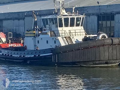
DELTA LINDA
Tug
Current Trip
SFB HARBOR OPS
| Time Travelled | 5 h, 50 mins |
|---|---|
| Remaining Time | --- |
| Distance Travelled | 38.48 nm |
| Remaining Distance | --- |
| AVG Speed | 8.6 Knopen |
| MAX Speed | 10.4 Knopen |
| AVG Wind | 3 knots |
| MAX Wind | 5.6 knots |
| MIN Temp | 13.7°C / 56.66°F |
| MAX Temp | 21.6°C / 70.88°F |
| Diepgang | 1 M |
| Positie ontvangen | 2 m geleden |
Current Position
| Lengtegraad | -122.26959° |
|---|---|
| Breedtegraat | 38.05741° |
| Status | Under way using engine |
| Snelheid | 8.2 Knopen |
| Koers | 79.2° |
| Gebied | North Pacific Ocean |
| Station | T-AIS |
| Positie ontvangen | 2 m geleden |
Info
Information
The current position of DELTA LINDA is in North Pacific Ocean with coordinates 38.05741° / -122.26959° as reported on 2024-04-16 22:48 by AIS to our vessel tracker app. The vessel's current speed is 8.2 Knopen
The vessel DELTA LINDA (IMO: 940994800, MMSI: 367328780) is a Tug It's sailing under the flag of [US] USA.
In this page you can find informations about the vessels current position, last detected port calls, and current voyage information. If the vessels is not in coverage by AIS you will find the latest position.
The current position of DELTA LINDA is detected by our AIS receivers and we are not responsible for the reliability of the data. The last position was recorded while the vessel was in Coverage by the Ais receivers of our vessel tracking app.
The current draught of DELTA LINDA as reported by AIS is 1 meters
Weather
| Temperature | 21.6°C / 70.88°F |
|---|---|
| Wind Speed | 5 knots |
| Direction | 267° W |
| Pressure | 1018.5 hPa |
| Humidity | 44.3 % |
| Cloud Coverage | 14 % |
Featured Company
Last Port Calls
| Port | Arrival | Departure | Time In Port |
|---|---|---|---|
| 2024-04-16 06:08 | 2024-04-16 17:01 | 10 h | |
| 2024-04-15 23:15 | 2024-04-16 01:16 | 2 h | |
| 2024-04-15 05:46 | 2024-04-15 21:58 | 16 h | |
| 2024-04-14 12:23 | 2024-04-15 01:50 | 13 h | |
| 2024-04-14 02:30 | 2024-04-14 08:32 | 6 h | |
| 2024-04-14 00:01 | 2024-04-14 01:19 | 1 h | |
| 2024-04-13 21:43 | |||
| 2024-04-13 10:37 | |||
| 2024-04-13 10:37 | |||
| 2024-04-13 08:59 |
Most Visited Ports (Last year)
| Port | Arrivals | |
|---|---|---|
| 460 | ||
| 228 | ||
| 132 | ||
| 90 | ||
| 83 | ||
| 69 |
Last Trips
| Origin | Departure | Destination | Arrival | Distance | |
|---|---|---|---|---|---|
| 2024-04-15 18:16 | 2024-04-15 23:08 | 35.18 nm | |||
| 2024-04-15 14:58 | 2024-04-15 16:15 | 4.68 nm | |||
| 2024-04-14 18:50 | 2024-04-14 22:46 | 34.47 nm | |||
| 2024-04-14 01:32 | 2024-04-14 05:23 | 8.31 nm | |||
| 2024-04-13 18:19 | 2024-04-13 19:30 | 1.89 nm | |||
| 2024-04-13 14:43 | 2024-04-13 17:01 | 4.21 nm | |||
| 2024-04-13 03:37 | 2024-04-13 03:37 | --- | |||
| 2024-04-12 18:12 | 2024-04-13 01:59 | 26.66 nm | |||
| 2024-04-12 16:29 | 2024-04-12 17:18 | 7.35 nm | |||
| 2024-04-12 01:09 | 2024-04-12 05:37 | 18.93 nm |
Events
| Tijd | Evenement | Details | Positie / Bestemming | Info |
|---|---|---|---|---|
| 2024-04-16 21:00 | Start beweging | 2.51 nm, South East of CHEVRON SF |
37.90419 / -122.36299
SFB HARBOR OPS
|
Snelheid: 3.3 kn Koers: 262° |
| 2024-04-16 19:38 | Stop beweging | 2.32 nm, East of CHEVRON SF |
37.91082 / -122.36359
SFB HARBOR OPS
|
Snelheid: 0.2 kn Koers: 350° |
| 2024-04-16 17:46 | Status Changed | Under way using engine Default |
38.05625 / -122.27819
SFB HARBOR OPS
|
Snelheid: 8.9 kn Koers: 259° |
| 2024-04-16 17:07 | Status Changed | Default Under way using engine |
38.03366 / -122.16443
SFB HARBOR OPS
|
Snelheid: 8.1 kn Koers: 238° |
| 2024-04-16 17:01 | Vertrekhaven |
|
38.03518 / -122.14741
SFB HARBOR OPS
|
Snelheid: 6.9 kn Koers: 235° |
| 2024-04-16 16:58 | Status Changed | Under way using engine Default |
38.03856 / -122.13962
[US] BENICIA
|
Snelheid: Koers: 242° |
| 2024-04-16 16:58 | Start beweging |
38.03856 / -122.13962
[US] BENICIA
|
Snelheid: 6.9 kn Koers: 235° |
|
| 2024-04-16 16:44 | Binnenbereik |
38.03856 / -122.13962
North Pacific Ocean
[US] BENICIA
|
Snelheid: 6.9 kn Koers: 241.1° |
|
| 2024-04-16 06:08 | Aankomsthaven |
|
38.04548 / -122.12770
[US] BENICIA
|
Snelheid: 0.2 kn Koers: 320° |
| 2024-04-16 05:57 | Stop beweging | 0.43 nm, North East of BENICIA |
38.04484 / -122.12758
SFB HARBOR OPS
|
Snelheid: 0.2 kn Koers: 320° |