
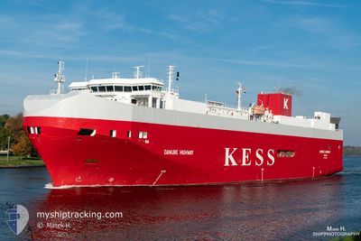
DANUBE HIGHWAY
Vehicles Carrier
Current Trip
| Trip Time | 1 day |
|---|---|
| Trip Distance | 308.94 nm |
| AVG Speed | 9.6 Knopen |
| MAX Speed | 9.6 Knopen |
| Diepgang | 7.4 M |
| AVG Wind | 16.1 knots |
| MAX Wind | 27.9 knots |
| MIN Temp | 4.2°C / 39.56°F |
| MAX Temp | 8°C / 46.4°F |
| Positie ontvangen | 2 m geleden |
Current Position
| Lengtegraad | 0.73982° |
|---|---|
| Breedtegraat | 51.43830° |
| Status | Moored |
| Snelheid | |
| Koers | 25° |
| Gebied | North Sea |
| Station | T-AIS |
| Positie ontvangen | 2 m geleden |
Info
Information
The current position of DANUBE HIGHWAY is in North Sea with coordinates 51.43830° / 0.73982° as reported on 2024-04-25 14:24 by AIS to our vessel tracker app. The vessel's current speed is 0 Knopen and is currently inside the port of SHEERNESS.
The vessel DANUBE HIGHWAY (IMO: 9316309, MMSI: 308803000) is a Vehicles Carrier that was built in 2006 ( 18 Jaar oud ). It's sailing under the flag of [BS] Bahamas.
In this page you can find informations about the vessels current position, last detected port calls, and current voyage information. If the vessels is not in coverage by AIS you will find the latest position.
The current position of DANUBE HIGHWAY is detected by our AIS receivers and we are not responsible for the reliability of the data. The last position was recorded while the vessel was in Coverage by the Ais receivers of our vessel tracking app.
The current draught of DANUBE HIGHWAY as reported by AIS is 7.4 meters
Weather
| Temperature | 9°C / 48.2°F |
|---|---|
| Wind Speed | 14 knots |
| Direction | 291° WNW |
| Pressure | 1002.4 hPa |
| Humidity | 79 % |
| Cloud Coverage | 100 % |
Featured Company
Last Port Calls
| Port | Arrival | Departure | Time In Port |
|---|---|---|---|
| 2024-04-24 23:22 | |||
| 2024-04-23 05:39 | 2024-04-23 20:52 | 15 h | |
| 2024-04-21 16:59 | 2024-04-22 05:22 | 12 h | |
| 2024-04-20 09:10 | 2024-04-20 18:20 | 9 h | |
| 2024-04-17 09:52 | 2024-04-17 23:12 | 13 h | |
| 2024-04-17 01:56 | 2024-04-17 06:25 | 4 h | |
| 2024-04-15 03:53 | 2024-04-15 16:31 | 12 h | |
| 2024-04-11 23:16 | 2024-04-12 21:49 | 22 h | |
| 2024-04-11 03:46 | 2024-04-11 14:12 | 10 h | |
| 2024-04-08 13:23 | 2024-04-10 02:47 | 1 d |
Last Trips
| Origin | Departure | Destination | Arrival | Distance | |
|---|---|---|---|---|---|
| 2024-04-23 22:52 | 2024-04-25 00:22 | 308.94 nm | |||
| 2024-04-22 06:22 | 2024-04-23 07:39 | 332.02 nm | |||
| 2024-04-20 20:20 | 2024-04-21 17:59 | 339.44 nm | |||
| 2024-04-18 02:12 | 2024-04-20 11:10 | 994.61 nm | |||
| 2024-04-17 09:25 | 2024-04-17 12:52 | 46.23 nm | |||
| 2024-04-15 18:31 | 2024-04-17 04:56 | 518.50 nm | |||
| 2024-04-12 23:49 | 2024-04-15 05:53 | 671.56 nm | |||
| 2024-04-11 15:12 | 2024-04-12 01:16 | 98.18 nm | |||
| 2024-04-10 04:47 | 2024-04-11 04:46 | 310.80 nm | |||
| 2024-04-04 15:45 | 2024-04-08 15:23 | 1020.58 nm |
Events
| Tijd | Evenement | Details | Positie / Bestemming | Info |
|---|---|---|---|---|
| 2024-04-25 05:51 | Status Changed | Moored Default |
51.43827 / .73982
[GB] SHEERNESS
|
Snelheid: Koers: 25° |
| 2024-04-25 05:48 | Status Changed | Default Moored |
51.43828 / .73981
[GB] SHEERNESS
|
Snelheid: Koers: 25° |
| 2024-04-24 23:35 | Status Changed | Moored Under way using engine |
51.43830 / .73984
[GB] SHEERNESS
|
Snelheid: Koers: 25° |
| 2024-04-24 23:26 | Stop beweging |
51.43826 / .73952
[GB] SHEERNESS
|
Snelheid: 0.3 kn Koers: 26° |
|
| 2024-04-24 23:22 | Aankomsthaven |
|
51.43870 / .73881
[GB] SHEERNESS
|
Snelheid: 0.7 kn Koers: 40° |
| 2024-04-24 18:44 | Start beweging |
51.67037 / 2.08817
SHEERNESS
|
Snelheid: 10 kn Koers: 233.8° |
|
| 2024-04-24 18:44 | Stop beweging |
51.67174 / 2.09119
SHEERNESS
|
Snelheid: Koers: 0° |
|
| 2024-04-24 16:08 | Gevonden in zee | United Kingdom part of the North Sea |
51.98213 / 2.62302
North Sea
SHEERNESS
|
Snelheid: 12 kn Koers: 223.2° |
| 2024-04-24 14:50 | Status Changed | Under way using engine Default |
52.15902 / 2.91260
SHEERNESS
|
Snelheid: 11.6 kn Koers: 223° |
| 2024-04-24 14:45 | Status Changed | Default Under way using engine |
52.16804 / 2.93019
SHEERNESS
|
Snelheid: 11.6 kn Koers: 220.6° |