
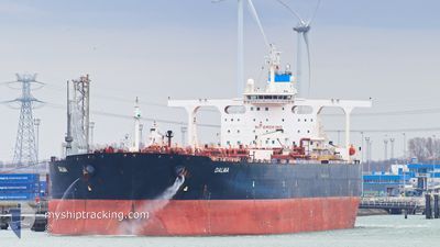
DALMA
Crude Oil Tanker
Current Trip
| Time Travelled | 56 days |
|---|---|
| Remaining Time | --- |
| Distance Travelled | 12067.64 nm |
| Remaining Distance | --- |
| AVG Speed | 11.3 Knopen |
| MAX Speed | 11.3 Knopen |
| AVG Wind | 8.7 knots |
| MAX Wind | 25.7 knots |
| MIN Temp | -6.1°C / 21.02°F |
| MAX Temp | 30.8°C / 87.44°F |
| Diepgang | 19.9 M |
| Positie ontvangen | 4 d geleden |
Current Position
| Lengtegraad | 104.41188° |
|---|---|
| Breedtegraat | 1.35750° |
| Status | Under way using engine |
| Snelheid | 11.7 Knopen |
| Koers | 46° |
| Gebied | South China Sea |
| Station | T-AIS |
| Positie ontvangen | 4 d geleden |
Info
Information
The current position of DALMA is in South China Sea with coordinates 1.35750° / 104.41188° as reported on 2024-04-19 04:20 by AIS to our vessel tracker app. The vessel's current speed is 11.7 Knopen and is heading at the port of TAEAN-GUN. The estimated time of arrival as calculated by MyShipTracking vessel tracking app is 2024-04-28 00:00 LT
The vessel DALMA (IMO: 9322279, MMSI: 636018893) is a Crude Oil Tanker that was built in 2007 ( 17 Jaar oud ). It's sailing under the flag of [LR] Liberia.
In this page you can find informations about the vessels current position, last detected port calls, and current voyage information. If the vessels is not in coverage by AIS you will find the latest position.
The current position of DALMA is detected by our AIS receivers and we are not responsible for the reliability of the data. The last position was recorded while the vessel was in Coverage by the Ais receivers of our vessel tracking app.
The current draught of DALMA as reported by AIS is 19.9 meters
Weather
| Temperature | 27.4°C / 81.32°F |
|---|---|
| Wind Speed | 7 knots |
| Direction | 276° W |
| Pressure | 1009.5 hPa |
| Humidity | 73.1 % |
| Cloud Coverage | 100 % |
Featured Company
Most Visited Ports (Last year)
| Port | Arrivals | |
|---|---|---|
| 1 | ||
| 1 | ||
| 1 |
Last Trips
| Origin | Departure | Destination | Arrival | Distance |
|---|
Events
| Tijd | Evenement | Details | Positie / Bestemming | Info |
|---|---|---|---|---|
| 2024-04-19 04:20 | Buitenbereik |
1.35750 / 104.41188
South China Sea
KRTAN
|
Snelheid: 11.7 kn Koers: 46° |
|
| 2024-04-19 03:58 | Wijzig zee gebeid | Malaysian part of the South China Sea Malaysian part of the Singapore Strait |
1.30920 / 104.35981
South China Sea
KRTAN
|
Snelheid: 11.8 kn Koers: 51° |
| 2024-04-19 03:04 | Wijzig zee gebeid | Malaysian part of the Singapore Strait Indonesian part of the Singapore Strait |
1.25622 / 104.18978
Singapore Strait
KRTAN
|
Snelheid: 11.9 kn Koers: 82° |
| 2024-04-19 01:02 | Wijzig zee gebeid | Indonesian part of the Singapore Strait Singaporean part of the Singapore Strait |
1.18142 / 103.82808
Singapore Strait
KRTAN
|
Snelheid: 10.1 kn Koers: 69° |
| 2024-04-19 00:44 | Wijzig zee gebeid | Singaporean part of the Singapore Strait Indonesian part of the Singapore Strait |
1.16038 / 103.78688
Singapore Strait
KRTAN
|
Snelheid: 8.5 kn Koers: 51° |
| 2024-04-18 22:36 | ETA Changed | 2024/04/28 00:00 2024/04/27 22:00 |
1.13402 / 103.51182
KRTAN
|
Snelheid: 8.9 kn Koers: 125° |
| 2024-04-18 21:53 | Wijzig zee gebeid | Indonesian part of the Singapore Strait Indonesian part of the Malacca Strait |
1.18437 / 103.42870
Singapore Strait
KRTAN
|
Snelheid: 8 kn Koers: 124° |
| 2024-04-18 21:42 | Gevonden in zee | Indonesian part of the Malacca Strait |
1.19865 / 103.40717
Malacca Strait
KRTAN
|
Snelheid: 8 kn Koers: 121° |
| 2024-04-18 21:42 | Binnenbereik |
1.19865 / 103.40717
Malacca Strait
KRTAN
|
Snelheid: 8 kn Koers: 121° |