
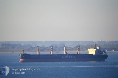
CS SONOMA
Bulk Carrier
Current Trip
| Time Travelled | 46 days |
|---|---|
| Remaining Time | --- |
| Distance Travelled | 12336.36 nm |
| Remaining Distance | --- |
| AVG Speed | 10.9 Knopen |
| MAX Speed | 13.6 Knopen |
| AVG Wind | 14.1 knots |
| MAX Wind | 29.8 knots |
| MIN Temp | 8.9°C / 48.02°F |
| MAX Temp | 30.2°C / 86.36°F |
| Diepgang | 11.8 M |
| Positie ontvangen | 17 h, 2 m geleden |
Current Position
| Lengtegraad | -17.06290° |
|---|---|
| Breedtegraat | 22.92852° |
| Status | Under way using engine |
| Snelheid | 10.5 Knopen |
| Koers | 16° |
| Gebied | North Atlantic Ocean |
| Station | T-AIS |
| Positie ontvangen | 17 h, 2 m geleden |
Info
Information
The current position of CS SONOMA is in North Atlantic Ocean with coordinates 22.92852° / -17.06290° as reported on 2024-04-19 07:40 by AIS to our vessel tracker app. The vessel's current speed is 10.5 Knopen and is heading at the port of GIBRALTAR. The estimated time of arrival as calculated by MyShipTracking vessel tracking app is 2024-04-23 05:00 LT
The vessel CS SONOMA (IMO: 9569944, MMSI: 311033300) is a Bulk Carrier that was built in 2010 ( 14 Jaar oud ). It's sailing under the flag of [BS] Bahamas.
In this page you can find informations about the vessels current position, last detected port calls, and current voyage information. If the vessels is not in coverage by AIS you will find the latest position.
The current position of CS SONOMA is detected by our AIS receivers and we are not responsible for the reliability of the data. The last position was recorded while the vessel was in Coverage by the Ais receivers of our vessel tracking app.
The current draught of CS SONOMA as reported by AIS is 11.8 meters
Weather
| Temperature | 19.3°C / 66.74°F |
|---|---|
| Wind Speed | 12 knots |
| Direction | 17° NNE |
| Pressure | 1016.5 hPa |
| Humidity | 85.2 % |
| Cloud Coverage | 100 % |
Featured Company
Last Trips
Events
| Tijd | Evenement | Details | Positie / Bestemming | Info |
|---|---|---|---|---|
| 2024-04-19 07:45 | Status Changed | Default Under way using engine |
22.94168 / -17.05847
GIBRALTAR
|
Snelheid: 10.5 kn Koers: 16° |
| 2024-04-19 07:40 | Buitenbereik |
22.92852 / -17.06290
North Atlantic Ocean
GIBRALTAR
|
Snelheid: 10.5 kn Koers: 16° |
|
| 2024-04-19 07:26 | Binnenbereik |
22.89043 / -17.07525
North Atlantic Ocean
GIBRALTAR
|
Snelheid: 10.4 kn Koers: 15° |
|
| 2024-04-19 01:54 | Status Changed | Default Under way using engine |
21.98022 / -17.38750
GIBRALTAR
|
Snelheid: 10.7 kn Koers: 16° |
| 2024-04-19 01:41 | Buitenbereik |
21.94322 / -17.39975
North Atlantic Ocean
GIBRALTAR
|
Snelheid: 10.7 kn Koers: 16° |
|
| 2024-04-19 01:27 | Status Changed | Under way using engine Default |
21.90268 / -17.41362
GIBRALTAR
|
Snelheid: 10.3 kn Koers: 16° |
| 2024-04-19 01:13 | Binnenbereik |
21.90268 / -17.41362
North Atlantic Ocean
GIBRALTAR
|
Snelheid: 10.4 kn Koers: 12° |
|
| 2024-04-18 22:05 | Status Changed | Default Under way using engine |
21.32087 / -17.55813
GIBRALTAR
|
Snelheid: 10.7 kn Koers: 4° |
| 2024-04-18 22:03 | Buitenbereik |
21.31312 / -17.55870
North Atlantic Ocean
GIBRALTAR
|
Snelheid: 10.7 kn Koers: 4° |
|
| 2024-04-18 22:00 | Status Changed | Under way using engine Default |
21.30608 / -17.55932
GIBRALTAR
|
Snelheid: 10.6 kn Koers: 1° |