
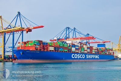
COSCO PISCES
Cargo A
Current Trip
| Time Travelled | 15 days |
|---|---|
| Remaining Time | --- |
| Distance Travelled | 6498.34 nm |
| Remaining Distance | --- |
| AVG Speed | 17.7 Knopen |
| MAX Speed | 20.2 Knopen |
| AVG Wind | 11.3 knots |
| MAX Wind | 23 knots |
| MIN Temp | 8.1°C / 46.58°F |
| MAX Temp | 29°C / 84.2°F |
| Diepgang | 11.4 M |
| Positie ontvangen | 2 d geleden |
Current Position
| Lengtegraad | --- |
|---|---|
| Breedtegraat | --- |
| Status | Under way using engine |
| Snelheid | 16 Knopen |
| Koers | 116.1° |
| Gebied | South Atlantic Ocean |
| Station | T-AIS |
| Positie ontvangen | 2 d geleden |
Info
Information
The current position of COSCO PISCES is in South Atlantic Ocean with coordinates -34.59131° / 18.58469° as reported on 2025-12-05 12:44 by AIS to our vessel tracker app. The vessel's current speed is 16 Knopen
The vessel COSCO PISCES (IMO: 9789647, MMSI: 477232800) is a Cargo A It's sailing under the flag of [HK] Hong Kong.
In this page you can find informations about the vessels current position, last detected port calls, and current voyage information. If the vessels is not in coverage by AIS you will find the latest position.
The current position of COSCO PISCES is detected by our AIS receivers and we are not responsible for the reliability of the data. The last position was recorded while the vessel was in Coverage by the Ais receivers of our vessel tracking app.
The current draught of COSCO PISCES as reported by AIS is 11.4 meters
Weather
| Temperature | 21°C / 69.8°F |
|---|---|
| Wind Speed | 10 knots |
| Direction | 128° SE |
| Pressure | 1016.9 hPa |
| Humidity | 69.7 % |
| Cloud Coverage | 73 % |
Featured Company
Last Trips
| Origin | Departure | Destination | Arrival | Distance | |
|---|---|---|---|---|---|
| 2025-11-13 01:25 | 2025-11-19 06:15 | 524.59 nm | |||
| 2025-11-10 15:51 | 2025-11-11 10:32 | 255.06 nm | |||
| 2025-11-06 09:37 | 2025-11-09 06:42 | 141.52 nm | |||
| 2025-10-31 03:38 | 2025-11-04 09:36 | 1064.99 nm | |||
| 2025-09-26 21:58 | 2025-10-27 17:46 | 12277.47 nm |
Events
| Tijd | Evenement | Details | Positie / Bestemming | Info |
|---|---|---|---|---|
| 2025-12-05 12:46 | Status Changed | Default Under way using engine |
-34.59531 / 18.59432
ESVLC TO SGSIN-PWBGA
|
Snelheid: 16 kn Koers: 116.1° |
| 2025-12-05 12:44 | Buitenbereik |
-34.59131 / 18.58469
South Atlantic Ocean
ESVLC TO SGSIN-PWBGA
|
Snelheid: 16 kn Koers: 116.1° |
|
| 2025-12-05 12:44 | Status Changed | Under way using engine Default |
-34.59009 / 18.58168
ESVLC TO SGSIN-PWBGA
|
Snelheid: 16.1 kn Koers: 115° |
| 2025-12-05 12:44 | Binnenbereik |
-34.59131 / 18.58469
South Atlantic Ocean
ESVLC TO SGSIN-PWBGA
|
Snelheid: 16 kn Koers: 116.1° |
|
| 2025-12-05 11:43 | Status Changed | Default Under way using engine |
-34.46555 / 18.29391
ESVLC TO SGSIN-PWBGA
|
Snelheid: 15.7 kn Koers: 116.3° |
| 2025-12-05 11:37 | Buitenbereik |
-34.45390 / 18.26497
South Atlantic Ocean
ESVLC TO SGSIN-PWBGA
|
Snelheid: 15.7 kn Koers: 116.3° |
|
| 2025-12-05 11:33 | Status Changed | Under way using engine Default |
-34.44487 / 18.24580
ESVLC TO SGSIN-PWBGA
|
Snelheid: 15.8 kn Koers: 138° |
| 2025-12-05 11:16 | Status Changed | Default Under way using engine |
-34.39101 / 18.18589
ESVLC TO SGSIN-PWBGA
|
Snelheid: 16.3 kn Koers: 120.7° |
| 2025-12-05 09:28 | Status Changed | Under way using engine Default |
-34.07855 / 17.74047
ESVLC TO SGSIN-PWBGA
|
Snelheid: 16.3 kn Koers: 132° |
| 2025-12-05 09:28 | Binnenbereik |
-34.07855 / 17.74047
South Atlantic Ocean
ESVLC TO SGSIN-PWBGA
|
Snelheid: 16.4 kn Koers: 131.7° |