
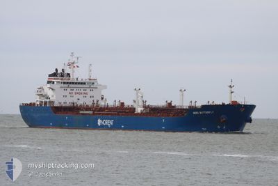
CLOTILDE
Oil/Chemical Tanker
Current Trip
| Trip Time | 3 days |
|---|---|
| Trip Distance | 463.10 nm |
| AVG Speed | 7.7 Knopen |
| MAX Speed | 11.3 Knopen |
| Diepgang | 0 M |
| AVG Wind | 10.9 knots |
| MAX Wind | 35 knots |
| MIN Temp | 13°C / 55.4°F |
| MAX Temp | 20.4°C / 68.72°F |
| Positie ontvangen | 19 h, 47 m geleden |
Current Position
| Lengtegraad | --- |
|---|---|
| Breedtegraat | --- |
| Status | Under way using engine |
| Snelheid | 0.8 Knopen |
| Koers | 258° |
| Gebied | Mediterranean Sea - Western Basin |
| Station | T-AIS |
| Positie ontvangen | 19 h, 47 m geleden |
Info
Information
The current position of CLOTILDE is in Mediterranean Sea - Western Basin with coordinates 35.84444° / -0.27166° as reported on 2025-12-08 16:01 by AIS to our vessel tracker app. The vessel's current speed is 0.8 Knopen and is currently inside the port of ARZEW.
The vessel CLOTILDE (IMO: 9448310, MMSI: 215910000) is a Oil/Chemical Tanker that was built in 2008 ( 17 Jaar oud ). It's sailing under the flag of [MT] Malta.
In this page you can find informations about the vessels current position, last detected port calls, and current voyage information. If the vessels is not in coverage by AIS you will find the latest position.
The current position of CLOTILDE is detected by our AIS receivers and we are not responsible for the reliability of the data. The last position was recorded while the vessel was in Coverage by the Ais receivers of our vessel tracking app.
Weather
| Temperature | 19.1°C / 66.38°F |
|---|---|
| Wind Speed | 2 knots |
| Direction | 190° S |
| Pressure | 1023.4 hPa |
| Humidity | 41.1 % |
| Cloud Coverage | --- |
Featured Company
Last Port Calls
| Port | Arrival | Departure | Time In Port |
|---|---|---|---|
| 2025-12-08 16:23 | |||
| 2025-12-03 14:04 | 2025-12-04 19:01 | 1 d | |
| 2025-11-22 19:37 | 2025-11-26 21:51 | 4 d | |
| 2025-11-17 15:54 | 2025-11-19 03:43 | 1 d | |
| 2025-11-15 20:24 | 2025-11-16 19:32 | 23 h | |
| 2025-11-12 08:00 | 2025-11-15 10:40 | 3 d | |
| 2025-11-08 02:18 | 2025-11-11 04:48 | 3 d | |
| 2025-11-03 12:00 | 2025-11-07 10:40 | 3 d | |
| 2025-10-31 20:12 | 2025-11-02 07:55 | 1 d | |
| 2025-10-27 00:55 | 2025-10-30 11:06 | 3 d |
Last Trips
| Origin | Departure | Destination | Arrival | Distance | |
|---|---|---|---|---|---|
| 2025-12-04 19:01 | 2025-12-08 16:23 | 463.10 nm | |||
| 2025-11-26 21:51 | 2025-12-03 14:04 | 697.55 nm | |||
| 2025-11-19 03:43 | 2025-11-22 19:37 | 458.09 nm | |||
| 2025-11-16 19:32 | 2025-11-17 15:54 | 114.02 nm | |||
| 2025-11-15 10:40 | 2025-11-15 20:24 | 115.37 nm | |||
| 2025-11-11 04:48 | 2025-11-12 08:00 | 213.92 nm | |||
| 2025-11-07 10:40 | 2025-11-08 02:18 | 200.83 nm | |||
| 2025-11-02 07:55 | 2025-11-03 12:00 | 195.82 nm | |||
| 2025-10-30 11:06 | 2025-10-31 20:12 | 376.35 nm | |||
| 2025-10-23 02:02 | 2025-10-27 00:55 | 461.47 nm |
Events
| Tijd | Evenement | Details | Positie / Bestemming | Info |
|---|---|---|---|---|
| 2025-12-08 16:55 | Stop beweging |
35.84833 / -.29833
[DZ] ARZEW
|
Snelheid: Koers: -1° |
|
| 2025-12-08 16:22 | Start beweging |
35.84296 / -.27508
[DZ] ARZEW
|
Snelheid: 3.5 kn Koers: 276° |
|
| 2025-12-08 16:10 | Stop beweging |
35.84333 / -.26833
[DZ] ARZEW
|
Snelheid: Koers: -1° |
|
| 2025-12-08 16:04 | Status Changed | Default Under way using engine |
35.84436 / -.27093
[DZ] ARZEW
|
Snelheid: 0.8 kn Koers: 258° |
| 2025-12-08 16:01 | Buitenbereik |
35.84444 / -.27166
Mediterranean Sea - Western Basin
[DZ] ARZEW
|
Snelheid: 0.8 kn Koers: 98° |
|
| 2025-12-08 15:23 | Aankomsthaven |
|
35.85014 / -.26147
[DZ] ARZEW
|
Snelheid: 2.9 kn Koers: 258° |
| 2025-12-08 14:29 | Status Changed | Under way using engine Default |
35.91625 / -.18676
DZ SKI - DZ AZW
|
Snelheid: 10.4 kn Koers: 217° |
| 2025-12-08 14:27 | Status Changed | Default Under way using engine |
35.92224 / -.18068
DZ SKI - DZ AZW
|
Snelheid: 10.1 kn Koers: 209.9° |
| 2025-12-08 14:16 | Status Changed | Under way using engine Default |
35.94558 / -.15972
DZ SKI - DZ AZW
|
Snelheid: 7.8 kn Koers: 217° |
| 2025-12-08 14:06 | Start beweging | 9.21 nm, North East of ARZEW |
35.96176 / -.15013
DZ SKI - DZ AZW
|
Snelheid: 3.7 kn Koers: 193° |