
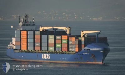
CLAIRE A
Container Ship
Current Trip
| Time Travelled | 5 days |
|---|---|
| Remaining Time | --- |
| Distance Travelled | 720.45 nm |
| Remaining Distance | --- |
| AVG Speed | 12.1 Knopen |
| MAX Speed | 17.2 Knopen |
| AVG Wind | 17 knots |
| MAX Wind | 29.4 knots |
| MIN Temp | 9.8°C / 49.64°F |
| MAX Temp | 23.3°C / 73.94°F |
| Diepgang | 8.7 M |
| Positie ontvangen | 2 d geleden |
Current Position
| Lengtegraad | 38.80488° |
|---|---|
| Breedtegraat | 42.18797° |
| Status | Under way using engine |
| Snelheid | 14.2 Knopen |
| Koers | 89.6° |
| Gebied | Black Sea |
| Station | T-AIS |
| Positie ontvangen | 2 d geleden |
Info
Information
The current position of CLAIRE A is in Black Sea with coordinates 42.18797° / 38.80488° as reported on 2024-04-22 05:28 by AIS to our vessel tracker app. The vessel's current speed is 14.2 Knopen
The vessel CLAIRE A (IMO: 9379387, MMSI: 271001092) is a Container Ship that was built in 2008 ( 16 Jaar oud ). It's sailing under the flag of [TR] Turkey.
In this page you can find informations about the vessels current position, last detected port calls, and current voyage information. If the vessels is not in coverage by AIS you will find the latest position.
The current position of CLAIRE A is detected by our AIS receivers and we are not responsible for the reliability of the data. The last position was recorded while the vessel was in Coverage by the Ais receivers of our vessel tracking app.
The current draught of CLAIRE A as reported by AIS is 8.7 meters
Weather
| Temperature | 21.2°C / 70.16°F |
|---|---|
| Wind Speed | 25 knots |
| Direction | 91° E |
| Pressure | 1010.9 hPa |
| Humidity | 47.3 % |
| Cloud Coverage | 14 % |
Featured Company
Last Port Calls
| Port | Arrival | Departure | Time In Port |
|---|---|---|---|
| 2024-04-18 03:04 | 2024-04-19 10:50 | 1 d | |
| 2024-04-15 13:22 | 2024-04-15 20:25 | 7 h | |
| 2024-04-11 22:13 | 2024-04-13 07:45 | 1 d | |
| 2024-04-05 15:52 | 2024-04-05 17:06 | 1 h | |
| 2024-04-03 19:56 | 2024-04-05 09:14 | 1 d | |
| 2024-04-02 11:58 | 2024-04-02 21:32 | 9 h | |
| 2024-04-02 06:31 | 2024-04-02 07:46 | 1 h | |
| 2024-03-29 23:53 | 2024-03-31 09:05 | 1 d | |
| 2024-03-21 19:54 | 2024-03-23 03:25 | 1 d | |
| 2024-03-18 13:19 | 2024-03-19 00:00 | 10 h |
Last Trips
| Origin | Departure | Destination | Arrival | Distance | |
|---|---|---|---|---|---|
| 2024-04-15 23:25 | 2024-04-18 06:04 | 78.54 nm | |||
| 2024-04-13 11:45 | 2024-04-15 16:22 | 646.24 nm | |||
| 2024-04-05 20:06 | 2024-04-12 02:13 | 577.53 nm | |||
| 2024-04-05 12:14 | 2024-04-05 18:52 | 48.09 nm | |||
| 2024-04-03 00:32 | 2024-04-03 22:56 | 50.50 nm | |||
| 2024-04-02 10:46 | 2024-04-02 14:58 | 53.64 nm | |||
| 2024-03-31 13:05 | 2024-04-02 09:31 | 574.32 nm | |||
| 2024-03-23 06:25 | 2024-03-30 03:53 | 716.77 nm | |||
| 2024-03-19 03:00 | 2024-03-21 22:54 | 59.36 nm | |||
| 2024-03-09 03:50 | 2024-03-15 02:41 | 657.60 nm |
Events
| Tijd | Evenement | Details | Positie / Bestemming | Info |
|---|---|---|---|---|
| 2024-04-22 14:36 | Stop beweging | 2.19 nm, West of POTI |
42.16161 / 41.60077
GEPTI
|
Snelheid: 0.2 kn Koers: 343° |
| 2024-04-22 05:31 | Status Changed | Default Under way using engine |
42.18667 / 38.81833
GEPTI
|
Snelheid: 14.2 kn Koers: 89.6° |
| 2024-04-22 05:28 | Buitenbereik |
42.18797 / 38.80488
Black Sea
GEPTI
|
Snelheid: 14.2 kn Koers: 89.6° |
|
| 2024-04-22 05:21 | Status Changed | Under way using engine Default |
42.18789 / 38.76560
GEPTI
|
Snelheid: 14.2 kn Koers: 88° |
| 2024-04-22 04:36 | Status Changed | Default Under way using engine |
42.18991 / 38.52858
GEPTI
|
Snelheid: 14 kn Koers: 92.4° |
| 2024-04-22 03:59 | Status Changed | Under way using engine Default |
42.19242 / 38.33658
GEPTI
|
Snelheid: 13.7 kn Koers: 90° |
| 2024-04-22 03:52 | Binnenbereik |
42.19224 / 38.35120
Black Sea
GEPTI
|
Snelheid: 13.7 kn Koers: 88.8° |
|
| 2024-04-20 23:47 | Status Changed | Default Under way using engine |
41.26494 / 29.72479
GEPTI
|
Snelheid: 14.2 kn Koers: 89.4° |
| 2024-04-20 23:37 | Buitenbereik |
41.26550 / 29.67006
Black Sea
GEPTI
|
Snelheid: 14.2 kn Koers: 89.4° |
|
| 2024-04-20 21:53 | Wijzig zee gebeid | Turkish part of the Black Sea Turkish part of the Sea of Marmara |
41.22914 / 29.14922
Black Sea
GEPTI
|
Snelheid: 12.2 kn Koers: 53.2° |