
CL TOMO
Cargo
Current Trip
| Time Travelled | 13 days |
|---|---|
| Remaining Time | 6 days |
| Distance Travelled | 3492.17 nm |
| Remaining Distance | 1507.12 nm |
| AVG Speed | 10.6 Knopen |
| MAX Speed | 13.9 Knopen |
| AVG Wind | 11.7 knots |
| MAX Wind | 19 knots |
| MIN Temp | 16.7°C / 62.06°F |
| MAX Temp | 24.8°C / 76.64°F |
| Diepgang | 12.2 M |
| Positie ontvangen | 8 d geleden |
Current Position
| Lengtegraad | -78.71417° |
|---|---|
| Breedtegraat | 26.22317° |
| Status | Under way using engine |
| Snelheid | 11.6 Knopen |
| Koers | 110.6° |
| Gebied | North Atlantic Ocean |
| Station | T-AIS |
| Positie ontvangen | 8 d geleden |
Info
Information
The current position of CL TOMO is in North Atlantic Ocean with coordinates 26.22317° / -78.71417° as reported on 2024-04-16 22:51 by AIS to our vessel tracker app. The vessel's current speed is 11.6 Knopen and is heading at the port of GIBRALTAR. The estimated time of arrival as calculated by MyShipTracking vessel tracking app is 2024-05-01 21:21 LT
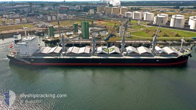
The vessel CL TOMO (IMO: 9908279, MMSI: 374182000) is a Cargo It's sailing under the flag of [PA] Panama.
In this page you can find informations about the vessels current position, last detected port calls, and current voyage information. If the vessels is not in coverage by AIS you will find the latest position.
The current position of CL TOMO is detected by our AIS receivers and we are not responsible for the reliability of the data. The last position was recorded while the vessel was in Coverage by the Ais receivers of our vessel tracking app.
The current draught of CL TOMO as reported by AIS is 12.2 meters
Weather
| Temperature | 16.7°C / 62.06°F |
|---|---|
| Wind Speed | 10 knots |
| Direction | 59° ENE |
| Pressure | 1028.3 hPa |
| Humidity | 74.5 % |
| Cloud Coverage | 38 % |
Featured Company
Last Port Calls
| Port | Arrival | Departure | Time In Port |
|---|---|---|---|
| 2024-04-09 18:31 | 2024-04-12 10:21 | 2 d | |
| 2024-03-30 01:51 | 2024-03-30 02:35 | 44 m | |
| 2024-02-26 17:28 | 2024-02-29 20:11 | 3 d | |
| 2024-02-21 00:59 | 2024-02-24 23:33 | 3 d |
Last Trips
| Origin | Departure | Destination | Arrival | Distance | |
|---|---|---|---|---|---|
| 2024-03-29 21:35 | 2024-04-09 13:31 | 230.36 nm | |||
| 2024-02-29 17:11 | 2024-03-29 20:51 | 5492.10 nm | |||
| 2024-02-24 20:33 | 2024-02-26 14:28 | 307.30 nm | |||
| 2023-12-31 19:55 | 2024-02-20 21:59 | 6473.69 nm |
Events
| Tijd | Evenement | Details | Positie / Bestemming | Info |
|---|---|---|---|---|
| 2024-04-16 22:57 | Status Changed | Default Under way using engine |
26.21633 / -78.69381
GIGIB
|
Snelheid: 11.6 kn Koers: 110.6° |
| 2024-04-16 22:51 | Buitenbereik |
26.22317 / -78.71417
North Atlantic Ocean
GIGIB
|
Snelheid: 11.6 kn Koers: 110.6° |
|
| 2024-04-16 22:17 | Status Changed | Under way using engine Default |
26.22991 / -78.83232
GIGIB
|
Snelheid: 11.1 kn Koers: 90° |
| 2024-04-16 22:14 | Status Changed | Default Under way using engine |
26.22984 / -78.84377
GIGIB
|
Snelheid: 11 kn Koers: 90.8° |
| 2024-04-16 21:59 | Status Changed | Under way using engine Default |
26.23040 / -78.89244
GIGIB
|
Snelheid: 10.9 kn Koers: 90° |
| 2024-04-16 21:58 | Status Changed | Default Under way using engine |
26.23033 / -78.89804
GIGIB
|
Snelheid: 11 kn Koers: 88.5° |
| 2024-04-16 21:51 | Status Changed | Under way using engine Default |
26.22997 / -78.92176
GIGIB
|
Snelheid: 11 kn Koers: 88° |
| 2024-04-16 21:18 | Status Changed | Default Under way using engine |
26.22645 / -79.03332
GIGIB
|
Snelheid: 10.9 kn Koers: 82.2° |
| 2024-04-16 21:05 | Status Changed | Under way using engine Default |
26.22271 / -79.07519
GIGIB
|
Snelheid: 10.8 kn Koers: 67° |
| 2024-04-16 20:50 | Status Changed | Default Under way using engine |
26.21234 / -79.12247
GIGIB
|
Snelheid: 10.8 kn Koers: 66.9° |