
CHRISTINA
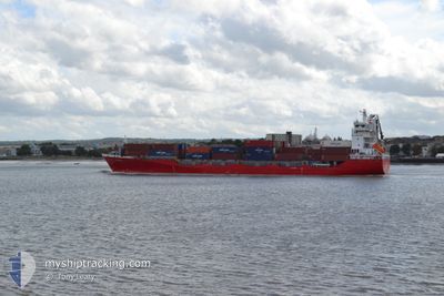
Container Ship
Current Trip
| Trip Time | 1 day |
|---|---|
| Trip Distance | 598.04 nm |
| AVG Speed | 14.8 Knopen |
| MAX Speed | 16.8 Knopen |
| Diepgang | 6.4 M |
| AVG Wind | 8.4 knots |
| MAX Wind | 13.2 knots |
| MIN Temp | 16.7°C / 62.06°F |
| MAX Temp | 20.8°C / 69.44°F |
| Positie ontvangen | 1 m geleden |
Current Position
| Lengtegraad | -6.87980° |
|---|---|
| Breedtegraat | 37.15067° |
| Status | Moored |
| Snelheid | |
| Koers | 306° |
| Gebied | North Atlantic Ocean |
| Station | T-AIS |
| Positie ontvangen | 1 m geleden |
Info
Information
The current position of CHRISTINA is in North Atlantic Ocean with coordinates 37.15067° / -6.87980° as reported on 2024-04-19 15:35 by AIS to our vessel tracker app. The vessel's current speed is 0 Knopen and is currently inside the port of HUELVA.
The vessel CHRISTINA (IMO: 9429211, MMSI: 255806310) is a Container Ship that was built in 2010 ( 14 Jaar oud ). It's sailing under the flag of [PT] Portugal.
In this page you can find informations about the vessels current position, last detected port calls, and current voyage information. If the vessels is not in coverage by AIS you will find the latest position.
The current position of CHRISTINA is detected by our AIS receivers and we are not responsible for the reliability of the data. The last position was recorded while the vessel was in Coverage by the Ais receivers of our vessel tracking app.
The current draught of CHRISTINA as reported by AIS is 6.4 meters
Weather
| Temperature | 20.7°C / 69.26°F |
|---|---|
| Wind Speed | 9 knots |
| Direction | 191° S |
| Pressure | 1014.2 hPa |
| Humidity | 59.9 % |
| Cloud Coverage | 100 % |
Featured Company
Last Port Calls
| Port | Arrival | Departure | Time In Port |
|---|---|---|---|
| 2024-04-18 16:44 | |||
| 2024-04-16 18:56 | 2024-04-17 01:36 | 6 h | |
| 2024-04-16 07:37 | 2024-04-16 16:42 | 9 h | |
| 2024-04-15 12:37 | 2024-04-16 01:07 | 12 h | |
| 2024-04-15 02:25 | 2024-04-15 07:50 | 5 h | |
| 2024-04-11 21:49 | 2024-04-13 04:58 | 1 d | |
| 2024-04-09 16:47 | 2024-04-09 22:03 | 5 h | |
| 2024-04-09 04:14 | 2024-04-09 13:52 | 9 h | |
| 2024-04-08 06:42 | 2024-04-08 15:37 | 8 h | |
| 2024-04-07 17:29 | 2024-04-08 02:39 | 9 h |
Most Visited Ports (Last year)
| Port | Arrivals | |
|---|---|---|
| 47 | ||
| 46 | ||
| 46 | ||
| 42 | ||
| 42 | ||
| 3 |
Last Trips
| Origin | Departure | Destination | Arrival | Distance | |
|---|---|---|---|---|---|
| 2024-04-17 02:36 | 2024-04-18 18:44 | 598.04 nm | |||
| 2024-04-16 17:42 | 2024-04-16 19:56 | 32.63 nm | |||
| 2024-04-16 02:07 | 2024-04-16 08:37 | 102.13 nm | |||
| 2024-04-15 08:50 | 2024-04-15 13:37 | 62.48 nm | |||
| 2024-04-13 06:58 | 2024-04-15 03:25 | 705.97 nm | |||
| 2024-04-09 23:03 | 2024-04-11 23:49 | 610.03 nm | |||
| 2024-04-09 14:52 | 2024-04-09 17:47 | 34.74 nm | |||
| 2024-04-08 16:37 | 2024-04-09 05:14 | 154.62 nm | |||
| 2024-04-08 03:39 | 2024-04-08 07:42 | 54.69 nm | |||
| 2024-04-05 20:41 | 2024-04-07 18:29 | 694.31 nm |
Events
| Tijd | Evenement | Details | Positie / Bestemming | Info |
|---|---|---|---|---|
| 2024-04-18 17:31 | Status Changed | Moored Under way using engine |
37.15067 / -6.87981
[ES] HUELVA
|
Snelheid: Koers: 305° |
| 2024-04-18 17:08 | Stop beweging |
37.15058 / -6.87978
[ES] HUELVA
|
Snelheid: 0.3 kn Koers: 306° |
|
| 2024-04-18 16:44 | Aankomsthaven |
|
37.12483 / -6.83600
[ES] HUELVA
|
Snelheid: 13.5 kn Koers: 337.4° |
| 2024-04-18 15:53 | Status Changed | Under way using engine Default |
36.98233 / -6.87850
ESHUV
|
Snelheid: 13.2 kn Koers: 33° |
| 2024-04-18 15:46 | Status Changed | Default Under way using engine |
36.95896 / -6.89728
ESHUV
|
Snelheid: 13.5 kn Koers: 33.4° |
| 2024-04-18 12:23 | Wijzig zee gebeid | Spanish part of the North Atlantic Ocean Portuguese part of the North Atlantic Ocean |
36.26410 / -7.44499
North Atlantic Ocean
ESHUV
|
Snelheid: 14.8 kn Koers: 47.8° |
| 2024-04-18 12:04 | Status Changed | Under way using engine Default |
36.19189 / -7.53881
ESHUV
|
Snelheid: 14.9 kn Koers: 47° |
| 2024-04-18 11:59 | Status Changed | Default Under way using engine |
36.19675 / -7.53244
ESHUV
|
Snelheid: 14.9 kn Koers: 46.1° |
| 2024-04-18 10:52 | Status Changed | Under way using engine Default |
35.97316 / -7.73000
ESHUV
|
Snelheid: 14.8 kn Koers: 35° |
| 2024-04-18 10:46 | Status Changed | Default Under way using engine |
35.95142 / -7.74907
ESHUV
|
Snelheid: 14.9 kn Koers: 32.1° |