
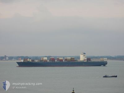
KOTA MANZANILLO
Container Ship
Current Trip
| Time Travelled | 2 days |
|---|---|
| Remaining Time | 8 days |
| Distance Travelled | 597.47 nm |
| Remaining Distance | 3386.00 nm |
| AVG Speed | 13.8 Knopen |
| MAX Speed | 17.4 Knopen |
| AVG Wind | 12 knots |
| MAX Wind | 20 knots |
| MIN Temp | 24.1°C / 75.38°F |
| MAX Temp | 29.6°C / 85.28°F |
| Diepgang | 10 M |
| Positie ontvangen | 1 h, 17 m geleden |
Current Position
| Lengtegraad | 55.94367° |
|---|---|
| Breedtegraat | 26.21148° |
| Status | Under way using engine |
| Snelheid | 16.6 Knopen |
| Koers | 51.2° |
| Gebied | Persian Gulf |
| Station | T-AIS |
| Positie ontvangen | 1 h, 17 m geleden |
Info
Information
The current position of KOTA MANZANILLO is in Persian Gulf with coordinates 26.21148° / 55.94367° as reported on 2024-04-23 21:26 by AIS to our vessel tracker app. The vessel's current speed is 16.6 Knopen and is heading at the port of SINGAPORE. The estimated time of arrival as calculated by MyShipTracking vessel tracking app is 2024-05-02 12:47 LT
The vessel KOTA MANZANILLO (IMO: 9305465, MMSI: 636018237) is a Container Ship that was built in 2005 ( 19 Jaar oud ). It's sailing under the flag of [LR] Liberia.
In this page you can find informations about the vessels current position, last detected port calls, and current voyage information. If the vessels is not in coverage by AIS you will find the latest position.
The current position of KOTA MANZANILLO is detected by our AIS receivers and we are not responsible for the reliability of the data. The last position was recorded while the vessel was in Coverage by the Ais receivers of our vessel tracking app.
The current draught of KOTA MANZANILLO as reported by AIS is 10 meters
Weather
| Temperature | 25.5°C / 77.9°F |
|---|---|
| Wind Speed | 12 knots |
| Direction | 176° S |
| Pressure | 1004 hPa |
| Humidity | 79.9 % |
| Cloud Coverage | --- |
Featured Company
Last Port Calls
| Port | Arrival | Departure | Time In Port |
|---|---|---|---|
| 2024-04-18 20:09 | 2024-04-21 12:48 | 2 d | |
| 2024-04-12 22:43 | 2024-04-15 14:34 | 2 d | |
| 2024-04-02 04:46 | 2024-04-02 16:26 | 11 h | |
| 2024-04-01 12:52 | 2024-04-02 02:53 | 14 h | |
| 2024-03-25 02:17 | 2024-03-25 23:03 | 20 h | |
| 2024-03-23 04:49 | 2024-03-23 17:10 | 12 h | |
| 2024-03-20 02:56 | 2024-03-20 23:52 | 20 h | |
| 2024-03-18 11:40 | |||
| 2024-03-15 06:17 | 2024-03-15 17:15 | 10 h | |
| 2024-03-12 14:35 | 2024-03-12 23:37 | 9 h |
Most Visited Ports (Last year)
| Port | Arrivals | |
|---|---|---|
| 10 | ||
| 5 | ||
| 5 | ||
| 5 | ||
| 5 | ||
| 4 |
Last Trips
| Origin | Departure | Destination | Arrival | Distance | |
|---|---|---|---|---|---|
| 2024-04-15 18:34 | 2024-04-18 23:09 | 388.39 nm | |||
| 2024-04-03 00:26 | 2024-04-13 02:43 | 3542.13 nm | |||
| 2024-04-02 10:53 | 2024-04-02 12:46 | 21.70 nm | |||
| 2024-03-26 07:03 | 2024-04-01 20:52 | 1632.14 nm | |||
| 2024-03-24 01:10 | 2024-03-25 10:17 | 134.23 nm | |||
| 2024-03-21 07:52 | 2024-03-23 12:49 | 804.62 nm | |||
| 2024-03-18 19:40 | 2024-03-20 10:56 | 226.79 nm | |||
| 2024-03-13 07:37 | 2024-03-15 14:17 | 394.41 nm | |||
| 2024-02-22 23:55 | 2024-03-12 22:35 | 7472.76 nm | |||
| 2024-02-15 19:06 | 2024-02-20 17:20 | 1992.26 nm |
Events
| Tijd | Evenement | Details | Positie / Bestemming | Info |
|---|---|---|---|---|
| 2024-04-23 21:32 | Status Changed | Default Under way using engine |
26.22968 / 55.96859
SGSIN PEBGA
|
Snelheid: 16.6 kn Koers: 51.2° |
| 2024-04-23 21:26 | Buitenbereik |
26.21148 / 55.94367
Persian Gulf
SGSIN PEBGA
|
Snelheid: 16.6 kn Koers: 51.2° |
|
| 2024-04-23 21:16 | Wijzig zee gebeid | Omani part of the Persian Gulf United Arab Emirates part of the Persian Gulf |
26.17997 / 55.90974
Persian Gulf
SGSIN PEBGA
|
Snelheid: 16.3 kn Koers: 35.9° |
| 2024-04-23 16:01 | Wijzig zee gebeid | United Arab Emirates part of the Persian Gulf Iranian part of the Persian Gulf |
25.69255 / 54.50961
Persian Gulf
SGSIN PEBGA
|
Snelheid: 17.1 kn Koers: 101.5° |
| 2024-04-23 13:08 | Destination Changed | SGSIN PEBGA QAHMD |
25.77426 / 53.63657
SGSIN PEBGA
|
Snelheid: 16.6 kn Koers: 80.5° |
| 2024-04-23 13:08 | ETA Changed | 2024/05/02 13:00 2024/04/22 12:30 |
25.77426 / 53.63657
SGSIN PEBGA
|
Snelheid: 16.6 kn Koers: 80.5° |
| 2024-04-23 13:07 | Wijzig zee gebeid | Iranian part of the Persian Gulf Qatari part of the Persian Gulf |
25.77348 / 53.63153
Persian Gulf
|
Snelheid: 16.6 kn Koers: 80.6° |
| 2024-04-23 13:06 | Status Changed | Under way using engine Default |
25.77278 / 53.62697
QAHMD
|
Snelheid: 16.8 kn Koers: 81° |
| 2024-04-23 12:56 | Binnenbereik |
25.77348 / 53.63153
Persian Gulf
|
Snelheid: 16.6 kn Koers: 80.6° |
|
| 2024-04-23 04:35 | Start beweging | 4.95 nm, North of MESAIEED |
25.01500 / 51.60166
QAHMD
|
Snelheid: 6 kn Koers: 179° |