
CHANG HANG RUN HAI
Cargo
Current Trip
| Time Travelled | 15 days |
|---|---|
| Remaining Time | 16 h, 44 mins |
| Distance Travelled | 3250.32 nm |
| Remaining Distance | 194.21 nm |
| AVG Speed | 12 Knopen |
| MAX Speed | 13.6 Knopen |
| AVG Wind | 11.2 knots |
| MAX Wind | 25.8 knots |
| MIN Temp | 5.3°C / 41.54°F |
| MAX Temp | 29.1°C / 84.38°F |
| Diepgang | 7.6 M |
| Positie ontvangen | 1 m geleden |
Current Position
| Lengtegraad | 103.86655° |
|---|---|
| Breedtegraat | 1.20471° |
| Status | Under way using engine |
| Snelheid | 10.5 Knopen |
| Koers | 232.8° |
| Gebied | Singapore Strait |
| Station | T-AIS |
| Positie ontvangen | 1 m geleden |
Info
Information
The current position of CHANG HANG RUN HAI is in Singapore Strait with coordinates 1.20471° / 103.86655° as reported on 2024-04-18 03:51 by AIS to our vessel tracker app. The vessel's current speed is 10.5 Knopen and is heading at the port of PORT KLANG. The estimated time of arrival as calculated by MyShipTracking vessel tracking app is 2024-04-18 20:36 LT
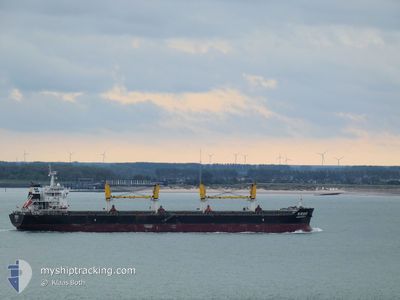
The vessel CHANG HANG RUN HAI (IMO: 9628726, MMSI: 414065000) is a Cargo It's sailing under the flag of [CN] China.
In this page you can find informations about the vessels current position, last detected port calls, and current voyage information. If the vessels is not in coverage by AIS you will find the latest position.
The current position of CHANG HANG RUN HAI is detected by our AIS receivers and we are not responsible for the reliability of the data. The last position was recorded while the vessel was in Coverage by the Ais receivers of our vessel tracking app.
The current draught of CHANG HANG RUN HAI as reported by AIS is 7.6 meters
Weather
| Temperature | 28.2°C / 82.76°F |
|---|---|
| Wind Speed | 5 knots |
| Direction | 215° SW |
| Pressure | 1010.7 hPa |
| Humidity | 78.1 % |
| Cloud Coverage | 100 % |
Featured Company
Last Port Calls
| Port | Arrival | Departure | Time In Port |
|---|---|---|---|
| 2024-03-30 03:25 | 2024-04-02 09:25 | 3 d | |
| 2024-03-23 22:29 | 2024-03-26 00:28 | 2 d | |
| 2024-02-16 20:07 | 2024-02-20 02:31 | 3 d |
Last Trips
| Origin | Departure | Destination | Arrival | Distance | |
|---|---|---|---|---|---|
| 2024-03-26 08:28 | 2024-03-30 11:25 | 766.37 nm | |||
| 2024-02-20 08:01 | 2024-03-24 06:29 | 6411.20 nm | |||
| 2024-01-08 07:58 | 2024-02-17 01:37 | 4208.32 nm |
Events
| Tijd | Evenement | Details | Positie / Bestemming | Info |
|---|---|---|---|---|
| 2024-04-18 03:05 | Wijzig zee gebeid | Singaporean part of the Singapore Strait Indonesian part of the Singapore Strait |
1.25744 / 103.99922
Singapore Strait
MY PKG
|
Snelheid: 11.4 kn Koers: 260.5° |
| 2024-04-18 02:38 | Wijzig zee gebeid | Indonesian part of the Singapore Strait Malaysian part of the Singapore Strait |
1.26684 / 104.08630
Singapore Strait
MY PKG
|
Snelheid: 11.7 kn Koers: 261.8° |
| 2024-04-18 01:55 | Draught Changed | 7.6 12.7 |
1.28437 / 104.22353
MY PKG
|
Snelheid: 11.5 kn Koers: 256.8° |
| 2024-04-18 01:55 | Destination Changed | MY PKG BAHODOPI |
1.28437 / 104.22353
MY PKG
|
Snelheid: 11.5 kn Koers: 256.8° |
| 2024-04-18 01:55 | ETA Changed | 2024/04/18 22:00 2024/03/03 04:00 |
1.28437 / 104.22353
MY PKG
|
Snelheid: 11.5 kn Koers: 256.8° |
| 2024-04-18 01:26 | Wijzig zee gebeid | Malaysian part of the Singapore Strait Chinese part of the South China Sea |
1.30288 / 104.31434
Singapore Strait
|
Snelheid: 11.7 kn Koers: 261.3° |
| 2024-04-18 01:26 | Binnenbereik |
1.30288 / 104.31434
Singapore Strait
|
Snelheid: 11.7 kn Koers: 261.3° |
|
| 2024-04-18 01:24 | Status Changed | Under way using engine Default |
1.30399 / 104.32076
BAHODOPI
|
Snelheid: 11.6 kn Koers: 240° |
| 2024-04-13 22:10 | Start beweging |
19.30387 / 105.82030
BAHODOPI
|
Snelheid: 3.4 kn Koers: 160° |
|
| 2024-04-11 05:12 | Stop beweging |
19.30600 / 105.82046
BAHODOPI
|
Snelheid: Koers: 337° |