
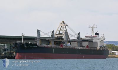
CAPTAIN HADDOCK
Cargo
Current Trip
| Time Travelled | 13 days |
|---|---|
| Remaining Time | --- |
| Distance Travelled | 3583.83 nm |
| Remaining Distance | --- |
| AVG Speed | 11.7 Knopen |
| MAX Speed | 15.7 Knopen |
| AVG Wind | 11.1 knots |
| MAX Wind | 21 knots |
| MIN Temp | 10.6°C / 51.08°F |
| MAX Temp | 29°C / 84.2°F |
| Diepgang | 12.3 M |
| Positie ontvangen | 4 d geleden |
Current Position
| Lengtegraad | -17.68587° |
|---|---|
| Breedtegraat | 12.08728° |
| Status | Under way using engine |
| Snelheid | 12 Knopen |
| Koers | 177.6° |
| Gebied | North Atlantic Ocean |
| Station | T-AIS |
| Positie ontvangen | 4 d geleden |
Info
Information
The current position of CAPTAIN HADDOCK is in North Atlantic Ocean with coordinates 12.08728° / -17.68587° as reported on 2024-04-21 01:36 by AIS to our vessel tracker app. The vessel's current speed is 12 Knopen and is heading at the port of RIZHAO. The estimated time of arrival as calculated by MyShipTracking vessel tracking app is 2024-06-01 00:01 LT
The vessel CAPTAIN HADDOCK (IMO: 9839791, MMSI: 538008274) is a Cargo It's sailing under the flag of [MH] Marshall Is.
In this page you can find informations about the vessels current position, last detected port calls, and current voyage information. If the vessels is not in coverage by AIS you will find the latest position.
The current position of CAPTAIN HADDOCK is detected by our AIS receivers and we are not responsible for the reliability of the data. The last position was recorded while the vessel was in Coverage by the Ais receivers of our vessel tracking app.
The current draught of CAPTAIN HADDOCK as reported by AIS is 12.3 meters
Weather
| Temperature | 28.9°C / 84.02°F |
|---|---|
| Wind Speed | 4 knots |
| Direction | 187° S |
| Pressure | 1011.1 hPa |
| Humidity | 74.4 % |
| Cloud Coverage | 100 % |
Featured Company
Last Port Calls
| Port | Arrival | Departure | Time In Port |
|---|---|---|---|
| 2024-04-05 07:08 | 2024-04-11 07:08 | 6 d | |
| 2024-03-24 15:40 | 2024-03-26 08:54 | 1 d | |
| 2024-03-08 06:18 | 2024-03-08 15:46 | 9 h | |
| 2024-03-03 09:12 | |||
| 2024-03-01 08:21 | 2024-03-01 17:25 | 9 h | |
| 2024-02-29 13:46 | 2024-03-01 08:02 | 18 h |
Most Visited Ports (Last year)
| Port | Arrivals | |
|---|---|---|
| 4 | ||
| 2 | ||
| 2 | ||
| 1 | ||
| 1 | ||
| 1 |
Last Trips
| Origin | Departure | Destination | Arrival | Distance | |
|---|---|---|---|---|---|
| 2024-03-26 09:54 | 2024-04-05 09:08 | 828.56 nm | |||
| 2024-03-01 10:02 | 2024-03-03 12:12 | 570.93 nm | |||
| 2024-03-01 10:02 | 2024-03-01 10:21 | --- | |||
| 2024-01-12 00:02 | 2024-02-29 15:46 | 13431.07 nm |
Events
| Tijd | Evenement | Details | Positie / Bestemming | Info |
|---|---|---|---|---|
| 2024-04-21 01:41 | Status Changed | Default Under way using engine |
12.06981 / -17.68539
CN RZH
|
Snelheid: 12 kn Koers: 177.6° |
| 2024-04-21 01:36 | Status Changed | Under way using engine Default |
12.08728 / -17.68587
CN RZH
|
Snelheid: 12 kn Koers: 179° |
| 2024-04-21 01:36 | Buitenbereik |
12.08728 / -17.68587
North Atlantic Ocean
|
Snelheid: 12 kn Koers: 177.6° |
|
| 2024-04-21 01:34 | Binnenbereik |
12.08728 / -17.68587
North Atlantic Ocean
|
Snelheid: 12 kn Koers: 177.6° |
|
| 2024-04-20 23:38 | Status Changed | Default Under way using engine |
12.48404 / -17.69451
CN RZH
|
Snelheid: 12 kn Koers: 180.1° |
| 2024-04-20 23:33 | Buitenbereik |
12.50152 / -17.69510
North Atlantic Ocean
|
Snelheid: 12 kn Koers: 180.1° |
|
| 2024-04-20 23:08 | Status Changed | Under way using engine Default |
12.58649 / -17.69865
CN RZH
|
Snelheid: 11.9 kn Koers: 179° |
| 2024-04-20 22:58 | Status Changed | Default Under way using engine |
12.61668 / -17.69954
CN RZH
|
Snelheid: 12 kn Koers: 179.6° |
| 2024-04-20 22:03 | Status Changed | Under way using engine Default |
12.80088 / -17.70505
CN RZH
|
Snelheid: 11.8 kn Koers: 179° |
| 2024-04-20 22:02 | Status Changed | Default Under way using engine |
12.80363 / -17.70510
CN RZH
|
Snelheid: 11.8 kn Koers: 182° |