
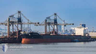
CAPE ELEKTRA
Bulk Carrier
Current Trip
| Trip Time | 15 days |
|---|---|
| Trip Distance | 3583.41 nm |
| AVG Speed | 9.7 Knopen |
| MAX Speed | 12.1 Knopen |
| Diepgang | 8.6 M |
| AVG Wind | 11.1 knots |
| MAX Wind | 33 knots |
| MIN Temp | -0.4°C / 31.28°F |
| MAX Temp | 29.5°C / 85.1°F |
| Positie ontvangen | 6 d geleden |
Current Position
| Lengtegraad | --- |
|---|---|
| Breedtegraat | --- |
| Status | Under way using engine |
| Snelheid | 9.7 Knopen |
| Koers | 16.6° |
| Gebied | Philippine Sea |
| Station | T-AIS |
| Positie ontvangen | 6 d geleden |
Info
Information
The current position of CAPE ELEKTRA is in Philippine Sea with coordinates 26.38835° / 128.27647° as reported on 2025-12-02 08:06 by AIS to our vessel tracker app. The vessel's current speed is 9.7 Knopen and is currently inside the port of POHANG.
The vessel CAPE ELEKTRA (IMO: 9527922, MMSI: 248859000) is a Bulk Carrier that was built in 2011 ( 14 Jaar oud ). It's sailing under the flag of [MT] Malta.
In this page you can find informations about the vessels current position, last detected port calls, and current voyage information. If the vessels is not in coverage by AIS you will find the latest position.
The current position of CAPE ELEKTRA is detected by our AIS receivers and we are not responsible for the reliability of the data. The last position was recorded while the vessel was in Coverage by the Ais receivers of our vessel tracking app.
The current draught of CAPE ELEKTRA as reported by AIS is 8.6 meters
Weather
| Temperature | 7.2°C / 44.96°F |
|---|---|
| Wind Speed | 9 knots |
| Direction | 286° WNW |
| Pressure | 1025 hPa |
| Humidity | 36.8 % |
| Cloud Coverage | --- |
Featured Company
Last Trips
| Origin | Departure | Destination | Arrival | Distance | |
|---|---|---|---|---|---|
| 2025-11-20 11:04 | 2025-12-06 11:36 | 3583.41 nm | |||
| 2025-10-30 12:20 | 2025-11-17 09:19 | 2791.21 nm | |||
| 2025-10-24 22:56 | 2025-10-29 13:32 | 231.89 nm | |||
| 2025-10-09 11:55 | 2025-10-23 09:28 | 2823.41 nm | |||
| 2025-09-03 06:19 | 2025-10-07 10:39 | 7025.01 nm |
Events
| Tijd | Evenement | Details | Positie / Bestemming | Info |
|---|---|---|---|---|
| 2025-12-06 02:49 | Stop beweging |
36.02317 / 129.40462
[KR] POHANG
|
Snelheid: 0.3 kn Koers: 214° |
|
| 2025-12-06 02:36 | Aankomsthaven |
|
36.02167 / 129.40834
[KR] POHANG
|
Snelheid: 4.5 kn Koers: 262° |
| 2025-12-06 01:12 | Start beweging | 6.84 nm, North East of POHANG |
36.11452 / 129.49219
AUPWL
|
Snelheid: 3.7 kn Koers: 155° |
| 2025-12-05 04:33 | Stop beweging | 7.04 nm, North East of POHANG |
36.11797 / 129.49324
AUPWL
|
Snelheid: 0.1 kn Koers: 345° |
| 2025-12-02 08:18 | Status Changed | Default Under way using engine |
26.41833 / 128.28500
AUPWL
|
Snelheid: 9.7 kn Koers: 16.6° |
| 2025-12-02 08:06 | Buitenbereik |
26.38835 / 128.27647
Philippine Sea
|
Snelheid: 9.7 kn Koers: 16.6° |
|
| 2025-12-02 08:04 | Status Changed | Under way using engine Default |
26.38312 / 128.27488
AUPWL
|
Snelheid: 9 kn Koers: 356° |
| 2025-12-02 08:00 | Status Changed | Default Under way using engine |
26.37167 / 128.27499
AUPWL
|
Snelheid: 10.3 kn Koers: 18.8° |
| 2025-12-02 07:10 | Wijzig zee gebeid | Japanese part of the Philippine Sea Australian part of the Indian Ocean |
26.23537 / 128.25584
Philippine Sea
|
Snelheid: 10.5 kn Koers: 5.5° |
| 2025-12-02 07:10 | Status Changed | Under way using engine Default |
26.23537 / 128.25584
AUPWL
|
Snelheid: 10 kn Koers: 3° |