
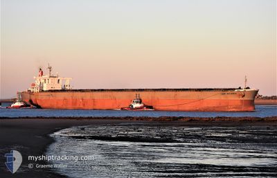
CAPE ALLIANCE
Bulk Carrier
Current Trip
GN BRP
| Time Travelled | 37 days |
|---|---|
| Remaining Time | --- |
| Distance Travelled | 11313.47 nm |
| Remaining Distance | --- |
| AVG Speed | 12.9 Knopen |
| MAX Speed | 15.5 Knopen |
| AVG Wind | 14.2 knots |
| MAX Wind | 42.3 knots |
| MIN Temp | 2.9°C / 37.22°F |
| MAX Temp | 30.4°C / 86.72°F |
| Diepgang | 11.1 M |
| Positie ontvangen | 8 d geleden |
Current Position
| Lengtegraad | 17.65163° |
|---|---|
| Breedtegraat | -34.24381° |
| Status | Under way using engine |
| Snelheid | 14.2 Knopen |
| Koers | 318.7° |
| Gebied | South Atlantic Ocean |
| Station | T-AIS |
| Positie ontvangen | 8 d geleden |
Info
Information
The current position of CAPE ALLIANCE is in South Atlantic Ocean with coordinates -34.24381° / 17.65163° as reported on 2024-04-07 14:45 by AIS to our vessel tracker app. The vessel's current speed is 14.2 Knopen
The vessel CAPE ALLIANCE (IMO: 9374038, MMSI: 372526000) is a Bulk Carrier that was built in 2007 ( 17 Jaar oud ). It's sailing under the flag of [PA] Panama.
In this page you can find informations about the vessels current position, last detected port calls, and current voyage information. If the vessels is not in coverage by AIS you will find the latest position.
The current position of CAPE ALLIANCE is detected by our AIS receivers and we are not responsible for the reliability of the data. The last position was recorded while the vessel was in Coverage by the Ais receivers of our vessel tracking app.
The current draught of CAPE ALLIANCE as reported by AIS is 11.1 meters
Weather
| Temperature | 29.7°C / 85.46°F |
|---|---|
| Wind Speed | 8 knots |
| Direction | 150° SSE |
| Pressure | 1011 hPa |
| Humidity | 74.3 % |
| Cloud Coverage | 48 % |
Featured Company
Most Visited Ports (Last year)
| Port | Arrivals | |
|---|---|---|
| 2 | ||
| 2 | ||
| 1 | ||
| 1 | ||
| 1 | ||
| 1 |
Last Trips
| Origin | Departure | Destination | Arrival | Distance | |
|---|---|---|---|---|---|
| 2024-02-29 17:40 | 2024-03-10 07:35 | 56.43 nm | |||
| 2024-01-13 11:40 | 2024-02-28 01:17 | 4361.83 nm |
Events
| Tijd | Evenement | Details | Positie / Bestemming | Info |
|---|---|---|---|---|
| 2024-04-07 14:51 | Status Changed | Default Under way using engine |
-34.22623 / 17.63223
GN BRP
|
Snelheid: 14.2 kn Koers: 318.7° |
| 2024-04-07 14:45 | Buitenbereik |
-34.24381 / 17.65163
South Atlantic Ocean
GN BRP
|
Snelheid: 14.2 kn Koers: 318.7° |
|
| 2024-04-07 14:44 | Status Changed | Under way using engine Default |
-34.24707 / 17.65513
GN BRP
|
Snelheid: 13.8 kn Koers: 319° |
| 2024-04-07 14:34 | Status Changed | Default Under way using engine |
-34.27507 / 17.68549
GN BRP
|
Snelheid: 13.8 kn Koers: 316.3° |
| 2024-04-07 13:37 | Status Changed | Under way using engine Default |
-34.42511 / 17.88985
GN BRP
|
Snelheid: 14.7 kn Koers: 295° |
| 2024-04-07 13:35 | Status Changed | Default Under way using engine |
-34.42903 / 17.89967
GN BRP
|
Snelheid: 14.8 kn Koers: 296.1° |
| 2024-04-07 11:02 | Draught Changed | 11.1 10.5 |
-34.73453 / 18.55188
GN BRP
|
Snelheid: 14.2 kn Koers: 299.2° |
| 2024-04-07 11:02 | Destination Changed | GN BRP SG PEBG-C |
-34.73453 / 18.55188
GN BRP
|
Snelheid: 14.2 kn Koers: 299.2° |
| 2024-04-07 11:02 | ETA Changed | 2024/04/18 12:00 2024/03/18 04:15 |
-34.73453 / 18.55188
GN BRP
|
Snelheid: 14.2 kn Koers: 299.2° |
| 2024-04-07 10:58 | Status Changed | Under way using engine Default |
-34.74166 / 18.56714
SG PEBG-C
|
Snelheid: 13.9 kn Koers: 301° |