
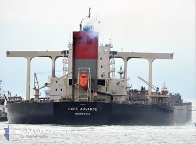
CAPE ADVANCE
Cargo
Current Trip
| Time Travelled | 2 days |
|---|---|
| Remaining Time | 8 days |
| Distance Travelled | 733.89 nm |
| Remaining Distance | 2997.23 nm |
| AVG Speed | 11.9 Knopen |
| MAX Speed | 14.4 Knopen |
| AVG Wind | 11.1 knots |
| MAX Wind | 17 knots |
| MIN Temp | 24.4°C / 75.92°F |
| MAX Temp | 29°C / 84.2°F |
| Diepgang | 18 M |
| Positie ontvangen | 1 d geleden |
Current Position
| Lengtegraad | 119.68157° |
|---|---|
| Breedtegraat | -17.50089° |
| Status | Under way using engine |
| Snelheid | 13.5 Knopen |
| Koers | 25° |
| Gebied | Indian Ocean |
| Station | T-AIS |
| Positie ontvangen | 1 d geleden |
Info
Information
The current position of CAPE ADVANCE is in Indian Ocean with coordinates -17.50089° / 119.68157° as reported on 2024-04-23 15:40 by AIS to our vessel tracker app. The vessel's current speed is 13.5 Knopen and is heading at the port of GWANGYANG. The estimated time of arrival as calculated by MyShipTracking vessel tracking app is 2024-05-04 06:19 LT
The vessel CAPE ADVANCE (IMO: 9621314, MMSI: 636015917) is a Cargo It's sailing under the flag of [LR] Liberia.
In this page you can find informations about the vessels current position, last detected port calls, and current voyage information. If the vessels is not in coverage by AIS you will find the latest position.
The current position of CAPE ADVANCE is detected by our AIS receivers and we are not responsible for the reliability of the data. The last position was recorded while the vessel was in Coverage by the Ais receivers of our vessel tracking app.
The current draught of CAPE ADVANCE as reported by AIS is 18 meters
Weather
| Temperature | 28.9°C / 84.02°F |
|---|---|
| Wind Speed | 6 knots |
| Direction | 170° S |
| Pressure | 1008.4 hPa |
| Humidity | 72.9 % |
| Cloud Coverage | 6 % |
Featured Company
Last Port Calls
| Port | Arrival | Departure | Time In Port |
|---|---|---|---|
| 2024-04-21 06:51 | 2024-04-23 00:13 | 1 d | |
| 2024-03-27 17:44 | 2024-04-04 03:01 | 7 d | |
| 2024-03-05 13:37 | 2024-03-06 23:55 | 1 d | |
| 2024-02-15 04:24 | 2024-02-24 05:01 | 9 d | |
| 2024-02-01 05:45 |
Most Visited Ports (Last year)
| Port | Arrivals | |
|---|---|---|
| 6 | ||
| 3 | ||
| 3 | ||
| 1 | ||
| 1 | ||
| 1 |
Last Trips
| Origin | Departure | Destination | Arrival | Distance | |
|---|---|---|---|---|---|
| 2024-04-04 12:01 | 2024-04-21 14:51 | 3440.24 nm | |||
| 2024-03-07 07:55 | 2024-03-28 02:44 | 3431.68 nm | |||
| 2024-02-24 14:01 | 2024-03-05 21:37 | 3463.48 nm | |||
| 2024-02-01 13:45 | 2024-02-15 13:24 | 3624.57 nm |
Events
| Tijd | Evenement | Details | Positie / Bestemming | Info |
|---|---|---|---|---|
| 2024-04-23 15:48 | Status Changed | Default Under way using engine |
-17.47584 / 119.69325
KR KAN
|
Snelheid: 13.5 kn Koers: 25° |
| 2024-04-23 15:40 | Buitenbereik |
-17.50089 / 119.68157
Indian Ocean
KR KAN
|
Snelheid: 13.5 kn Koers: 25° |
|
| 2024-04-23 14:48 | Status Changed | Under way using engine Default |
-17.67593 / 119.59512
KR KAN
|
Snelheid: 12.9 kn Koers: 25° |
| 2024-04-23 14:47 | Status Changed | Default Under way using engine |
-17.67762 / 119.59431
KR KAN
|
Snelheid: 12.9 kn Koers: 25.2° |
| 2024-04-23 14:33 | Status Changed | Under way using engine Default |
-17.72326 / 119.57210
KR KAN
|
Snelheid: 13 kn Koers: 24° |
| 2024-04-23 14:27 | Binnenbereik |
-17.72117 / 119.57309
Indian Ocean
KR KAN
|
Snelheid: 13 kn Koers: 24.6° |
|
| 2024-04-23 02:47 | Status Changed | Default Under way using engine |
-19.96471 / 118.45161
KR KAN
|
Snelheid: 11.6 kn Koers: 24.2° |
| 2024-04-23 02:35 | Buitenbereik |
-20.00016 / 118.43508
Indian Ocean
KR KAN
|
Snelheid: 11.6 kn Koers: 24.2° |
|
| 2024-04-23 02:23 | Status Changed | Under way using engine Default |
-20.03598 / 118.41843
KR KAN
|
Snelheid: 11.2 kn Koers: 356° |
| 2024-04-23 02:19 | Status Changed | Default Under way using engine |
-20.04842 / 118.41754
KR KAN
|
Snelheid: 11 kn Koers: 328.7° |