
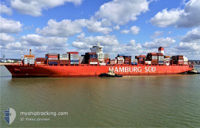
SAN RAPHAEL MAERSK
Container Ship
Current Trip
| Time Travelled | 2 days |
|---|---|
| Remaining Time | --- |
| Distance Travelled | 1012.82 nm |
| Remaining Distance | --- |
| AVG Speed | 16.6 Knopen |
| MAX Speed | 18.4 Knopen |
| AVG Wind | 11.7 knots |
| MAX Wind | 23.4 knots |
| MIN Temp | 15.8°C / 60.44°F |
| MAX Temp | 21.7°C / 71.06°F |
| Diepgang | 11.9 M |
| Positie ontvangen | 7 h, 43 m geleden |
Current Position
| Lengtegraad | -17.40102° |
|---|---|
| Breedtegraat | 25.81527° |
| Status | Under way using engine |
| Snelheid | 17.4 Knopen |
| Koers | 203.5° |
| Gebied | North Atlantic Ocean |
| Station | T-AIS |
| Positie ontvangen | 7 h, 43 m geleden |
Info
Information
The current position of SAN RAPHAEL MAERSK is in North Atlantic Ocean with coordinates 25.81527° / -17.40102° as reported on 2024-04-24 21:19 by AIS to our vessel tracker app. The vessel's current speed is 17.4 Knopen and is heading at the port of SANTOS. The estimated time of arrival as calculated by MyShipTracking vessel tracking app is 2024-05-04 02:00 LT
The vessel SAN RAPHAEL MAERSK (IMO: 9622253, MMSI: 219107000) is a Container Ship that was built in 2014 ( 10 Jaar oud ). It's sailing under the flag of [DK] Denmark.
In this page you can find informations about the vessels current position, last detected port calls, and current voyage information. If the vessels is not in coverage by AIS you will find the latest position.
The current position of SAN RAPHAEL MAERSK is detected by our AIS receivers and we are not responsible for the reliability of the data. The last position was recorded while the vessel was in Coverage by the Ais receivers of our vessel tracking app.
The current draught of SAN RAPHAEL MAERSK as reported by AIS is 11.9 meters
Weather
| Temperature | 21.1°C / 69.98°F |
|---|---|
| Wind Speed | 15 knots |
| Direction | 33° NNE |
| Pressure | 1012.9 hPa |
| Humidity | 80.6 % |
| Cloud Coverage | 100 % |
Featured Company
Last Port Calls
| Port | Arrival | Departure | Time In Port |
|---|---|---|---|
| 2024-04-22 03:04 | 2024-04-22 18:26 | 15 h | |
| 2024-04-17 06:29 | 2024-04-18 16:44 | 1 d | |
| 2024-04-14 17:44 | 2024-04-15 19:23 | 1 d | |
| 2024-04-12 11:16 | 2024-04-13 04:39 | 17 h | |
| 2024-04-10 09:43 | 2024-04-11 11:19 | 1 d | |
| 2024-04-08 09:17 | 2024-04-09 02:39 | 17 h | |
| 2024-03-16 19:53 | 2024-03-18 04:46 | 1 d | |
| 2024-03-15 15:26 | 2024-03-16 09:58 | 18 h | |
| 2024-03-09 21:12 | 2024-03-10 22:35 | 1 d | |
| 2024-03-08 03:20 | 2024-03-09 04:45 | 1 d |
Most Visited Ports (Last year)
| Port | Arrivals | |
|---|---|---|
| 10 | ||
| 9 | ||
| 6 | ||
| 5 | ||
| 5 | ||
| 5 |
Last Trips
| Origin | Departure | Destination | Arrival | Distance | |
|---|---|---|---|---|---|
| 2024-04-18 18:44 | 2024-04-22 04:04 | 1427.41 nm | |||
| 2024-04-15 21:23 | 2024-04-17 08:29 | 445.52 nm | |||
| 2024-04-13 06:39 | 2024-04-14 19:44 | 143.86 nm | |||
| 2024-04-11 12:19 | 2024-04-12 13:16 | 384.91 nm | |||
| 2024-04-09 04:39 | 2024-04-10 10:43 | 214.90 nm | |||
| 2024-03-18 01:46 | 2024-04-08 11:17 | 5971.33 nm | |||
| 2024-03-16 06:58 | 2024-03-16 16:53 | 158.48 nm | |||
| 2024-03-10 19:35 | 2024-03-15 12:26 | 899.91 nm | |||
| 2024-03-09 01:45 | 2024-03-09 18:12 | 146.72 nm | |||
| 2024-03-03 16:21 | 2024-03-08 00:20 | 1007.44 nm |
Events
| Tijd | Evenement | Details | Positie / Bestemming | Info |
|---|---|---|---|---|
| 2024-04-24 21:26 | Status Changed | Default Under way using engine |
25.78365 / -17.41653
SANTOS BRASIL
|
Snelheid: 17.4 kn Koers: 203.5° |
| 2024-04-24 21:19 | Status Changed | Under way using engine Default |
25.81527 / -17.40102
SANTOS BRASIL
|
Snelheid: 17.4 kn Koers: 204° |
| 2024-04-24 21:19 | Buitenbereik |
25.81527 / -17.40102
North Atlantic Ocean
SANTOS BRASIL
|
Snelheid: 17.4 kn Koers: 203.5° |
|
| 2024-04-24 20:25 | Status Changed | Default Under way using engine |
26.05265 / -17.28836
SANTOS BRASIL
|
Snelheid: 16.9 kn Koers: 203.3° |
| 2024-04-23 20:52 | Wijzig zee gebeid | Spanish (Canary Islands) part of the North Atlantic Ocean Moroccan part of the North Atlantic Ocean |
31.23450 / -12.31877
North Atlantic Ocean
SANTOS BRASIL
|
Snelheid: 18 kn Koers: 228.5° |
| 2024-04-23 20:52 | Status Changed | Under way using engine Default |
31.23450 / -12.31877
SANTOS BRASIL
|
Snelheid: 18 kn Koers: 228° |
| 2024-04-23 20:17 | Status Changed | Default Under way using engine |
31.34333 / -12.16333
SANTOS BRASIL
|
Snelheid: 18 kn Koers: 231° |
| 2024-04-23 20:07 | Status Changed | Under way using engine Default |
31.37590 / -12.11925
SANTOS BRASIL
|
Snelheid: 18 kn Koers: 231° |
| 2024-04-23 20:02 | Status Changed | Default Under way using engine |
31.39282 / -12.09508
SANTOS BRASIL
|
Snelheid: 18 kn Koers: 230.6° |
| 2024-04-23 19:55 | Status Changed | Under way using engine Default |
31.41575 / -12.06234
SANTOS BRASIL
|
Snelheid: 18 kn Koers: 231° |