
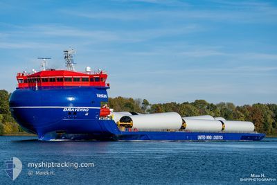
BRAVEWIND
Cargo
Current Trip
| Time Travelled | 2 days |
|---|---|
| Remaining Time | 14 days |
| Distance Travelled | 311.96 nm |
| Remaining Distance | 2395.69 nm |
| AVG Speed | 6 Knopen |
| MAX Speed | 7.9 Knopen |
| AVG Wind | 10.9 knots |
| MAX Wind | 26.8 knots |
| MIN Temp | 7.6°C / 45.68°F |
| MAX Temp | 17.4°C / 63.32°F |
| Diepgang | 5 M |
| Positie ontvangen | 3 h, 29 m geleden |
Current Position
| Lengtegraad | 14.69571° |
|---|---|
| Breedtegraat | 38.18145° |
| Status | Under way using engine |
| Snelheid | 7.2 Knopen |
| Koers | 257.8° |
| Gebied | Tyrrhenian Sea |
| Station | T-AIS |
| Positie ontvangen | 3 h, 29 m geleden |
Info
Information
The current position of BRAVEWIND is in Tyrrhenian Sea with coordinates 38.18145° / 14.69571° as reported on 2024-04-25 11:45 by AIS to our vessel tracker app. The vessel's current speed is 7.2 Knopen and is heading at the port of ANTWERP. The estimated time of arrival as calculated by MyShipTracking vessel tracking app is 2024-05-10 08:49 LT
The vessel BRAVEWIND (IMO: 9886330, MMSI: 255806364) is a Cargo It's sailing under the flag of [PT] Portugal.
In this page you can find informations about the vessels current position, last detected port calls, and current voyage information. If the vessels is not in coverage by AIS you will find the latest position.
The current position of BRAVEWIND is detected by our AIS receivers and we are not responsible for the reliability of the data. The last position was recorded while the vessel was in Coverage by the Ais receivers of our vessel tracking app.
The current draught of BRAVEWIND as reported by AIS is 5 meters
Weather
| Temperature | 15.4°C / 59.72°F |
|---|---|
| Wind Speed | 16 knots |
| Direction | 287° WNW |
| Pressure | 1011.9 hPa |
| Humidity | 65.6 % |
| Cloud Coverage | 100 % |
Featured Company
Last Port Calls
| Port | Arrival | Departure | Time In Port |
|---|---|---|---|
| 2024-04-17 14:56 | 2024-04-23 05:32 | 5 d | |
| 2024-04-12 16:46 | 2024-04-13 03:06 | 10 h | |
| 2024-03-23 12:11 | 2024-03-25 14:14 | 2 d | |
| 2024-03-19 06:04 | 2024-03-20 16:42 | 1 d | |
| 2024-03-14 14:53 | 2024-03-15 15:09 | 1 d | |
| 2024-03-11 18:52 | |||
| 2024-02-10 10:16 | 2024-02-15 12:49 | 5 d |
Last Trips
| Origin | Departure | Destination | Arrival | Distance | |
|---|---|---|---|---|---|
| 2024-04-13 05:06 | 2024-04-17 16:56 | 1258.67 nm | |||
| 2024-03-25 15:14 | 2024-04-12 18:46 | 1739.89 nm | |||
| 2024-03-20 17:42 | 2024-03-23 13:11 | 635.01 nm | |||
| 2024-03-15 16:09 | 2024-03-19 07:04 | 735.18 nm | |||
| 2024-03-11 19:52 | 2024-03-14 15:53 | 724.01 nm | |||
| 2024-01-30 15:47 | 2024-02-10 11:16 | 790.65 nm |
Events
| Tijd | Evenement | Details | Positie / Bestemming | Info |
|---|---|---|---|---|
| 2024-04-25 11:48 | Status Changed | Default Under way using engine |
38.18035 / 14.68910
BEANR
|
Snelheid: 7.2 kn Koers: 257.8° |
| 2024-04-25 11:45 | Buitenbereik |
38.18145 / 14.69571
Tyrrhenian Sea
BEANR
|
Snelheid: 7.2 kn Koers: 257.8° |
|
| 2024-04-25 03:11 | Wijzig zee gebeid | Italian part of the Tyrrhenian Sea Italian part of the Ionian Sea |
38.24965 / 15.66361
Tyrrhenian Sea
BEANR
|
Snelheid: 7 kn Koers: 62° |
| 2024-04-24 21:47 | Status Changed | Under way using engine Default |
37.86632 / 15.89662
BEANR
|
Snelheid: 3 kn Koers: -1° |
| 2024-04-24 21:33 | Status Changed | Default Under way using engine |
37.86500 / 15.91333
BEANR
|
Snelheid: 3.6 kn Koers: 277° |
| 2024-04-24 21:30 | Draught Changed | 5 4.8 |
37.86501 / 15.91838
BEANR
|
Snelheid: 3.6 kn Koers: 277° |
| 2024-04-24 21:30 | ETA Changed | 2024/05/05 04:00 2024/05/03 04:00 |
37.86501 / 15.91838
BEANR
|
Snelheid: 3.6 kn Koers: 277° |
| 2024-04-24 21:23 | Binnenbereik |
37.86427 / 15.92625
Ionian Sea
BEANR
|
Snelheid: 3.7 kn Koers: 276.8° |
|
| 2024-04-24 15:49 | Status Changed | Default Under way using engine |
38.14177 / 16.40023
BEANR
|
Snelheid: 6.1 kn Koers: 218.5° |
| 2024-04-24 15:37 | Buitenbereik |
38.15775 / 16.41576
Ionian Sea
BEANR
|
Snelheid: 6.1 kn Koers: 218.5° |