
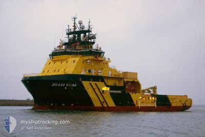
BRAGE VIKING
Anchor Handling Vessel
Current Trip
ST.JOHN
| Time Travelled | 3 days |
|---|---|
| Remaining Time | --- |
| Distance Travelled | 1043.81 nm |
| Remaining Distance | --- |
| AVG Speed | 12.1 Knopen |
| MAX Speed | 18.5 Knopen |
| AVG Wind | 16.7 knots |
| MAX Wind | 26.5 knots |
| MIN Temp | 7.2°C / 44.96°F |
| MAX Temp | 12.3°C / 54.14°F |
| Diepgang | 6.9 M |
| Positie ontvangen | 1 d geleden |
Current Position
| Lengtegraad | -7.00860° |
|---|---|
| Breedtegraat | 49.79021° |
| Status | Under way using engine |
| Snelheid | 12.4 Knopen |
| Koers | 278.5° |
| Gebied | Celtic Sea |
| Station | T-AIS |
| Positie ontvangen | 1 d geleden |
Info
Information
The current position of BRAGE VIKING is in Celtic Sea with coordinates 49.79021° / -7.00860° as reported on 2024-04-22 11:30 by AIS to our vessel tracker app. The vessel's current speed is 12.4 Knopen
The vessel BRAGE VIKING (IMO: 9475791, MMSI: 257050000) is a Anchor Handling Vessel that was built in 2012 ( 12 Jaar oud ). It's sailing under the flag of [NO] Norway.
In this page you can find informations about the vessels current position, last detected port calls, and current voyage information. If the vessels is not in coverage by AIS you will find the latest position.
The current position of BRAGE VIKING is detected by our AIS receivers and we are not responsible for the reliability of the data. The last position was recorded while the vessel was in Coverage by the Ais receivers of our vessel tracking app.
The current draught of BRAGE VIKING as reported by AIS is 6.9 meters
Weather
| Temperature | 10.1°C / 50.18°F |
|---|---|
| Wind Speed | 7 knots |
| Direction | 207° SSW |
| Pressure | 1023.5 hPa |
| Humidity | 89.6 % |
| Cloud Coverage | 100 % |
Featured Company
Last Port Calls
| Port | Arrival | Departure | Time In Port |
|---|---|---|---|
| 2024-04-20 19:01 | 2024-04-20 19:48 | 47 m | |
| 2024-04-15 02:00 | 2024-04-20 17:23 | 5 d | |
| 2024-04-08 11:40 | 2024-04-08 12:30 | 49 m | |
| 2024-03-20 23:04 | 2024-04-06 12:23 | 16 d | |
| 2024-03-10 09:28 | 2024-03-17 09:10 | 6 d | |
| 2024-03-05 13:45 | 2024-03-06 17:21 | 1 d | |
| 2024-02-16 20:29 | 2024-02-19 14:50 | 2 d | |
| 2024-02-15 19:24 | 2024-02-16 06:49 | 11 h | |
| 2024-02-09 22:32 | 2024-02-09 22:58 | 26 m | |
| 2024-02-08 18:22 | 2024-02-08 18:33 | 11 m |
Most Visited Ports (Last year)
| Port | Arrivals | |
|---|---|---|
| 18 | ||
| 6 | ||
| 3 | ||
| 3 | ||
| 2 | ||
| 2 |
Last Trips
| Origin | Departure | Destination | Arrival | Distance | |
|---|---|---|---|---|---|
| 2024-04-20 19:23 | 2024-04-20 21:01 | 9.86 nm | |||
| 2024-04-08 13:30 | 2024-04-15 04:00 | 472.04 nm | |||
| 2024-04-06 13:23 | 2024-04-08 12:40 | 48.51 nm | |||
| 2024-03-17 10:10 | 2024-03-20 23:04 | 664.79 nm | |||
| 2024-03-06 18:21 | 2024-03-10 10:28 | 804.19 nm | |||
| 2024-02-19 15:50 | 2024-03-05 14:45 | 1459.65 nm | |||
| 2024-02-16 07:49 | 2024-02-16 21:29 | 101.35 nm | |||
| 2024-02-09 23:58 | 2024-02-15 20:24 | 370.85 nm | |||
| 2024-02-08 19:33 | 2024-02-09 23:32 | 269.99 nm | |||
| 2024-02-07 19:10 | 2024-02-08 19:22 | 50.25 nm |
Events
| Tijd | Evenement | Details | Positie / Bestemming | Info |
|---|---|---|---|---|
| 2024-04-22 11:35 | Status Changed | Default Under way using engine |
49.79167 / -7.03167
ST.JOHN
|
Snelheid: 12.4 kn Koers: 278.5° |
| 2024-04-22 11:30 | Wijzig zee gebeid | United Kingdom part of the Celtic Sea United Kingdom part of the English Channel |
49.79021 / -7.00860
Celtic Sea
ST.JOHN
|
Snelheid: 12.4 kn Koers: 278.5° |
| 2024-04-22 11:30 | Status Changed | Under way using engine Default |
49.79021 / -7.00860
ST.JOHN
|
Snelheid: 12 kn Koers: 278° |
| 2024-04-22 11:30 | Buitenbereik |
49.79021 / -7.00860
Celtic Sea
ST.JOHN
|
Snelheid: 12.4 kn Koers: 278.5° |
|
| 2024-04-22 11:23 | Binnenbereik |
49.79021 / -7.00860
Celtic Sea
ST.JOHN
|
Snelheid: 12.4 kn Koers: 278.5° |
|
| 2024-04-22 06:10 | Status Changed | Default Under way using engine |
49.80784 / -5.23294
ST.JOHN
|
Snelheid: 12.3 kn Koers: 260.5° |
| 2024-04-22 06:03 | Buitenbereik |
49.81204 / -5.19413
English Channel
ST.JOHN
|
Snelheid: 12.3 kn Koers: 260.5° |
|
| 2024-04-22 06:02 | Status Changed | Under way using engine Default |
49.81233 / -5.19142
ST.JOHN
|
Snelheid: 12.3 kn Koers: 261° |
| 2024-04-22 05:31 | Status Changed | Default Under way using engine |
49.82858 / -5.02440
ST.JOHN
|
Snelheid: 12.3 kn Koers: 262.2° |
| 2024-04-22 05:25 | Status Changed | Under way using engine Default |
49.83111 / -4.99551
ST.JOHN
|
Snelheid: 12.3 kn Koers: 262° |