
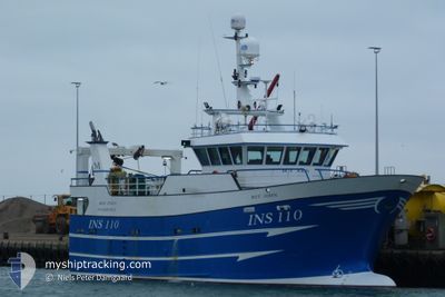
BOY JOHN INS 110
Fishing
Current Trip
| Trip Time | 9 days |
|---|---|
| Trip Distance | 41.66 nm |
| AVG Speed | 9.2 Knopen |
| MAX Speed | 11.2 Knopen |
| Diepgang | 0 M |
| AVG Wind | 18 knots |
| MAX Wind | 21.9 knots |
| MIN Temp | 5.7°C / 42.26°F |
| MAX Temp | 10.4°C / 50.72°F |
| Positie ontvangen | 3 d geleden |
Current Position
| Lengtegraad | -1.77374° |
|---|---|
| Breedtegraat | 57.49674° |
| Status | Engaged in Fishing |
| Snelheid | 8.4 Knopen |
| Koers | 128° |
| Gebied | North Sea |
| Station | T-AIS |
| Positie ontvangen | 3 d geleden |
Info
Information
The current position of BOY JOHN INS 110 is in North Sea with coordinates 57.49674° / -1.77374° as reported on 2024-04-21 23:31 by AIS to our vessel tracker app. The vessel's current speed is 8.4 Knopen and is currently inside the port of PETERHEAD.
The vessel BOY JOHN INS 110 (IMO: 9698044, MMSI: 235108172) is a Fishing It's sailing under the flag of [GB] United Kingdom.
In this page you can find informations about the vessels current position, last detected port calls, and current voyage information. If the vessels is not in coverage by AIS you will find the latest position.
The current position of BOY JOHN INS 110 is detected by our AIS receivers and we are not responsible for the reliability of the data. The last position was recorded while the vessel was in Coverage by the Ais receivers of our vessel tracking app.
Weather
| Temperature | 7.7°C / 45.86°F |
|---|---|
| Wind Speed | 5 knots |
| Direction | 264° W |
| Pressure | 1031 hPa |
| Humidity | 93.8 % |
| Cloud Coverage | 100 % |
Featured Company
Last Port Calls
| Port | Arrival | Departure | Time In Port |
|---|---|---|---|
| 2024-04-21 17:13 | |||
| 2024-04-12 00:10 | 2024-04-12 16:51 | 16 h | |
| 2024-04-04 17:21 | 2024-04-04 23:57 | 6 h | |
| 2024-03-28 03:04 | 2024-04-04 14:41 | 7 d | |
| 2024-03-19 13:22 | 2024-03-19 20:36 | 7 h | |
| 2024-03-12 12:15 | 2024-03-13 00:53 | 12 h | |
| 2024-03-05 14:23 | 2024-03-05 22:32 | 8 h | |
| 2024-02-27 13:16 | 2024-03-05 13:29 | 7 d | |
| 2024-02-04 19:19 | 2024-02-27 11:35 | 22 d |
Last Trips
| Origin | Departure | Destination | Arrival | Distance | |
|---|---|---|---|---|---|
| 2024-04-12 17:51 | 2024-04-21 18:13 | 41.66 nm | |||
| 2024-04-05 00:57 | 2024-04-12 01:10 | 35.92 nm | |||
| 2024-04-04 15:41 | 2024-04-04 18:21 | 13.18 nm | |||
| 2024-03-19 20:36 | 2024-03-28 03:04 | 14.24 nm | |||
| 2024-03-13 00:53 | 2024-03-19 13:22 | 24.23 nm | |||
| 2024-03-05 22:32 | 2024-03-12 12:15 | 46.46 nm | |||
| 2024-03-05 13:29 | 2024-03-05 14:23 | 4.08 nm | |||
| 2024-02-27 11:35 | 2024-02-27 13:16 | 13.82 nm | |||
| 2024-01-28 21:05 | 2024-02-04 19:19 | 17.95 nm |
Events
| Tijd | Evenement | Details | Positie / Bestemming | Info |
|---|---|---|---|---|
| 2024-04-21 23:31 | Buitenbereik |
57.49674 / -1.77374
North Sea
[GB] PETERHEAD
|
Snelheid: 8.4 kn Koers: 129.3° |
|
| 2024-04-21 23:24 | Start beweging |
57.50420 / -1.77242
[GB] PETERHEAD
|
Snelheid: 4.2 kn Koers: 209° |
|
| 2024-04-21 19:22 | Binnenbereik |
57.50682 / -1.77092
North Sea
[GB] PETERHEAD
|
Snelheid: 0.4 kn Koers: 63.3° |
|
| 2024-04-21 17:45 | Buitenbereik |
57.50687 / -1.77093
North Sea
[GB] PETERHEAD
|
Snelheid: 0.6 kn Koers: 66.2° |
|
| 2024-04-21 17:13 | Aankomsthaven |
|
57.49713 / -1.77384
[GB] PETERHEAD
|
Snelheid: 9.5 kn Koers: 298.9° |
| 2024-04-21 15:03 | Binnenbereik |
57.76711 / -1.47769
North Sea
|
Snelheid: 9.2 kn Koers: 204.5° |