
BEVER
Tug
Current Trip
| Time Travelled | 1 day |
|---|---|
| Remaining Time | --- |
| Distance Travelled | 149.02 nm |
| Remaining Distance | --- |
| AVG Speed | 6.9 Knopen |
| MAX Speed | 12.2 Knopen |
| AVG Wind | 11.5 knots |
| MAX Wind | 17 knots |
| MIN Temp | 6.9°C / 44.42°F |
| MAX Temp | 12.3°C / 54.14°F |
| Diepgang | 4.2 M |
| Positie ontvangen | 15 m geleden |
Current Position
| Lengtegraad | -4.75103° |
|---|---|
| Breedtegraat | 47.69438° |
| Status | Restricted manoeuverability |
| Snelheid | 6 Knopen |
| Koers | 300.9° |
| Gebied | Celtic Sea |
| Station | T-AIS |
| Positie ontvangen | 15 m geleden |
Info
Information
The current position of BEVER is in Celtic Sea with coordinates 47.69438° / -4.75103° as reported on 2024-04-24 04:17 by AIS to our vessel tracker app. The vessel's current speed is 6 Knopen and is heading at the port of FALMOUTH. The estimated time of arrival as calculated by MyShipTracking vessel tracking app is 2024-04-25 09:00 LT
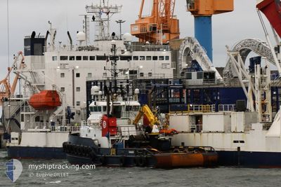
The vessel BEVER (IMO: 9492256, MMSI: 244536000) is a Tug that was built in 2010 ( 14 Jaar oud ). It's sailing under the flag of [NL] Netherlands.
In this page you can find informations about the vessels current position, last detected port calls, and current voyage information. If the vessels is not in coverage by AIS you will find the latest position.
The current position of BEVER is detected by our AIS receivers and we are not responsible for the reliability of the data. The last position was recorded while the vessel was in Coverage by the Ais receivers of our vessel tracking app.
The current draught of BEVER as reported by AIS is 4.2 meters
Weather
| Temperature | 11.3°C / 52.34°F |
|---|---|
| Wind Speed | 14 knots |
| Direction | 329° NNW |
| Pressure | 1021.5 hPa |
| Humidity | 74.1 % |
| Cloud Coverage | 10 % |
Featured Company
Last Port Calls
| Port | Arrival | Departure | Time In Port |
|---|---|---|---|
| 2024-04-21 12:40 | 2024-04-22 16:23 | 1 d | |
| 2024-04-18 12:28 | 2024-04-19 05:26 | 16 h | |
| 2024-04-15 11:44 | 2024-04-17 06:30 | 1 d | |
| 2024-04-10 12:19 | 2024-04-10 17:47 | 5 h | |
| 2024-04-09 16:19 | 2024-04-10 12:07 | 19 h | |
| 2024-04-09 15:07 | 2024-04-09 16:07 | 59 m | |
| 2024-04-04 10:23 | 2024-04-09 14:52 | 5 d | |
| 2024-04-04 06:07 | 2024-04-04 10:07 | 3 h | |
| 2024-03-31 16:19 | 2024-04-04 05:43 | 3 d | |
| 2024-03-31 05:55 | 2024-03-31 15:47 | 9 h |
Most Visited Ports (Last year)
| Port | Arrivals | |
|---|---|---|
| 21 | ||
| 13 | ||
| 8 | ||
| 8 | ||
| 8 | ||
| 4 |
Last Trips
| Origin | Departure | Destination | Arrival | Distance | |
|---|---|---|---|---|---|
| 2024-04-19 07:26 | 2024-04-21 14:40 | 78.09 nm | |||
| 2024-04-17 08:30 | 2024-04-18 14:28 | 73.58 nm | |||
| 2024-04-10 19:47 | 2024-04-15 13:44 | 75.41 nm | |||
| 2024-04-10 14:07 | 2024-04-10 14:19 | 1.76 nm | |||
| 2024-04-09 18:07 | 2024-04-09 18:19 | 0.18 nm | |||
| 2024-04-09 16:52 | 2024-04-09 17:07 | 1.56 nm | |||
| 2024-04-04 12:07 | 2024-04-04 12:23 | 1.41 nm | |||
| 2024-04-04 07:43 | 2024-04-04 08:07 | 2.05 nm | |||
| 2024-03-31 17:47 | 2024-03-31 18:19 | 2.31 nm | |||
| 2024-03-31 07:23 | 2024-03-31 07:55 | 2.10 nm |
Events
| Tijd | Evenement | Details | Positie / Bestemming | Info |
|---|---|---|---|---|
| 2024-04-24 04:19 | Status Changed | Default Restricted manoeuverability |
47.69500 / -4.75500
GBFAL
|
Snelheid: 6 kn Koers: 300.9° |
| 2024-04-24 02:43 | Wijzig zee gebeid | French part of the Celtic Sea French part of the Bay of Biscay |
47.60948 / -4.54037
Celtic Sea
GBFAL
|
Snelheid: 6.6 kn Koers: 301.6° |
| 2024-04-24 02:33 | Binnenbereik |
47.60028 / -4.51801
Bay of Biscay
GBFAL
|
Snelheid: 6.8 kn Koers: 302.3° |
|
| 2024-04-24 02:32 | Status Changed | Restricted manoeuverability Default |
47.59829 / -4.51328
GBFAL
|
Snelheid: 6 kn Koers: 302° |
| 2024-04-23 16:56 | Status Changed | Default Restricted manoeuverability |
47.07833 / -3.13935
GBFAL
|
Snelheid: 6.1 kn Koers: 288.8° |
| 2024-04-23 16:45 | Buitenbereik |
47.07269 / -3.11412
Bay of Biscay
GBFAL
|
Snelheid: 6.1 kn Koers: 288.8° |
|
| 2024-04-23 10:41 | Status Changed | Restricted manoeuverability Under way using engine |
46.88637 / -2.30363
GBFAL
|
Snelheid: 4.3 kn Koers: 287° |
| 2024-04-23 10:41 | Destination Changed | GBFAL OFF SHORE KP2.5 |
46.88631 / -2.30336
GBFAL
|
Snelheid: 4.3 kn Koers: 287° |
| 2024-04-23 10:41 | ETA Changed | 2024/04/25 09:00 2024/04/22 23:00 |
46.88631 / -2.30336
GBFAL
|
Snelheid: 4.3 kn Koers: 287° |
| 2024-04-23 10:24 | Start beweging | 5.68 nm, West of LA BARRE DE MONTS |
46.88082 / -2.27633
OFF SHORE KP2.5
|
Snelheid: 3.3 kn Koers: 332° |