
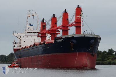
BEREKET M
Bulk Carrier
Current Trip
| Trip Time | 7 days |
|---|---|
| Trip Distance | 736.44 nm |
| AVG Speed | 8.9 Knopen |
| MAX Speed | 8.9 Knopen |
| Diepgang | 9.9 M |
| AVG Wind | 7.2 knots |
| MAX Wind | 17.8 knots |
| MIN Temp | 10.8°C / 51.44°F |
| MAX Temp | 27.4°C / 81.32°F |
| Positie ontvangen | 8 d geleden |
Current Position
| Lengtegraad | 26.99252° |
|---|---|
| Breedtegraat | 38.41598° |
| Status | Under way using engine |
| Snelheid | 5.9 Knopen |
| Koers | 71.5° |
| Gebied | Aegean Sea |
| Station | T-AIS |
| Positie ontvangen | 8 d geleden |
Info
Information
The current position of BEREKET M is in Aegean Sea with coordinates 38.41598° / 26.99252° as reported on 2024-04-16 12:27 by AIS to our vessel tracker app. The vessel's current speed is 5.9 Knopen and is currently inside the port of IZMIR.
The vessel BEREKET M (IMO: 9123702, MMSI: 374681000) is a Bulk Carrier that was built in 1997 ( 27 Jaar oud ). It's sailing under the flag of [PA] Panama.
In this page you can find informations about the vessels current position, last detected port calls, and current voyage information. If the vessels is not in coverage by AIS you will find the latest position.
The current position of BEREKET M is detected by our AIS receivers and we are not responsible for the reliability of the data. The last position was recorded while the vessel was in Coverage by the Ais receivers of our vessel tracking app.
The current draught of BEREKET M as reported by AIS is 9.9 meters
Weather
| Temperature | 17.5°C / 63.5°F |
|---|---|
| Wind Speed | 4 knots |
| Direction | 195° SSW |
| Pressure | 1005.5 hPa |
| Humidity | 82.8 % |
| Cloud Coverage | 100 % |
Featured Company
Last Trips
| Origin | Departure | Destination | Arrival | Distance | |
|---|---|---|---|---|---|
| 2024-04-09 07:50 | 2024-04-16 15:49 | 736.44 nm | |||
| 2024-03-20 02:11 | 2024-03-30 15:01 | 1141.99 nm | |||
| 2024-02-24 08:07 | 2024-03-11 09:24 | 1104.09 nm | |||
| 2024-02-15 12:02 | 2024-02-21 17:55 | 516.93 nm | |||
| 2024-01-25 09:50 | 2024-02-07 18:26 | 3321.22 nm |
Events
| Tijd | Evenement | Details | Positie / Bestemming | Info |
|---|---|---|---|---|
| 2024-04-19 19:28 | Stop beweging |
38.44371 / 27.16039
[TR] IZMIR
|
Snelheid: 0.1 kn Koers: 21° |
|
| 2024-04-19 18:05 | Start beweging |
38.42104 / 27.09708
[TR] IZMIR
|
Snelheid: 3.1 kn Koers: 264° |
|
| 2024-04-16 13:47 | Stop beweging |
38.42102 / 27.09944
[TR] IZMIR
|
Snelheid: 0.3 kn Koers: 206° |
|
| 2024-04-16 12:49 | Aankomsthaven |
|
38.42297 / 27.04906
[TR] IZMIR
|
Snelheid: 7.3 kn Koers: 92° |
| 2024-04-16 12:35 | Status Changed | Default Under way using engine |
38.42127 / 27.01353
TRIZMIR
|
Snelheid: 5.9 kn Koers: 71.5° |
| 2024-04-16 12:27 | Buitenbereik |
38.41598 / 26.99252
Aegean Sea
[TR] IZMIR
|
Snelheid: 5.9 kn Koers: 71.5° |
|
| 2024-04-16 12:22 | Status Changed | Under way using engine Default |
38.41281 / 26.98134
TRIZMIR
|
Snelheid: 8.1 kn Koers: 73° |
| 2024-04-16 12:17 | Status Changed | Default Under way using engine |
38.41081 / 26.97370
TRIZMIR
|
Snelheid: 9 kn Koers: 74.1° |
| 2024-04-16 11:46 | Status Changed | Under way using engine At anchor |
38.41136 / 26.86697
TRIZMIR
|
Snelheid: 7.3 kn Koers: 125.7° |
| 2024-04-16 11:26 | Start beweging | 4.09 nm, East of URLA |
38.41674 / 26.83433
TRIZMIR
|
Snelheid: 5.7 kn Koers: 0.1° |