
ROY P. BENAVIDEZ
Logistics Naval Vessel
Current Trip
NIRVANA
| Time Travelled | 8 days |
|---|---|
| Remaining Time | --- |
| Distance Travelled | 1467.82 nm |
| Remaining Distance | --- |
| AVG Speed | 8.2 Knopen |
| MAX Speed | 8.2 Knopen |
| AVG Wind | 17.8 knots |
| MAX Wind | 32.7 knots |
| MIN Temp | 15.3°C / 59.54°F |
| MAX Temp | 26.8°C / 80.24°F |
| Diepgang | 7.4 M |
| Positie ontvangen | 2 d geleden |
Current Position
| Lengtegraad | 24.88068° |
|---|---|
| Breedtegraat | 35.89718° |
| Status | Under way using engine |
| Snelheid | 5.4 Knopen |
| Koers | 88.5° |
| Gebied | Aegean Sea |
| Station | T-AIS |
| Positie ontvangen | 2 d geleden |
Info
Information
The current position of ROY P. BENAVIDEZ is in Aegean Sea with coordinates 35.89718° / 24.88068° as reported on 2024-04-22 19:27 by AIS to our vessel tracker app. The vessel's current speed is 5.4 Knopen
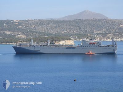
The vessel ROY P. BENAVIDEZ (IMO: 9218210, MMSI: 368026000) is a Logistics Naval Vessel that was built in 2003 ( 21 Jaar oud ). It's sailing under the flag of [US] USA.
In this page you can find informations about the vessels current position, last detected port calls, and current voyage information. If the vessels is not in coverage by AIS you will find the latest position.
The current position of ROY P. BENAVIDEZ is detected by our AIS receivers and we are not responsible for the reliability of the data. The last position was recorded while the vessel was in Coverage by the Ais receivers of our vessel tracking app.
The current draught of ROY P. BENAVIDEZ as reported by AIS is 7.4 meters
Weather
| Temperature | 26.9°C / 80.42°F |
|---|---|
| Wind Speed | 10 knots |
| Direction | 152° SSE |
| Pressure | 1005.9 hPa |
| Humidity | 39.2 % |
| Cloud Coverage | 71 % |
Featured Company
Last Port Calls
| Port | Arrival | Departure | Time In Port |
|---|---|---|---|
| 2024-04-05 06:44 | 2024-04-17 04:39 | 11 d | |
| 2024-02-19 14:30 | 2024-03-22 05:38 | ||
| 2024-02-15 21:01 |
Most Visited Ports (Last year)
| Port | Arrivals | |
|---|---|---|
| 2 | ||
| 1 | ||
| 1 |
Last Trips
| Origin | Departure | Destination | Arrival | Distance | |
|---|---|---|---|---|---|
| 2024-03-22 01:38 | 2024-04-05 09:44 | 5448.37 nm | |||
| 2024-02-15 16:01 | 2024-02-19 09:30 | 1151.05 nm |
Events
| Tijd | Evenement | Details | Positie / Bestemming | Info |
|---|---|---|---|---|
| 2024-04-22 19:27 | Buitenbereik |
35.89718 / 24.88068
Aegean Sea
|
Snelheid: 5.4 kn Koers: 88.5° |
|
| 2024-04-22 06:25 | Start beweging |
35.78108 / 25.02793
|
Snelheid: 3.2 kn Koers: 179° |
|
| 2024-04-21 12:13 | Stop beweging |
35.82203 / 25.09403
|
Snelheid: 0.3 kn Koers: 277° |
|
| 2024-04-20 01:40 | Start beweging |
35.83339 / 25.32546
|
Snelheid: 3.2 kn Koers: 9° |
|
| 2024-04-19 17:09 | Stop beweging |
35.89082 / 25.22614
|
Snelheid: 0.3 kn Koers: 76° |
|
| 2024-04-19 14:20 | Binnenbereik |
35.56106 / 24.40806
Aegean Sea
|
Snelheid: 17.6 kn Koers: 69° |
|
| 2024-04-19 12:16 | Buitenbereik |
35.48282 / 24.13780
Aegean Sea
|
Snelheid: 1.5 kn Koers: 275.9° |
|
| 2024-04-19 11:25 | Binnenbereik |
35.50255 / 24.24504
Aegean Sea
|
Snelheid: 8.9 kn Koers: 253.1° |
|
| 2024-04-19 08:57 | Buitenbereik |
35.63717 / 24.64880
Aegean Sea
|
Snelheid: 9.9 kn Koers: 249.1° |
|
| 2024-04-17 05:25 | Binnenbereik |
35.52639 / 24.26969
Aegean Sea
|
Snelheid: 11.3 kn Koers: 67.4° |