
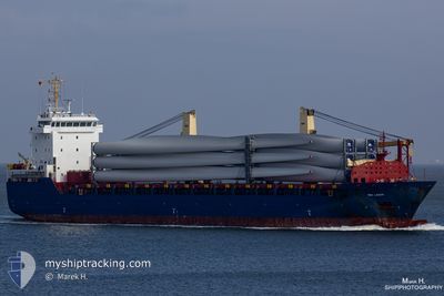
BBC LAGOS
General Cargo
Current Trip
| Time Travelled | 7 days |
|---|---|
| Remaining Time | 4 h, 48 mins |
| Distance Travelled | 966.95 nm |
| Remaining Distance | 57.43 nm |
| AVG Speed | 9.1 Knopen |
| MAX Speed | 13.9 Knopen |
| AVG Wind | 13.1 knots |
| MAX Wind | 23 knots |
| MIN Temp | 5.2°C / 41.36°F |
| MAX Temp | 12.4°C / 54.32°F |
| Diepgang | 6.5 M |
| Positie ontvangen | 59 m geleden |
Current Position
| Lengtegraad | -10.57360° |
|---|---|
| Breedtegraat | 52.20562° |
| Status | Under way using engine |
| Snelheid | 11 Knopen |
| Koers | 51.3° |
| Gebied | North Atlantic Ocean |
| Station | T-AIS |
| Positie ontvangen | 59 m geleden |
Info
Information
The current position of BBC LAGOS is in North Atlantic Ocean with coordinates 52.20562° / -10.57360° as reported on 2024-04-25 00:11 by AIS to our vessel tracker app. The vessel's current speed is 11 Knopen and is heading at the port of FOYNES. The estimated time of arrival as calculated by MyShipTracking vessel tracking app is 2024-04-25 05:59 LT
The vessel BBC LAGOS (IMO: 9570668, MMSI: 305774000) is a General Cargo that was built in 2012 ( 12 Jaar oud ). It's sailing under the flag of [AG] Antigua Barbuda.
In this page you can find informations about the vessels current position, last detected port calls, and current voyage information. If the vessels is not in coverage by AIS you will find the latest position.
The current position of BBC LAGOS is detected by our AIS receivers and we are not responsible for the reliability of the data. The last position was recorded while the vessel was in Coverage by the Ais receivers of our vessel tracking app.
The current draught of BBC LAGOS as reported by AIS is 6.5 meters
Weather
| Temperature | 8.9°C / 48.02°F |
|---|---|
| Wind Speed | 4 knots |
| Direction | 309° NW |
| Pressure | 1013.6 hPa |
| Humidity | 81.4 % |
| Cloud Coverage | 100 % |
Featured Company
Last Port Calls
| Port | Arrival | Departure | Time In Port |
|---|---|---|---|
| 2024-04-15 22:53 | 2024-04-17 14:15 | 1 d | |
| 2024-04-12 02:33 | 2024-04-13 19:59 | 1 d | |
| 2024-04-06 21:15 | 2024-04-09 10:45 | 2 d | |
| 2024-04-05 10:14 | 2024-04-05 19:12 | 8 h | |
| 2024-03-18 07:06 | 2024-03-20 08:31 | 2 d | |
| 2024-03-11 08:57 | 2024-03-13 06:10 | 1 d | |
| 2024-02-26 18:20 | 2024-03-02 19:43 | 5 d | |
| 2024-02-19 16:15 | 2024-02-19 21:36 | 5 h | |
| 2024-02-07 19:50 | 2024-02-11 01:00 | 3 d | |
| 2024-02-04 12:14 | 2024-02-06 22:01 | 2 d |
Last Trips
| Origin | Departure | Destination | Arrival | Distance | |
|---|---|---|---|---|---|
| 2024-04-13 21:59 | 2024-04-16 00:53 | 364.82 nm | |||
| 2024-04-09 12:45 | 2024-04-12 04:33 | 584.57 nm | |||
| 2024-04-05 21:12 | 2024-04-06 23:15 | 281.18 nm | |||
| 2024-03-20 11:31 | 2024-04-05 12:14 | 3633.07 nm | |||
| 2024-03-13 09:10 | 2024-03-18 10:06 | 238.28 nm | |||
| 2024-03-02 22:43 | 2024-03-11 11:57 | 374.88 nm | |||
| 2024-02-19 22:36 | 2024-02-26 21:20 | 1768.97 nm | |||
| 2024-02-11 02:00 | 2024-02-19 17:15 | 2072.69 nm | |||
| 2024-02-06 23:01 | 2024-02-07 20:50 | 239.14 nm | |||
| 2024-02-02 01:46 | 2024-02-04 13:14 | 583.05 nm |
Events
| Tijd | Evenement | Details | Positie / Bestemming | Info |
|---|---|---|---|---|
| 2024-04-25 00:15 | Status Changed | Default Under way using engine |
52.21333 / -10.55833
IE FOV
|
Snelheid: 11 kn Koers: 51.3° |
| 2024-04-25 00:11 | Status Changed | Under way using engine Default |
52.20562 / -10.57360
IE FOV
|
Snelheid: 11 kn Koers: 52° |
| 2024-04-24 23:24 | Status Changed | Default Under way using engine |
52.10667 / -10.73500
IE FOV
|
Snelheid: 10.7 kn Koers: 41.4° |
| 2024-04-24 19:58 | Status Changed | Under way using engine Default |
51.57838 / -10.41528
IE FOV
|
Snelheid: 10 kn Koers: 320° |
| 2024-04-24 19:50 | Status Changed | Default Under way using engine |
51.56167 / -10.39167
IE FOV
|
Snelheid: 10.2 kn Koers: 314.3° |
| 2024-04-24 19:36 | Status Changed | Under way using engine Default |
51.53575 / -10.34358
IE FOV
|
Snelheid: 10 kn Koers: 303° |
| 2024-04-24 19:23 | Status Changed | Default Under way using engine |
51.51667 / -10.29500
IE FOV
|
Snelheid: 9.6 kn Koers: 300.7° |
| 2024-04-24 18:56 | Status Changed | Under way using engine Default |
51.47638 / -10.19334
IE FOV
|
Snelheid: 10 kn Koers: 304° |
| 2024-04-24 18:53 | Status Changed | Default Under way using engine |
51.47167 / -10.18333
IE FOV
|
Snelheid: 10 kn Koers: 301.3° |
| 2024-04-24 18:10 | Wijzig zee gebeid | Irish part of the North Atlantic Ocean Irish part of the Celtic Sea |
51.40795 / -10.02126
North Atlantic Ocean
IE FOV
|
Snelheid: 9.7 kn Koers: 302.2° |