
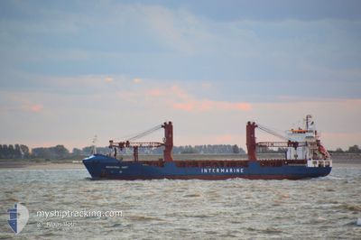
BBC DART
General Cargo
Current Trip
| Time Travelled | 25 days |
|---|---|
| Remaining Time | 5 h, 50 mins |
| Distance Travelled | 4617.69 nm |
| Remaining Distance | 66.92 nm |
| AVG Speed | 12 Knopen |
| MAX Speed | 17.4 Knopen |
| AVG Wind | 11.1 knots |
| MAX Wind | 26 knots |
| MIN Temp | 22.4°C / 72.32°F |
| MAX Temp | 29.6°C / 85.28°F |
| Diepgang | 5.6 M |
| Positie ontvangen | 5 h, 26 m geleden |
Current Position
| Lengtegraad | 114.42287° |
|---|---|
| Breedtegraat | -30.46413° |
| Status | Under way using engine |
| Snelheid | 10.7 Knopen |
| Koers | 157.7° |
| Gebied | Indian Ocean |
| Station | T-AIS |
| Positie ontvangen | 5 h, 26 m geleden |
Info
Information
The current position of BBC DART is in Indian Ocean with coordinates -30.46413° / 114.42287° as reported on 2024-04-19 15:49 by AIS to our vessel tracker app. The vessel's current speed is 10.7 Knopen and is heading at the port of FREMANTLE. The estimated time of arrival as calculated by MyShipTracking vessel tracking app is 2024-04-20 03:06 LT
The vessel BBC DART (IMO: 9360207, MMSI: 305187000) is a General Cargo that was built in 2008 ( 16 Jaar oud ). It's sailing under the flag of [AG] Antigua Barbuda.
In this page you can find informations about the vessels current position, last detected port calls, and current voyage information. If the vessels is not in coverage by AIS you will find the latest position.
The current position of BBC DART is detected by our AIS receivers and we are not responsible for the reliability of the data. The last position was recorded while the vessel was in Coverage by the Ais receivers of our vessel tracking app.
The current draught of BBC DART as reported by AIS is 5.6 meters
Weather
| Temperature | 22.7°C / 72.86°F |
|---|---|
| Wind Speed | 13 knots |
| Direction | 56° NE |
| Pressure | 1022.2 hPa |
| Humidity | 46.9 % |
| Cloud Coverage | --- |
Featured Company
Last Port Calls
| Port | Arrival | Departure | Time In Port |
|---|---|---|---|
| 2024-03-24 06:53 | 2024-03-25 14:17 | 1 d | |
| 2024-02-12 13:03 | 2024-02-23 11:25 | 10 d |
Last Trips
| Origin | Departure | Destination | Arrival | Distance | |
|---|---|---|---|---|---|
| 2024-02-23 03:25 | 2024-03-24 13:53 | 8604.87 nm | |||
| 2024-01-07 23:33 | 2024-02-12 05:03 | 10048.12 nm |
Events
| Tijd | Evenement | Details | Positie / Bestemming | Info |
|---|---|---|---|---|
| 2024-04-19 15:55 | Status Changed | Default Under way using engine |
-30.48046 / 114.43099
FREMANTLE
|
Snelheid: 10.7 kn Koers: 157.7° |
| 2024-04-19 15:49 | Buitenbereik |
-30.46413 / 114.42287
Indian Ocean
FREMANTLE
|
Snelheid: 10.7 kn Koers: 157.7° |
|
| 2024-04-19 15:40 | Status Changed | Under way using engine Default |
-30.43710 / 114.41032
FREMANTLE
|
Snelheid: 10.5 kn Koers: 158° |
| 2024-04-19 15:36 | Binnenbereik |
-30.43710 / 114.41032
Indian Ocean
FREMANTLE
|
Snelheid: 10.5 kn Koers: 159.3° |
|
| 2024-04-19 12:01 | Buitenbereik |
-29.86992 / 114.12252
Indian Ocean
FREMANTLE
|
Snelheid: 9.7 kn Koers: 143° |
|
| 2024-04-19 08:19 | Draught Changed | 5.6 5.8 |
-29.39714 / 113.69457
FREMANTLE
|
Snelheid: 10.3 kn Koers: 134.4° |
| 2024-04-19 08:15 | Status Changed | Under way using engine Default |
-29.39116 / 113.68746
FREMANTLE
|
Snelheid: 11 kn Koers: 135° |
| 2024-04-19 08:15 | Binnenbereik |
-29.39315 / 113.68984
Indian Ocean
FREMANTLE
|
Snelheid: 10.2 kn Koers: 134.3° |
|
| 2024-04-18 15:15 | Status Changed | Default Under way using engine |
-26.87913 / 112.41457
FREMANTLE
|
Snelheid: 9.7 kn Koers: 173.3° |
| 2024-04-18 15:10 | Buitenbereik |
-26.86531 / 112.41317
Indian Ocean
FREMANTLE
|
Snelheid: 9.7 kn Koers: 173.3° |