
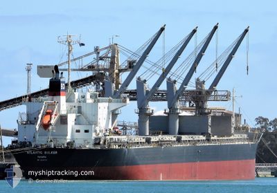
ATLANTIC BULKER
Bulk Carrier
Current Trip
| Time Travelled | 2 days |
|---|---|
| Remaining Time | --- |
| Distance Travelled | 419.93 nm |
| Remaining Distance | --- |
| AVG Speed | 10.7 Knopen |
| MAX Speed | 14.3 Knopen |
| AVG Wind | 9.4 knots |
| MAX Wind | 18 knots |
| MIN Temp | 11.7°C / 53.06°F |
| MAX Temp | 20.3°C / 68.54°F |
| Diepgang | 9.9 M |
| Positie ontvangen | 5 h, 38 m geleden |
Current Position
| Lengtegraad | -54.76071° |
|---|---|
| Breedtegraat | -35.06287° |
| Status | Under way using engine |
| Snelheid | 13.9 Knopen |
| Koers | 88.6° |
| Gebied | South Atlantic Ocean |
| Station | T-AIS |
| Positie ontvangen | 5 h, 38 m geleden |
Info
Information
The current position of ATLANTIC BULKER is in South Atlantic Ocean with coordinates -35.06287° / -54.76071° as reported on 2024-04-24 20:17 by AIS to our vessel tracker app. The vessel's current speed is 13.9 Knopen and is heading at the port of FORTALEZA. The estimated time of arrival as calculated by MyShipTracking vessel tracking app is 2024-05-02 21:00 LT
The vessel ATLANTIC BULKER (IMO: 9674799, MMSI: 354532000) is a Bulk Carrier that was built in 2014 ( 10 Jaar oud ). It's sailing under the flag of [PA] Panama.
In this page you can find informations about the vessels current position, last detected port calls, and current voyage information. If the vessels is not in coverage by AIS you will find the latest position.
The current position of ATLANTIC BULKER is detected by our AIS receivers and we are not responsible for the reliability of the data. The last position was recorded while the vessel was in Coverage by the Ais receivers of our vessel tracking app.
The current draught of ATLANTIC BULKER as reported by AIS is 9.9 meters
Weather
| Temperature | 16.4°C / 61.52°F |
|---|---|
| Wind Speed | 10 knots |
| Direction | 189° S |
| Pressure | 1019 hPa |
| Humidity | 63.8 % |
| Cloud Coverage | --- |
Featured Company
Last Port Calls
| Port | Arrival | Departure | Time In Port |
|---|---|---|---|
| 2024-04-20 03:01 | 2024-04-23 00:08 | 2 d | |
| 2024-02-23 04:56 | 2024-02-26 21:58 | 3 d | |
| 2024-02-04 20:20 |
Most Visited Ports (Last year)
| Port | Arrivals | |
|---|---|---|
| 2 | ||
| 2 | ||
| 1 | ||
| 1 | ||
| 1 | ||
| 1 |
Last Trips
| Origin | Departure | Destination | Arrival | Distance | |
|---|---|---|---|---|---|
| 2024-02-26 18:58 | 2024-04-20 00:01 | 10011.62 nm | |||
| 2024-02-04 17:20 | 2024-02-23 01:56 | 1375.14 nm |
Events
| Tijd | Evenement | Details | Positie / Bestemming | Info |
|---|---|---|---|---|
| 2024-04-24 20:22 | Status Changed | Default Under way using engine |
-35.06227 / -54.74010
BR FOR
|
Snelheid: 13.9 kn Koers: 88.6° |
| 2024-04-24 20:17 | Buitenbereik |
-35.06287 / -54.76071
South Atlantic Ocean
BR FOR
|
Snelheid: 13.9 kn Koers: 88.6° |
|
| 2024-04-24 19:05 | Wijzig zee gebeid | Uruguayan part of the South Atlantic Ocean Uruguayan part of the Rio de La Plata |
-35.07101 / -55.09769
South Atlantic Ocean
BR FOR
|
Snelheid: 13.1 kn Koers: 84.2° |
| 2024-04-24 17:33 | Gevonden in zee | Uruguayan part of the Rio de La Plata |
-35.07406 / -55.49459
Rio de La Plata
BR FOR
|
Snelheid: 12.5 kn Koers: 91.1° |
| 2024-04-24 17:32 | Status Changed | Under way using engine Default |
-35.07400 / -55.49884
BR FOR
|
Snelheid: 12.4 kn Koers: 90° |
| 2024-04-24 17:21 | Binnenbereik |
-35.07406 / -55.49459
Rio de La Plata
BR FOR
|
Snelheid: 12.5 kn Koers: 91.1° |
|
| 2024-04-24 05:47 | Start beweging | 8.35 nm, North of LA PLATA |
-34.71713 / -57.83327
BR FOR
|
Snelheid: 4 kn Koers: 105° |
| 2024-04-24 01:18 | Stop beweging | 8.06 nm, North of LA PLATA |
-34.72089 / -57.83825
BR FOR
|
Snelheid: 0.3 kn Koers: 124° |
| 2024-04-23 23:25 | Status Changed | Default Under way using engine |
-34.62485 / -58.15556
BR FOR
|
Snelheid: 10.5 kn Koers: 100.9° |
| 2024-04-23 23:18 | Buitenbereik |
-34.62145 / -58.17689
Rio de La Plata
BR FOR
|
Snelheid: 10.5 kn Koers: 100.9° |