
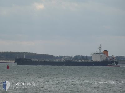
ASPHALT SPLENDOR
Tanker
Current Trip
FOR ORDERS
| Time Travelled | 33 days |
|---|---|
| Remaining Time | --- |
| Distance Travelled | 3925.20 nm |
| Remaining Distance | --- |
| AVG Speed | 10.6 Knopen |
| MAX Speed | 15 Knopen |
| AVG Wind | 15.2 knots |
| MAX Wind | 30.2 knots |
| MIN Temp | -2.5°C / 27.5°F |
| MAX Temp | 25.6°C / 78.08°F |
| Diepgang | 6.5 M |
| Positie ontvangen | 6 d geleden |
Current Position
| Lengtegraad | -53.68578° |
|---|---|
| Breedtegraat | 47.05420° |
| Status | Under way using engine |
| Snelheid | 10.1 Knopen |
| Koers | 221.7° |
| Gebied | North Atlantic Ocean |
| Station | T-AIS |
| Positie ontvangen | 6 d geleden |
Info
Information
The current position of ASPHALT SPLENDOR is in North Atlantic Ocean with coordinates 47.05420° / -53.68578° as reported on 2024-04-16 22:53 by AIS to our vessel tracker app. The vessel's current speed is 10.1 Knopen
The vessel ASPHALT SPLENDOR (IMO: 9763332, MMSI: 538006655) is a Tanker It's sailing under the flag of [MH] Marshall Is.
In this page you can find informations about the vessels current position, last detected port calls, and current voyage information. If the vessels is not in coverage by AIS you will find the latest position.
The current position of ASPHALT SPLENDOR is detected by our AIS receivers and we are not responsible for the reliability of the data. The last position was recorded while the vessel was in Coverage by the Ais receivers of our vessel tracking app.
The current draught of ASPHALT SPLENDOR as reported by AIS is 6.5 meters
Weather
| Temperature | 9.6°C / 49.28°F |
|---|---|
| Wind Speed | 17 knots |
| Direction | 45° NE |
| Pressure | 1025.3 hPa |
| Humidity | 65.3 % |
| Cloud Coverage | 100 % |
Featured Company
Events
| Tijd | Evenement | Details | Positie / Bestemming | Info |
|---|---|---|---|---|
| 2024-04-19 19:49 | Stop beweging |
42.50167 / -53.41000
FOR ORDERS
|
Snelheid: Koers: -1° |
|
| 2024-04-16 23:01 | Status Changed | Default Under way using engine |
47.03667 / -53.70334
FOR ORDERS
|
Snelheid: 10.1 kn Koers: 221.7° |
| 2024-04-16 22:53 | Buitenbereik |
47.05420 / -53.68578
North Atlantic Ocean
FOR ORDERS
|
Snelheid: 10.1 kn Koers: 221.7° |
|
| 2024-04-16 22:50 | Status Changed | Under way using engine Default |
47.06034 / -53.67368
FOR ORDERS
|
Snelheid: 7 kn Koers: 251° |
| 2024-04-16 22:43 | Status Changed | Default Under way using engine |
47.06500 / -53.64667
FOR ORDERS
|
Snelheid: 4.6 kn Koers: 272° |
| 2024-04-16 22:35 | Start beweging | 19.78 nm, South East of ARGENTIA |
47.06679 / -53.63338
FOR ORDERS
|
Snelheid: 3.1 kn Koers: 281° |
| 2024-04-16 22:32 | Status Changed | Under way using engine At anchor |
47.06599 / -53.63021
FOR ORDERS
|
Snelheid: 0.1 kn Koers: 285° |
| 2024-04-16 21:14 | Destination Changed | FOR ORDERS CA ST. MARY'S |
47.06761 / -53.62859
FOR ORDERS
|
Snelheid: 0.2 kn Koers: 238° |
| 2024-04-16 21:14 | ETA Changed | 2024/04/17 22:00 2024/04/05 11:30 |
47.06761 / -53.62859
FOR ORDERS
|
Snelheid: 0.2 kn Koers: 238° |
| 2024-04-16 20:56 | Status Changed | At anchor Default |
47.06718 / -53.62827
CA ST. MARY'S
|
Snelheid: Koers: -1° |