
ANNA
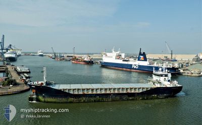
General Cargo
Current Trip
| Time Travelled | 1 day |
|---|---|
| Remaining Time | 7 h, 0 mins |
| Distance Travelled | 513.10 nm |
| Remaining Distance | 102.89 nm |
| AVG Speed | 10.9 Knopen |
| MAX Speed | 12.8 Knopen |
| AVG Wind | 12.9 knots |
| MAX Wind | 21.8 knots |
| MIN Temp | 5.3°C / 41.54°F |
| MAX Temp | 10.9°C / 51.62°F |
| Diepgang | 5.5 M |
| Positie ontvangen | 1 h, 15 m geleden |
Current Position
| Lengtegraad | -5.80650° |
|---|---|
| Breedtegraat | 52.29350° |
| Status | Under way using engine |
| Snelheid | 8.7 Knopen |
| Koers | 358° |
| Gebied | Irish Sea and St. George's Channel |
| Station | T-AIS |
| Positie ontvangen | 1 h, 15 m geleden |
Info
Information
The current position of ANNA is in Irish Sea and St. George's Channel with coordinates 52.29350° / -5.80650° as reported on 2024-04-19 10:10 by AIS to our vessel tracker app. The vessel's current speed is 8.7 Knopen and is heading at the port of DROGHEDA. The estimated time of arrival as calculated by MyShipTracking vessel tracking app is 2024-04-19 18:25 LT
The vessel ANNA (IMO: 9361110, MMSI: 245615000) is a General Cargo that was built in 2008 ( 16 Jaar oud ). It's sailing under the flag of [NL] Netherlands.
In this page you can find informations about the vessels current position, last detected port calls, and current voyage information. If the vessels is not in coverage by AIS you will find the latest position.
The current position of ANNA is detected by our AIS receivers and we are not responsible for the reliability of the data. The last position was recorded while the vessel was in Coverage by the Ais receivers of our vessel tracking app.
The current draught of ANNA as reported by AIS is 5.5 meters
Weather
| Temperature | 10.7°C / 51.26°F |
|---|---|
| Wind Speed | 14 knots |
| Direction | 302° WNW |
| Pressure | 1021.7 hPa |
| Humidity | 83.8 % |
| Cloud Coverage | 57 % |
Featured Company
Last Port Calls
| Port | Arrival | Departure | Time In Port |
|---|---|---|---|
| 2024-04-14 09:11 | 2024-04-17 12:05 | 3 d | |
| 2024-04-11 10:02 | 2024-04-13 17:23 | 2 d | |
| 2024-04-03 22:45 | 2024-04-06 13:18 | 2 d | |
| 2024-03-30 16:04 | 2024-04-03 17:27 | 4 d | |
| 2024-03-20 15:15 | 2024-03-22 11:33 | 1 d | |
| 2024-03-16 07:26 | 2024-03-20 10:42 | 4 d | |
| 2024-02-26 15:46 | 2024-02-29 05:29 | 2 d | |
| 2024-02-23 04:55 | 2024-02-25 07:39 | 2 d | |
| 2024-02-16 05:09 | 2024-02-16 10:15 | 5 h | |
| 2024-02-02 01:02 | 2024-02-04 19:42 | 2 d |
Last Trips
| Origin | Departure | Destination | Arrival | Distance | |
|---|---|---|---|---|---|
| 2024-04-13 18:23 | 2024-04-14 10:11 | 169.93 nm | |||
| 2024-04-06 15:18 | 2024-04-11 11:02 | 735.42 nm | |||
| 2024-04-03 19:27 | 2024-04-04 00:45 | 40.28 nm | |||
| 2024-03-22 12:33 | 2024-03-30 17:04 | 668.36 nm | |||
| 2024-03-20 11:42 | 2024-03-20 16:15 | 27.70 nm | |||
| 2024-02-29 08:29 | 2024-03-16 08:26 | 3217.61 nm | |||
| 2024-02-25 09:39 | 2024-02-26 18:46 | 308.26 nm | |||
| 2024-02-16 11:15 | 2024-02-23 06:55 | 1633.69 nm | |||
| 2024-02-04 20:42 | 2024-02-16 06:09 | 1940.20 nm | |||
| 2024-01-31 16:12 | 2024-02-02 02:02 | 279.09 nm |
Events
| Tijd | Evenement | Details | Positie / Bestemming | Info |
|---|---|---|---|---|
| 2024-04-19 10:44 | Status Changed | Default Under way using engine |
52.37266 / -5.80617
IEDRO
|
Snelheid: 8.7 kn Koers: 358° |
| 2024-04-19 10:10 | Gevonden in zee | Irish part of the Irish Sea and St. George's Channel |
52.29350 / -5.80650
Irish Sea and St. George's Channel
IEDRO
|
Snelheid: 8.7 kn Koers: 358° |
| 2024-04-19 10:10 | Status Changed | Under way using engine Default |
52.29350 / -5.80650
IEDRO
|
Snelheid: 8 kn Koers: 358° |
| 2024-04-19 10:10 | Binnenbereik |
52.29350 / -5.80650
Irish Sea and St. George's Channel
IEDRO
|
Snelheid: 8.7 kn Koers: 358° |
|
| 2024-04-19 10:10 | Buitenbereik |
52.29350 / -5.80650
Irish Sea and St. George's Channel
IEDRO
|
Snelheid: 8.7 kn Koers: 358° |
|
| 2024-04-19 00:41 | Status Changed | Default Under way using engine |
50.59717 / -5.86400
IEDRO
|
Snelheid: 10.9 kn Koers: 359° |
| 2024-04-18 23:59 | Buitenbereik |
50.46950 / -5.86050
Celtic Sea
IEDRO
|
Snelheid: 10.9 kn Koers: 359° |
|
| 2024-04-18 23:09 | Status Changed | Under way using engine Default |
50.31450 / -5.86317
IEDRO
|
Snelheid: 11.5 kn Koers: 3° |
| 2024-04-18 23:09 | Binnenbereik |
50.31450 / -5.86317
Celtic Sea
IEDRO
|
Snelheid: 11.3 kn Koers: 1° |
|
| 2024-04-18 21:41 | Buitenbereik |
50.03667 / -5.87667
Celtic Sea
IEDRO
|
Snelheid: 11.1 kn Koers: 0° |