
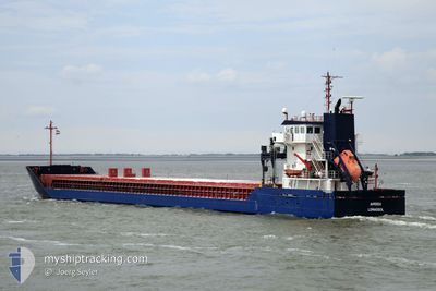
AMISIA
General Cargo
Current Trip
| Time Travelled | 1 day |
|---|---|
| Remaining Time | --- |
| Distance Travelled | 329.90 nm |
| Remaining Distance | --- |
| AVG Speed | 8.2 Knopen |
| MAX Speed | 12.1 Knopen |
| AVG Wind | 5.4 knots |
| MAX Wind | 14.5 knots |
| MIN Temp | 1.8°C / 35.24°F |
| MAX Temp | 9.1°C / 48.38°F |
| Diepgang | 6.5 M |
| Positie ontvangen | 6 h, 41 m geleden |
Current Position
| Lengtegraad | 16.95089° |
|---|---|
| Breedtegraat | 56.25896° |
| Status | Under way using engine |
| Snelheid | 11.2 Knopen |
| Koers | 25.5° |
| Gebied | Baltic Sea |
| Station | T-AIS |
| Positie ontvangen | 6 h, 41 m geleden |
Info
Information
The current position of AMISIA is in Baltic Sea with coordinates 56.25896° / 16.95089° as reported on 2024-04-19 02:11 by AIS to our vessel tracker app. The vessel's current speed is 11.2 Knopen and is heading at the port of RONNSKAR. The estimated time of arrival as calculated by MyShipTracking vessel tracking app is 2024-04-21 06:00 LT
The vessel AMISIA (IMO: 9361378, MMSI: 209530000) is a General Cargo that was built in 2008 ( 16 Jaar oud ). It's sailing under the flag of [CY] Cyprus.
In this page you can find informations about the vessels current position, last detected port calls, and current voyage information. If the vessels is not in coverage by AIS you will find the latest position.
The current position of AMISIA is detected by our AIS receivers and we are not responsible for the reliability of the data. The last position was recorded while the vessel was in Coverage by the Ais receivers of our vessel tracking app.
The current draught of AMISIA as reported by AIS is 6.5 meters
Weather
| Temperature | 3.2°C / 37.76°F |
|---|---|
| Wind Speed | 10 knots |
| Direction | 113° ESE |
| Pressure | 1007.9 hPa |
| Humidity | 86.4 % |
| Cloud Coverage | 74 % |
Featured Company
Last Port Calls
| Port | Arrival | Departure | Time In Port |
|---|---|---|---|
| 2024-04-17 11:40 | 2024-04-17 14:40 | 2 h | |
| 2024-04-15 16:15 | 2024-04-15 16:31 | 16 m | |
| 2024-04-14 08:43 | 2024-04-14 18:40 | 9 h | |
| 2024-04-12 03:51 | 2024-04-12 21:25 | 17 h | |
| 2024-04-09 14:26 | 2024-04-10 06:24 | 15 h | |
| 2024-03-30 18:03 | 2024-04-05 11:08 | 5 d | |
| 2024-03-20 11:12 | 2024-03-20 11:44 | 32 m | |
| 2024-03-17 13:27 | 2024-03-19 17:56 | 2 d | |
| 2024-02-29 11:47 | 2024-03-06 00:43 | 5 d | |
| 2024-02-24 06:30 | 2024-02-25 15:15 | 1 d |
Most Visited Ports (Last year)
| Port | Arrivals | |
|---|---|---|
| 4 | ||
| 3 | ||
| 3 | ||
| 3 | ||
| 2 | ||
| 2 |
Last Trips
| Origin | Departure | Destination | Arrival | Distance | |
|---|---|---|---|---|---|
| 2024-04-15 18:31 | 2024-04-17 13:40 | 10.58 nm | |||
| 2024-04-14 20:40 | 2024-04-15 18:15 | 215.67 nm | |||
| 2024-04-12 23:25 | 2024-04-14 10:43 | 331.47 nm | |||
| 2024-04-10 08:24 | 2024-04-12 05:51 | 299.84 nm | |||
| 2024-04-05 12:08 | 2024-04-09 16:26 | 1046.10 nm | |||
| 2024-03-20 12:44 | 2024-03-30 18:03 | 1084.91 nm | |||
| 2024-03-19 17:56 | 2024-03-20 12:12 | 214.52 nm | |||
| 2024-03-06 00:43 | 2024-03-17 13:27 | 1671.16 nm | |||
| 2024-02-25 16:15 | 2024-02-29 11:47 | 594.48 nm | |||
| 2024-02-19 19:38 | 2024-02-24 07:30 | 1193.64 nm |
Events
| Tijd | Evenement | Details | Positie / Bestemming | Info |
|---|---|---|---|---|
| 2024-04-19 02:11 | Buitenbereik |
56.25896 / 16.95089
Baltic Sea
SESFT
|
Snelheid: 11.2 kn Koers: 25.5° |
|
| 2024-04-19 02:11 | Binnenbereik |
56.25896 / 16.95089
Baltic Sea
SESFT
|
Snelheid: 11.2 kn Koers: 25.5° |
|
| 2024-04-19 01:01 | Buitenbereik |
56.07006 / 16.77081
Baltic Sea
SESFT
|
Snelheid: 11.2 kn Koers: 58° |
|
| 2024-04-18 20:08 | Gevonden in zee | Swedish part of the Baltic Sea |
55.62202 / 15.36673
Baltic Sea
SESFT
|
Snelheid: 11.3 kn Koers: 59.8° |
| 2024-04-18 14:59 | Gevonden in zee | Danish part of the Kattegat |
54.99755 / 14.04362
Kattegat
SESFT
|
Snelheid: 12.1 kn Koers: 70° |
| 2024-04-18 14:41 | Wijzig zee gebeid | Swedish part of the Baltic Sea German part of the Baltic Sea |
54.97725 / 13.94669
Baltic Sea
SESFT
|
Snelheid: 11.7 kn Koers: 69.8° |
| 2024-04-18 09:14 | Wijzig zee gebeid | German part of the Baltic Sea Danish part of the Baltic Sea |
54.59669 / 12.33601
Baltic Sea
SESFT
|
Snelheid: 10.7 kn Koers: 54.3° |
| 2024-04-18 09:02 | Wijzig zee gebeid | Danish part of the Baltic Sea German part of the Baltic Sea |
54.57070 / 12.29913
Baltic Sea
SESFT
|
Snelheid: 10.8 kn Koers: 17.2° |
| 2024-04-18 07:50 | Gevonden in zee | German part of the Baltic Sea |
54.40651 / 12.09731
Baltic Sea
SESFT
|
Snelheid: 10.9 kn Koers: 88.5° |
| 2024-04-18 05:32 | Gevonden in zee | Danish part of the Baltic Sea |
54.50179 / 11.43831
Baltic Sea
SESFT
|
Snelheid: 10.3 kn Koers: 115.6° |