
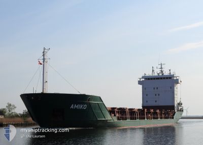
AMIKO
General Cargo
Current Trip
| Time Travelled | 6 days |
|---|---|
| Remaining Time | --- |
| Distance Travelled | 1063.94 nm |
| Remaining Distance | 2.20 nm |
| AVG Speed | 9.2 Knopen |
| MAX Speed | 13.2 Knopen |
| AVG Wind | 17.2 knots |
| MAX Wind | 34.9 knots |
| MIN Temp | 5.3°C / 41.54°F |
| MAX Temp | 17.8°C / 64.04°F |
| Diepgang | 6 M |
| Positie ontvangen | 3 m geleden |
Current Position
| Lengtegraad | -8.75194° |
|---|---|
| Breedtegraat | 41.15820° |
| Status | At anchor |
| Snelheid | 0.2 Knopen |
| Koers | 349° |
| Gebied | North Atlantic Ocean |
| Station | T-AIS |
| Positie ontvangen | 3 m geleden |
Info
Information
The current position of AMIKO is in North Atlantic Ocean with coordinates 41.15820° / -8.75194° as reported on 2024-04-23 20:02 by AIS to our vessel tracker app. The vessel's current speed is 0.2 Knopen and is heading at the port of LEIXOES. The estimated time of arrival as calculated by MyShipTracking vessel tracking app is 2024-04-23 05:00 LT
The vessel AMIKO (IMO: 9125669, MMSI: 277563000) is a General Cargo that was built in 1996 ( 28 Jaar oud ). It's sailing under the flag of [LT] Lithuania.
In this page you can find informations about the vessels current position, last detected port calls, and current voyage information. If the vessels is not in coverage by AIS you will find the latest position.
The current position of AMIKO is detected by our AIS receivers and we are not responsible for the reliability of the data. The last position was recorded while the vessel was in Coverage by the Ais receivers of our vessel tracking app.
The current draught of AMIKO as reported by AIS is 6 meters
Weather
| Temperature | 16.6°C / 61.88°F |
|---|---|
| Wind Speed | 10 knots |
| Direction | 355° N |
| Pressure | 1018.5 hPa |
| Humidity | 68.1 % |
| Cloud Coverage | --- |
Featured Company
Last Port Calls
| Port | Arrival | Departure | Time In Port |
|---|---|---|---|
| 2024-04-14 15:19 | 2024-04-17 06:23 | 2 d | |
| 2024-04-04 15:27 | 2024-04-08 15:11 | 3 d | |
| 2024-04-01 21:48 | 2024-04-03 13:27 | 1 d | |
| 2024-03-23 17:24 | 2024-03-25 21:27 | 2 d | |
| 2024-03-17 09:08 | 2024-03-19 11:17 | 2 d | |
| 2024-03-15 00:52 | 2024-03-15 18:16 | 17 h | |
| 2024-03-14 18:36 | 2024-03-14 19:20 | 43 m | |
| 2024-03-13 04:22 | 2024-03-14 16:54 | 1 d | |
| 2024-03-13 02:13 | 2024-03-13 03:35 | 1 h | |
| 2024-03-11 12:13 | 2024-03-11 14:47 | 2 h |
Last Trips
| Origin | Departure | Destination | Arrival | Distance | |
|---|---|---|---|---|---|
| 2024-04-08 17:11 | 2024-04-14 17:19 | 1346.91 nm | |||
| 2024-04-03 14:27 | 2024-04-04 17:27 | 279.75 nm | |||
| 2024-03-25 21:27 | 2024-04-01 22:48 | 1246.79 nm | |||
| 2024-03-19 11:17 | 2024-03-23 17:24 | 143.38 nm | |||
| 2024-03-15 19:16 | 2024-03-17 09:08 | 295.27 nm | |||
| 2024-03-14 20:20 | 2024-03-15 01:52 | 27.97 nm | |||
| 2024-03-14 17:54 | 2024-03-14 19:36 | 6.08 nm | |||
| 2024-03-13 04:35 | 2024-03-13 05:22 | 3.23 nm | |||
| 2024-03-11 15:47 | 2024-03-13 03:13 | 342.38 nm | |||
| 2024-03-09 13:30 | 2024-03-11 13:13 | 463.56 nm |
Events
| Tijd | Evenement | Details | Positie / Bestemming | Info |
|---|---|---|---|---|
| 2024-04-23 07:08 | Stop beweging | 2.61 nm, South West of LEIXOES |
41.16069 / -8.75491
PT LEI
|
Snelheid: 0.3 kn Koers: 101° |
| 2024-04-23 06:59 | Status Changed | At anchor Under way using engine |
41.16089 / -8.75356
PT LEI
|
Snelheid: 0.9 kn Koers: 151° |
| 2024-04-23 06:53 | Start beweging | 2.28 nm, South West of LEIXOES |
41.16146 / -8.74703
PT LEI
|
Snelheid: 4.3 kn Koers: 286° |
| 2024-04-23 06:41 | Status Changed | Under way using engine At anchor |
41.16055 / -8.74648
PT LEI
|
Snelheid: 0.5 kn Koers: 25° |
| 2024-04-23 06:27 | Stop beweging | 2.21 nm, South West of LEIXOES |
41.16062 / -8.74449
PT LEI
|
Snelheid: 0.3 kn Koers: 8° |
| 2024-04-23 06:26 | Status Changed | At anchor Under way using engine |
41.16058 / -8.74461
PT LEI
|
Snelheid: 0.8 kn Koers: 23° |
| 2024-04-23 04:06 | ETA Changed | 2024/04/23 05:00 2024/04/23 06:00 |
41.45344 / -8.97989
PT LEI
|
Snelheid: 8.9 kn Koers: 149.3° |
| 2024-04-23 03:40 | Status Changed | Under way using engine Default |
41.50703 / -9.02078
PT LEI
|
Snelheid: 9 kn Koers: 151° |
| 2024-04-23 03:15 | Status Changed | Default Under way using engine |
41.56333 / -9.06167
PT LEI
|
Snelheid: 9.4 kn Koers: 147.5° |
| 2024-04-23 03:02 | Wijzig zee gebeid | Portuguese part of the North Atlantic Ocean Spanish part of the North Atlantic Ocean |
41.59134 / -9.08787
North Atlantic Ocean
PT LEI
|
Snelheid: 9.1 kn Koers: 137.5° |