
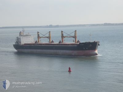
AMFITRITI
Cargo
Current Trip
OPL-PORT OF SPAIN
| Time Travelled | 5 days |
|---|---|
| Remaining Time | --- |
| Distance Travelled | 1478.62 nm |
| Remaining Distance | --- |
| AVG Speed | 12.4 Knopen |
| MAX Speed | 16.4 Knopen |
| AVG Wind | 9.4 knots |
| MAX Wind | 19 knots |
| MIN Temp | 22.7°C / 72.86°F |
| MAX Temp | 30.4°C / 86.72°F |
| Diepgang | 11.5 M |
| Positie ontvangen | 4 d geleden |
Current Position
| Lengtegraad | -50.81365° |
|---|---|
| Breedtegraat | 0.17555° |
| Status | Under way using engine |
| Snelheid | 12.7 Knopen |
| Koers | 81° |
| Gebied | North Atlantic Ocean |
| Station | T-AIS |
| Positie ontvangen | 4 d geleden |
Info
Information
The current position of AMFITRITI is in North Atlantic Ocean with coordinates 0.17555° / -50.81365° as reported on 2024-04-15 00:50 by AIS to our vessel tracker app. The vessel's current speed is 12.7 Knopen
The vessel AMFITRITI (IMO: 9463592, MMSI: 241508000) is a Cargo It's sailing under the flag of [GR] Greece.
In this page you can find informations about the vessels current position, last detected port calls, and current voyage information. If the vessels is not in coverage by AIS you will find the latest position.
The current position of AMFITRITI is detected by our AIS receivers and we are not responsible for the reliability of the data. The last position was recorded while the vessel was in Coverage by the Ais receivers of our vessel tracking app.
The current draught of AMFITRITI as reported by AIS is 11.5 meters
Weather
| Temperature | 27.5°C / 81.5°F |
|---|---|
| Wind Speed | 12 knots |
| Direction | 86° E |
| Pressure | 1012.2 hPa |
| Humidity | 87 % |
| Cloud Coverage | 100 % |
Featured Company
Most Visited Ports (Last year)
| Port | Arrivals | |
|---|---|---|
| 1 | ||
| 1 | ||
| 1 | ||
| 1 | ||
| 1 | ||
| 1 |
Last Trips
| Origin | Departure | Destination | Arrival | Distance | |
|---|---|---|---|---|---|
| 2024-02-14 20:44 | 2024-04-10 01:51 | 3014.94 nm | |||
| 2024-01-16 22:40 | 2024-02-06 15:35 | 1253.20 nm |
Events
| Tijd | Evenement | Details | Positie / Bestemming | Info |
|---|---|---|---|---|
| 2024-04-15 00:55 | Status Changed | Default Under way using engine |
.17815 / -50.79602
OPL-PORT OF SPAIN
|
Snelheid: 12.7 kn Koers: 81° |
| 2024-04-15 00:50 | Buitenbereik |
.17555 / -50.81365
North Atlantic Ocean
OPL-PORT OF SPAIN
|
Snelheid: 12.7 kn Koers: 81° |
|
| 2024-04-14 23:11 | Wijzig zee gebeid | Brazilian part of the North Atlantic Ocean Brazilian part of the South Atlantic Ocean |
.00410 / -51.00952
North Atlantic Ocean
OPL-PORT OF SPAIN
|
Snelheid: 10.4 kn Koers: 13° |
| 2024-04-14 20:03 | Status Changed | Under way using engine Default |
-.45328 / -51.32573
OPL-PORT OF SPAIN
|
Snelheid: 14.1 kn Koers: 81° |
| 2024-04-14 19:58 | Binnenbereik |
-.45313 / -51.32498
South Atlantic Ocean
OPL-PORT OF SPAIN
|
Snelheid: 13.8 kn Koers: 79° |
|
| 2024-04-14 04:37 | Status Changed | Default Under way using engine |
-2.04935 / -54.05082
OPL-PORT OF SPAIN
|
Snelheid: 14.4 kn Koers: 2° |
| 2024-04-14 04:32 | Buitenbereik |
-2.07303 / -54.05440
South Atlantic Ocean
OPL-PORT OF SPAIN
|
Snelheid: 14.4 kn Koers: 2° |
|
| 2024-04-14 03:38 | Status Changed | Under way using engine Default |
-2.29243 / -54.04568
OPL-PORT OF SPAIN
|
Snelheid: 13.1 kn Koers: 4° |
| 2024-04-14 03:30 | Status Changed | Default Under way using engine |
-2.32073 / -54.04677
OPL-PORT OF SPAIN
|
Snelheid: 12.7 kn Koers: 33° |
| 2024-04-14 03:22 | Status Changed | Under way using engine Default |
-2.34805 / -54.06268
OPL-PORT OF SPAIN
|
Snelheid: 14.1 kn Koers: 69° |