
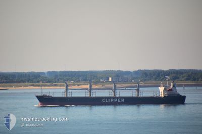
AMALEA
Bulk Carrier
Current Trip
| Time Travelled | 2 days |
|---|---|
| Remaining Time | --- |
| Distance Travelled | 574.30 nm |
| Remaining Distance | --- |
| AVG Speed | 9.2 Knopen |
| MAX Speed | 12.9 Knopen |
| AVG Wind | 11.9 knots |
| MAX Wind | 35.8 knots |
| MIN Temp | 13.4°C / 56.12°F |
| MAX Temp | 22.2°C / 71.96°F |
| Diepgang | 9.3 M |
| Positie ontvangen | 9 h, 12 m geleden |
Current Position
| Lengtegraad | 22.31780° |
|---|---|
| Breedtegraat | 36.31706° |
| Status | Under way using engine |
| Snelheid | 11.4 Knopen |
| Koers | 272.2° |
| Gebied | Mediterranean Sea - Eastern Basin |
| Station | T-AIS |
| Positie ontvangen | 9 h, 12 m geleden |
Info
Information
The current position of AMALEA is in Mediterranean Sea - Eastern Basin with coordinates 36.31706° / 22.31780° as reported on 2024-04-24 22:29 by AIS to our vessel tracker app. The vessel's current speed is 11.4 Knopen and is heading at the port of TEMA. The estimated time of arrival as calculated by MyShipTracking vessel tracking app is 2024-05-11 12:00 LT
The vessel AMALEA (IMO: 9470818, MMSI: 636018489) is a Bulk Carrier that was built in 2008 ( 16 Jaar oud ). It's sailing under the flag of [LR] Liberia.
In this page you can find informations about the vessels current position, last detected port calls, and current voyage information. If the vessels is not in coverage by AIS you will find the latest position.
The current position of AMALEA is detected by our AIS receivers and we are not responsible for the reliability of the data. The last position was recorded while the vessel was in Coverage by the Ais receivers of our vessel tracking app.
The current draught of AMALEA as reported by AIS is 9.3 meters
Weather
| Temperature | 14.8°C / 58.64°F |
|---|---|
| Wind Speed | 21 knots |
| Direction | 292° WNW |
| Pressure | 1009.9 hPa |
| Humidity | 68 % |
| Cloud Coverage | 50 % |
Featured Company
Events
| Tijd | Evenement | Details | Positie / Bestemming | Info |
|---|---|---|---|---|
| 2024-04-24 22:33 | Status Changed | Default Under way using engine |
36.31718 / 22.30213
GH TEM
|
Snelheid: 11.4 kn Koers: 272.2° |
| 2024-04-24 22:29 | Status Changed | Under way using engine Default |
36.31706 / 22.31780
GH TEM
|
Snelheid: 11.2 kn Koers: 271° |
| 2024-04-24 22:29 | Buitenbereik |
36.31706 / 22.31780
Mediterranean Sea - Eastern Basin
GH TEM
|
Snelheid: 11.4 kn Koers: 272.2° |
|
| 2024-04-24 22:20 | Binnenbereik |
36.31706 / 22.31780
Mediterranean Sea - Eastern Basin
GH TEM
|
Snelheid: 11.4 kn Koers: 272.2° |
|
| 2024-04-24 20:57 | Status Changed | Default Under way using engine |
36.36525 / 22.65232
GH TEM
|
Snelheid: 11.1 kn Koers: 248° |
| 2024-04-24 20:55 | Buitenbereik |
36.36716 / 22.65821
Mediterranean Sea - Eastern Basin
GH TEM
|
Snelheid: 11.1 kn Koers: 248° |
|
| 2024-04-24 20:34 | Status Changed | Under way using engine Default |
36.38150 / 22.73662
GH TEM
|
Snelheid: 11.2 kn Koers: 265° |
| 2024-04-24 20:31 | Status Changed | Default Under way using engine |
36.38247 / 22.74865
GH TEM
|
Snelheid: 11.1 kn Koers: 254.4° |
| 2024-04-24 19:37 | Status Changed | Under way using engine Default |
36.43324 / 22.94706
GH TEM
|
Snelheid: 10.7 kn Koers: 284° |
| 2024-04-24 19:10 | Status Changed | Default Under way using engine |
36.41528 / 23.03995
GH TEM
|
Snelheid: 10.6 kn Koers: 283.7° |