
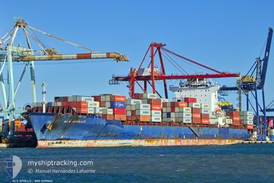
ALS APOLLO
Container Ship
Current Trip
| Time Travelled | 11 days |
|---|---|
| Remaining Time | 13 days |
| Distance Travelled | 5100.52 nm |
| Remaining Distance | 5642.87 nm |
| AVG Speed | 17.4 Knopen |
| MAX Speed | 19.9 Knopen |
| AVG Wind | 11.2 knots |
| MAX Wind | 26 knots |
| MIN Temp | 16.8°C / 62.24°F |
| MAX Temp | 29.2°C / 84.56°F |
| Diepgang | 9 M |
| Positie ontvangen | Nu |
Current Position
| Lengtegraad | 17.90852° |
|---|---|
| Breedtegraat | -34.27287° |
| Status | Under way using engine |
| Snelheid | 17.9 Knopen |
| Koers | 143° |
| Gebied | South Atlantic Ocean |
| Station | T-AIS |
| Positie ontvangen | Nu |
Info
Information
The current position of ALS APOLLO is in South Atlantic Ocean with coordinates -34.27287° / 17.90852° as reported on 2024-04-19 04:25 by AIS to our vessel tracker app. The vessel's current speed is 17.9 Knopen and is heading at the port of SINGAPORE. The estimated time of arrival as calculated by MyShipTracking vessel tracking app is 2024-05-02 11:35 LT
The vessel ALS APOLLO (IMO: 9401063, MMSI: 636092765) is a Container Ship that was built in 2009 ( 15 Jaar oud ). It's sailing under the flag of [LR] Liberia.
In this page you can find informations about the vessels current position, last detected port calls, and current voyage information. If the vessels is not in coverage by AIS you will find the latest position.
The current position of ALS APOLLO is detected by our AIS receivers and we are not responsible for the reliability of the data. The last position was recorded while the vessel was in Coverage by the Ais receivers of our vessel tracking app.
The current draught of ALS APOLLO as reported by AIS is 9 meters
Weather
| Temperature | 17°C / 62.6°F |
|---|---|
| Wind Speed | 13 knots |
| Direction | 142° SE |
| Pressure | 1016 hPa |
| Humidity | 91.2 % |
| Cloud Coverage | 100 % |
Featured Company
Last Port Calls
| Port | Arrival | Departure | Time In Port |
|---|---|---|---|
| 2024-04-06 09:51 | 2024-04-07 07:55 | 22 h | |
| 2024-04-05 20:31 | 2024-04-06 05:19 | 8 h | |
| 2024-04-03 04:47 | 2024-04-04 15:33 | 1 d | |
| 2024-03-30 06:36 | 2024-03-31 06:13 | 23 h | |
| 2024-03-11 08:19 | 2024-03-11 14:46 | 6 h | |
| 2024-02-14 03:15 | 2024-02-14 11:38 | 8 h | |
| 2024-02-03 17:42 | 2024-02-04 14:23 | 20 h | |
| 2024-02-01 09:44 | 2024-02-01 23:58 | 14 h |
Most Visited Ports (Last year)
| Port | Arrivals | |
|---|---|---|
| 6 | ||
| 4 | ||
| 4 | ||
| 4 | ||
| 3 | ||
| 3 |
Last Trips
| Origin | Departure | Destination | Arrival | Distance | |
|---|---|---|---|---|---|
| 2024-04-06 05:19 | 2024-04-06 11:51 | 34.98 nm | |||
| 2024-04-04 17:33 | 2024-04-05 20:31 | 412.25 nm | |||
| 2024-03-31 08:13 | 2024-04-03 06:47 | 281.13 nm | |||
| 2024-03-11 15:46 | 2024-03-30 07:36 | 4933.91 nm | |||
| 2024-02-14 19:38 | 2024-03-11 09:19 | 9727.30 nm | |||
| 2024-02-04 23:23 | 2024-02-14 11:15 | 699.77 nm | |||
| 2024-02-02 07:58 | 2024-02-04 02:42 | 481.72 nm | |||
| 2024-01-28 11:01 | 2024-02-01 17:44 | 1209.71 nm |
Events
| Tijd | Evenement | Details | Positie / Bestemming | Info |
|---|---|---|---|---|
| 2024-04-19 03:53 | Status Changed | Under way using engine Default |
-34.14079 / 17.79581
SINGAPORE PWBGA
|
Snelheid: 17.4 kn Koers: 144° |
| 2024-04-19 03:53 | Binnenbereik |
-34.14971 / 17.80333
South Atlantic Ocean
SINGAPORE PWBGA
|
Snelheid: 17.6 kn Koers: 145.2° |
|
| 2024-04-19 02:54 | Status Changed | Default Under way using engine |
-33.90709 / 17.59428
SINGAPORE PWBGA
|
Snelheid: 17.1 kn Koers: 137.4° |
| 2024-04-19 02:47 | Buitenbereik |
-33.88242 / 17.56834
South Atlantic Ocean
SINGAPORE PWBGA
|
Snelheid: 17.1 kn Koers: 137.4° |
|
| 2024-04-19 02:46 | Wijzig zee gebeid | South African part of the South Atlantic Ocean Moroccan part of the North Atlantic Ocean |
-33.87966 / 17.56529
South Atlantic Ocean
SINGAPORE PWBGA
|
Snelheid: 17.1 kn Koers: 137.9° |
| 2024-04-19 02:46 | Binnenbereik |
-33.87966 / 17.56529
South Atlantic Ocean
SINGAPORE PWBGA
|
Snelheid: 17.1 kn Koers: 137.9° |