
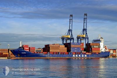
ALOPO
Container Ship
Current Trip
| Time Travelled | 15 h, 56 mins |
|---|---|
| Remaining Time | 22 h, 20 mins |
| Distance Travelled | 222.10 nm |
| Remaining Distance | 363.70 nm |
| AVG Speed | 14 Knopen |
| MAX Speed | 17.2 Knopen |
| AVG Wind | 11.2 knots |
| MAX Wind | 23 knots |
| MIN Temp | 14.8°C / 58.64°F |
| MAX Temp | 21.2°C / 70.16°F |
| Diepgang | 6.1 M |
| Positie ontvangen | Nu |
Current Position
| Lengtegraad | -4.65175° |
|---|---|
| Breedtegraat | 36.06006° |
| Status | Under way using engine |
| Snelheid | 14.7 Knopen |
| Koers | 78° |
| Gebied | Alboran Sea |
| Station | T-AIS |
| Positie ontvangen | Nu |
Info
Information
The current position of ALOPO is in Alboran Sea with coordinates 36.06006° / -4.65175° as reported on 2024-04-25 17:11 by AIS to our vessel tracker app. The vessel's current speed is 14.7 Knopen and is heading at the port of VALENCIA. The estimated time of arrival as calculated by MyShipTracking vessel tracking app is 2024-04-26 15:32 LT
The vessel ALOPO (IMO: 9329564, MMSI: 636019446) is a Container Ship that was built in 2004 ( 20 Jaar oud ). It's sailing under the flag of [LR] Liberia.
In this page you can find informations about the vessels current position, last detected port calls, and current voyage information. If the vessels is not in coverage by AIS you will find the latest position.
The current position of ALOPO is detected by our AIS receivers and we are not responsible for the reliability of the data. The last position was recorded while the vessel was in Coverage by the Ais receivers of our vessel tracking app.
The current draught of ALOPO as reported by AIS is 6.1 meters
Weather
| Temperature | 17.5°C / 63.5°F |
|---|---|
| Wind Speed | 24 knots |
| Direction | 264° W |
| Pressure | 1009.3 hPa |
| Humidity | 73.1 % |
| Cloud Coverage | 45 % |
Featured Company
Last Port Calls
| Port | Arrival | Departure | Time In Port |
|---|---|---|---|
| 2024-04-24 15:11 | 2024-04-25 01:16 | 10 h | |
| 2024-04-17 18:47 | |||
| 2024-04-11 06:33 | 2024-04-12 17:24 | 1 d | |
| 2024-04-09 06:48 | 2024-04-09 10:15 | 3 h | |
| 2024-04-06 01:13 | 2024-04-06 12:53 | 11 h | |
| 2024-04-04 14:23 | 2024-04-05 02:01 | 11 h | |
| 2024-04-02 22:39 | 2024-04-04 07:33 | 1 d | |
| 2024-03-28 08:25 | 2024-03-30 11:51 | 2 d | |
| 2024-03-26 05:08 | 2024-03-26 15:35 | 10 h | |
| 2024-03-23 12:44 | 2024-03-24 17:14 | 1 d |
Last Trips
| Origin | Departure | Destination | Arrival | Distance | |
|---|---|---|---|---|---|
| 2024-04-12 18:24 | 2024-04-17 19:47 | 609.64 nm | |||
| 2024-04-09 12:15 | 2024-04-11 07:33 | 315.86 nm | |||
| 2024-04-06 15:53 | 2024-04-09 08:48 | 794.15 nm | |||
| 2024-04-05 05:01 | 2024-04-06 04:13 | 255.47 nm | |||
| 2024-04-04 10:33 | 2024-04-04 17:23 | 57.81 nm | |||
| 2024-03-30 13:51 | 2024-04-03 01:39 | 919.76 nm | |||
| 2024-03-26 16:35 | 2024-03-28 10:25 | 510.78 nm | |||
| 2024-03-24 18:14 | 2024-03-26 06:08 | 383.37 nm | |||
| 2024-03-22 00:34 | 2024-03-23 13:44 | 484.92 nm | |||
| 2024-03-21 11:18 | 2024-03-21 15:47 | 43.72 nm |
Events
| Tijd | Evenement | Details | Positie / Bestemming | Info |
|---|---|---|---|---|
| 2024-04-25 15:37 | Wijzig zee gebeid | Spanish part of the Alboran Sea Spanish part of the Strait of Gibraltar |
35.98972 / -5.16707
Alboran Sea
ESVLC
|
Snelheid: 16.4 kn Koers: 79.3° |
| 2024-04-25 15:36 | Status Changed | Under way using engine Default |
35.98886 / -5.17260
ESVLC
|
Snelheid: 16 kn Koers: 80° |
| 2024-04-25 15:10 | Status Changed | Default Under way using engine |
35.96862 / -5.32109
ESVLC
|
Snelheid: 16.8 kn Koers: 80.5° |
| 2024-04-25 15:02 | Wijzig zee gebeid | Spanish part of the Strait of Gibraltar Moroccan part of the Strait of Gibraltar |
35.96243 / -5.36992
Strait of Gibraltar
ESVLC
|
Snelheid: 16.8 kn Koers: 80.5° |
| 2024-04-25 14:37 | ETA Changed | 2024/04/26 21:00 2024/04/26 23:00 |
35.93591 / -5.50354
ESVLC
|
Snelheid: 15.5 kn Koers: 74.8° |
| 2024-04-25 14:25 | Status Changed | Under way using engine Default |
35.92422 / -5.56450
ESVLC
|
Snelheid: 14.7 kn Koers: 75° |
| 2024-04-25 14:22 | Status Changed | Default Under way using engine |
35.92156 / -5.57719
ESVLC
|
Snelheid: 14.3 kn Koers: 77.4° |
| 2024-04-25 14:16 | Gevonden in zee | Moroccan part of the Strait of Gibraltar |
35.91539 / -5.60701
Strait of Gibraltar
ESVLC
|
Snelheid: 14.3 kn Koers: 77.4° |
| 2024-04-25 14:16 | Status Changed | Under way using engine Default |
35.91539 / -5.60701
ESVLC
|
Snelheid: 14.3 kn Koers: 77° |
| 2024-04-25 14:11 | Binnenbereik |
35.91539 / -5.60701
Strait of Gibraltar
ESVLC
|
Snelheid: 14.3 kn Koers: 77.4° |