
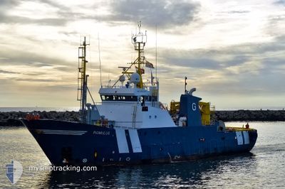
ALMAROON INTREPID
Oil/Chemical Tanker
Current Trip
KHH TW
| Time Travelled | 5 h, 15 mins |
|---|---|
| Remaining Time | --- |
| Distance Travelled | 11.79 nm |
| Remaining Distance | --- |
| AVG Speed | 6.4 Knopen |
| MAX Speed | 7.6 Knopen |
| AVG Wind | 2.2 knots |
| MAX Wind | 4 knots |
| MIN Temp | 27°C / 80.6°F |
| MAX Temp | 27.7°C / 81.86°F |
| Diepgang | 5 M |
| Positie ontvangen | 1 h, 13 m geleden |
Current Position
| Lengtegraad | --- |
|---|---|
| Breedtegraat | --- |
| Status | Default |
| Snelheid | 4.1 Knopen |
| Koers | 210.3° |
| Gebied | Philippine Sea |
| Station | T-AIS |
| Positie ontvangen | 1 h, 13 m geleden |
Info
Information
The current position of ALMAROON INTREPID is in Philippine Sea with coordinates 10.21428° / 123.98576° as reported on 2025-12-07 02:59 by AIS to our vessel tracker app. The vessel's current speed is 4.1 Knopen
The vessel ALMAROON INTREPID (IMO: 9154036, MMSI: 667001718) is a Oil/Chemical Tanker that was built in 1997 ( 28 Jaar oud ). It's sailing under the flag of [SL] Sierra Leone.
In this page you can find informations about the vessels current position, last detected port calls, and current voyage information. If the vessels is not in coverage by AIS you will find the latest position.
The current position of ALMAROON INTREPID is detected by our AIS receivers and we are not responsible for the reliability of the data. The last position was recorded while the vessel was in Coverage by the Ais receivers of our vessel tracking app.
The current draught of ALMAROON INTREPID as reported by AIS is 5 meters
Weather
| Temperature | 27.6°C / 81.68°F |
|---|---|
| Wind Speed | 4 knots |
| Direction | 172° S |
| Pressure | 1008 hPa |
| Humidity | 80.7 % |
| Cloud Coverage | 16 % |
Featured Company
Most Visited Ports (Last year)
| Port | Arrivals | |
|---|---|---|
| 4 |
Last Trips
| Origin | Departure | Destination | Arrival | Distance |
|---|
Events
| Tijd | Evenement | Details | Positie / Bestemming | Info |
|---|---|---|---|---|
| 2025-12-07 02:59 | Buitenbereik |
10.21428 / 123.98576
Philippine Sea
|
Snelheid: 4.1 kn Koers: 210.3° |
|
| 2025-12-07 02:49 | Binnenbereik |
10.22868 / 123.99393
Philippine Sea
|
Snelheid: 6.2 kn Koers: 212.4° |
|
| 2025-12-06 23:31 | Buitenbereik |
10.33624 / 124.04918
Philippine Sea
|
Snelheid: 7.6 kn Koers: 102.2° |
|
| 2025-12-06 22:57 | Vertrekhaven |
|
10.33900 / 123.98817
KHH TW
|
Snelheid: 4.9 kn Koers: 56.8° |
| 2025-12-06 22:49 | Binnenbereik |
10.33257 / 123.97800
Philippine Sea
[PH] CEBU
|
Snelheid: 4.1 kn Koers: 50.6° |