
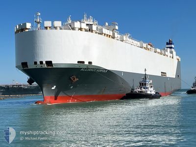
ALLIANCE NORFOLK
Vehicles Carrier
Current Trip
| Time Travelled | 6 days |
|---|---|
| Remaining Time | --- |
| Distance Travelled | 2753.28 nm |
| Remaining Distance | --- |
| AVG Speed | 17.4 Knopen |
| MAX Speed | 19.2 Knopen |
| AVG Wind | 11.1 knots |
| MAX Wind | 16.9 knots |
| MIN Temp | 22.2°C / 71.96°F |
| MAX Temp | 30.1°C / 86.18°F |
| Diepgang | 9.4 M |
| Positie ontvangen | 6 d geleden |
Current Position
| Lengtegraad | 31.47572° |
|---|---|
| Breedtegraat | -29.62690° |
| Status | Under way using engine |
| Snelheid | 16.8 Knopen |
| Koers | 58° |
| Gebied | Indian Ocean |
| Station | T-AIS |
| Positie ontvangen | 6 d geleden |
Info
Information
The current position of ALLIANCE NORFOLK is in Indian Ocean with coordinates -29.62690° / 31.47572° as reported on 2024-04-18 11:44 by AIS to our vessel tracker app. The vessel's current speed is 16.8 Knopen and is heading at the port of SOHAR. The estimated time of arrival as calculated by MyShipTracking vessel tracking app is 2024-04-28 08:00 LT
The vessel ALLIANCE NORFOLK (IMO: 9332547, MMSI: 338619000) is a Vehicles Carrier that was built in 2007 ( 17 Jaar oud ). It's sailing under the flag of [US] USA.
In this page you can find informations about the vessels current position, last detected port calls, and current voyage information. If the vessels is not in coverage by AIS you will find the latest position.
The current position of ALLIANCE NORFOLK is detected by our AIS receivers and we are not responsible for the reliability of the data. The last position was recorded while the vessel was in Coverage by the Ais receivers of our vessel tracking app.
The current draught of ALLIANCE NORFOLK as reported by AIS is 9.4 meters
Weather
| Temperature | 28.9°C / 84.02°F |
|---|---|
| Wind Speed | 10 knots |
| Direction | 360° N |
| Pressure | 1006.1 hPa |
| Humidity | 75.5 % |
| Cloud Coverage | 86 % |
Featured Company
Last Port Calls
| Port | Arrival | Departure | Time In Port |
|---|---|---|---|
| 2024-04-17 23:32 | 2024-04-18 10:00 | 10 h | |
| 2024-03-12 13:42 | |||
| 2024-03-09 13:50 | 2024-03-10 18:49 | 1 d | |
| 2024-03-07 21:04 | |||
| 2024-02-29 17:53 | 2024-03-03 01:24 | 2 d | |
| 2024-02-08 17:29 | 2024-02-09 08:40 | 15 h |
Last Trips
| Origin | Departure | Destination | Arrival | Distance | |
|---|---|---|---|---|---|
| 2024-03-10 13:49 | 2024-03-12 08:42 | 532.77 nm | |||
| 2024-03-07 15:04 | 2024-03-09 07:50 | 617.46 nm | |||
| 2024-02-09 10:40 | 2024-02-29 12:53 | 7077.55 nm | |||
| 2024-01-28 13:04 | 2024-02-08 19:29 | 3852.99 nm |
Events
| Tijd | Evenement | Details | Positie / Bestemming | Info |
|---|---|---|---|---|
| 2024-04-18 12:01 | Status Changed | Default Under way using engine |
-29.58757 / 31.55365
OMSOH
|
Snelheid: 16.8 kn Koers: 58° |
| 2024-04-18 11:44 | Buitenbereik |
-29.62690 / 31.47572
Indian Ocean
OMSOH
|
Snelheid: 16.8 kn Koers: 58° |
|
| 2024-04-18 11:00 | Destination Changed | OMSOH SOHAR |
-29.74215 / 31.28117
OMSOH
|
Snelheid: 16.6 kn Koers: 55° |
| 2024-04-18 10:24 | Destination Changed | SOHAR ZADUR |
-29.82173 / 31.12843
SOHAR
|
Snelheid: 14.1 kn Koers: 57° |
| 2024-04-18 10:24 | ETA Changed | 2024/04/28 08:00 2024/04/17 20:00 |
-29.82173 / 31.12843
SOHAR
|
Snelheid: 14.1 kn Koers: 57° |
| 2024-04-18 10:21 | Status Changed | Under way using engine Default |
-29.82817 / 31.11558
ZADUR
|
Snelheid: 0.4 kn Koers: 122° |
| 2024-04-18 10:21 | Start beweging | 5.58 nm, North East of DURBAN |
-29.82817 / 31.11558
ZADUR
|
Snelheid: 14.3 kn Koers: 60° |
| 2024-04-18 10:21 | Binnenbereik |
-29.82382 / 31.12470
Indian Ocean
|
Snelheid: 14.2 kn Koers: 59° |
|
| 2024-04-18 10:00 | Vertrekhaven |
|
-29.82817 / 31.11558
ZADUR
|
Snelheid: 0.4 kn Koers: 122° |
| 2024-04-17 23:38 | Buitenbereik |
-29.87707 / 31.04618
Indian Ocean
[ZA] DURBAN
|
Snelheid: 4.4 kn Koers: 272° |