
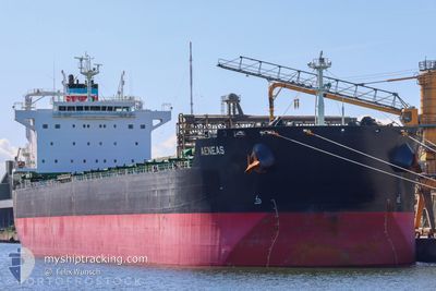
AENEAS
Bulk Carrier
Current Trip
CNFZH
| Time Travelled | 4 days |
|---|---|
| Remaining Time | --- |
| Distance Travelled | 906.23 nm |
| Remaining Distance | --- |
| AVG Speed | 12.3 Knopen |
| MAX Speed | 13.9 Knopen |
| AVG Wind | 5.3 knots |
| MAX Wind | 11 knots |
| MIN Temp | 19.7°C / 67.46°F |
| MAX Temp | 28.9°C / 84.02°F |
| Diepgang | 7.4 M |
| Positie ontvangen | 3 d geleden |
Current Position
| Lengtegraad | 117.77036° |
|---|---|
| Breedtegraat | 23.33331° |
| Status | Under way using engine |
| Snelheid | 11.6 Knopen |
| Koers | 226.9° |
| Gebied | South China Sea |
| Station | T-AIS |
| Positie ontvangen | 3 d geleden |
Info
Information
The current position of AENEAS is in South China Sea with coordinates 23.33331° / 117.77036° as reported on 2024-04-13 05:15 by AIS to our vessel tracker app. The vessel's current speed is 11.6 Knopen
The vessel AENEAS (IMO: 9585730, MMSI: 538004110) is a Bulk Carrier that was built in 2011 ( 13 Jaar oud ). It's sailing under the flag of [MH] Marshall Is.
In this page you can find informations about the vessels current position, last detected port calls, and current voyage information. If the vessels is not in coverage by AIS you will find the latest position.
The current position of AENEAS is detected by our AIS receivers and we are not responsible for the reliability of the data. The last position was recorded while the vessel was in Coverage by the Ais receivers of our vessel tracking app.
The current draught of AENEAS as reported by AIS is 7.4 meters
Weather
| Temperature | 28.9°C / 84.02°F |
|---|---|
| Wind Speed | 10 knots |
| Direction | 98° E |
| Pressure | 1009.4 hPa |
| Humidity | 76.2 % |
| Cloud Coverage | 13 % |
Featured Company
Last Port Calls
| Port | Arrival | Departure | Time In Port |
|---|---|---|---|
| 2024-04-06 02:37 | 2024-04-12 05:42 | 6 d | |
| 2024-03-28 19:45 | 2024-04-04 11:44 | 6 d | |
| 2024-03-08 06:16 | 2024-03-08 07:30 | 1 h |
Most Visited Ports (Last year)
| Port | Arrivals | |
|---|---|---|
| 1 | ||
| 1 | ||
| 1 | ||
| 1 | ||
| 1 | ||
| 1 |
Last Trips
| Origin | Departure | Destination | Arrival | Distance | |
|---|---|---|---|---|---|
| 2024-04-04 19:44 | 2024-04-06 10:37 | 245.57 nm | |||
| 2024-03-08 15:30 | 2024-03-29 03:45 | 2996.48 nm | |||
| 2024-01-19 10:52 | 2024-03-08 14:16 | 3973.01 nm |
Events
| Tijd | Evenement | Details | Positie / Bestemming | Info |
|---|---|---|---|---|
| 2024-04-13 05:25 | Status Changed | Default Under way using engine |
23.31399 / 117.74039
CNFZH
|
Snelheid: 11.6 kn Koers: 226.9° |
| 2024-04-13 05:15 | Buitenbereik |
23.33331 / 117.77036
South China Sea
|
Snelheid: 11.6 kn Koers: 226.9° |
|
| 2024-04-13 05:12 | Status Changed | Under way using engine Default |
23.33972 / 117.77827
CNFZH
|
Snelheid: 11 kn Koers: 233° |
| 2024-04-13 04:59 | Status Changed | Default Under way using engine |
23.36610 / 117.81625
CNFZH
|
Snelheid: 11.6 kn Koers: 231.9° |
| 2024-04-13 04:31 | Status Changed | Under way using engine Default |
23.42455 / 117.88786
CNFZH
|
Snelheid: 11 kn Koers: 230° |
| 2024-04-13 04:12 | Status Changed | Default Under way using engine |
23.46425 / 117.93681
CNFZH
|
Snelheid: 11.4 kn Koers: 231.6° |
| 2024-04-13 02:28 | Status Changed | Under way using engine Default |
23.63186 / 118.24846
CNFZH
|
Snelheid: 11 kn Koers: 242° |
| 2024-04-13 02:22 | Status Changed | Default Under way using engine |
23.64125 / 118.26794
CNFZH
|
Snelheid: 11.7 kn Koers: 247.4° |
| 2024-04-13 01:28 | Status Changed | Under way using engine Default |
23.71073 / 118.44733
CNFZH
|
Snelheid: 11.8 kn Koers: 212° |
| 2024-04-13 01:28 | Binnenbereik |
23.71044 / 118.44616
South China Sea
|
Snelheid: 12.1 kn Koers: 254.6° |